


Emisiones fugitivas y LDAR
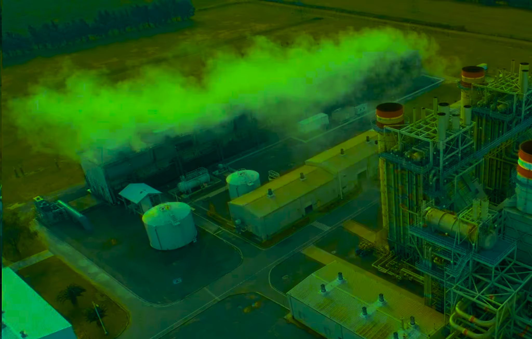
Automatice las inspecciones de OGI aprobadas por la EPA semanalmente para reducir la duración estimada de las fugas y la exposición a sanciones.

Petróleo y gas
Transformar las inspecciones anuales de cumplimiento normativo en controles automatizados diarios en plataformas de pozos remotas, oleoductos y parques de tanques, haciendo finalmente que el mantenimiento preventivo sea económicamente viable a gran escala.


Los vuelos autónomos sustituyen las rondas manuales. Pase del cumplimiento trimestral a la inteligencia operativa diaria en cada plataforma de pozos, oleoducto y parque de tanques.
Automatice las inspecciones de OGI aprobadas por la EPA semanalmente para reducir la duración estimada de las fugas y la exposición a sanciones.
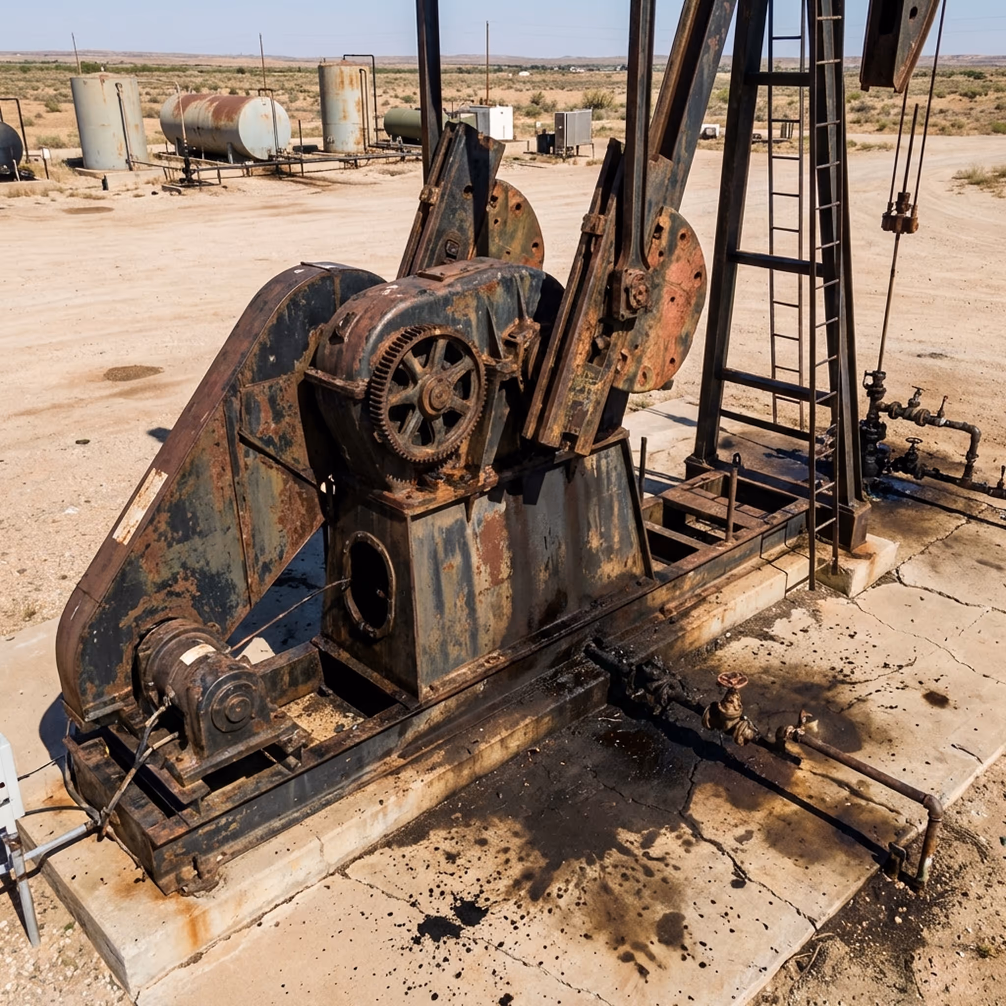
Detectar a tiempo los fallos en los rodamientos, la corrosión y el sobrecalentamiento evita costosos tiempos de inactividad no planificados.
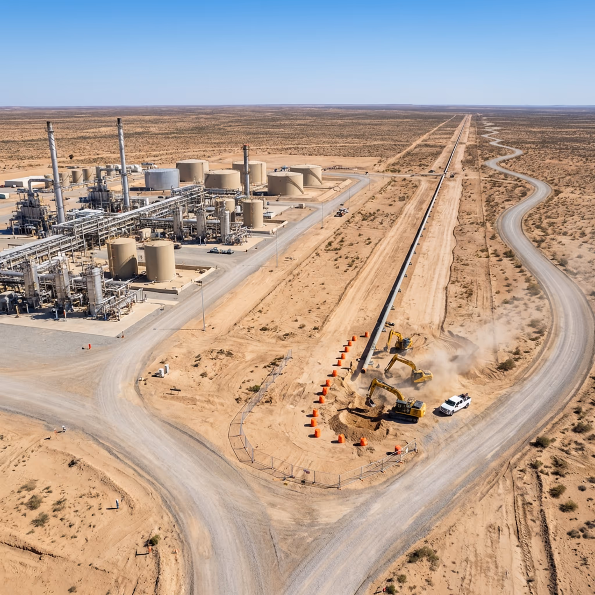
Supervise los corredores para detectar invasiones y excavaciones con el fin de prevenir incidentes que causen daños a terceros.

Proporcionar información térmica y visual en cuestión de minutos para coordinar una respuesta más segura ante incidentes.
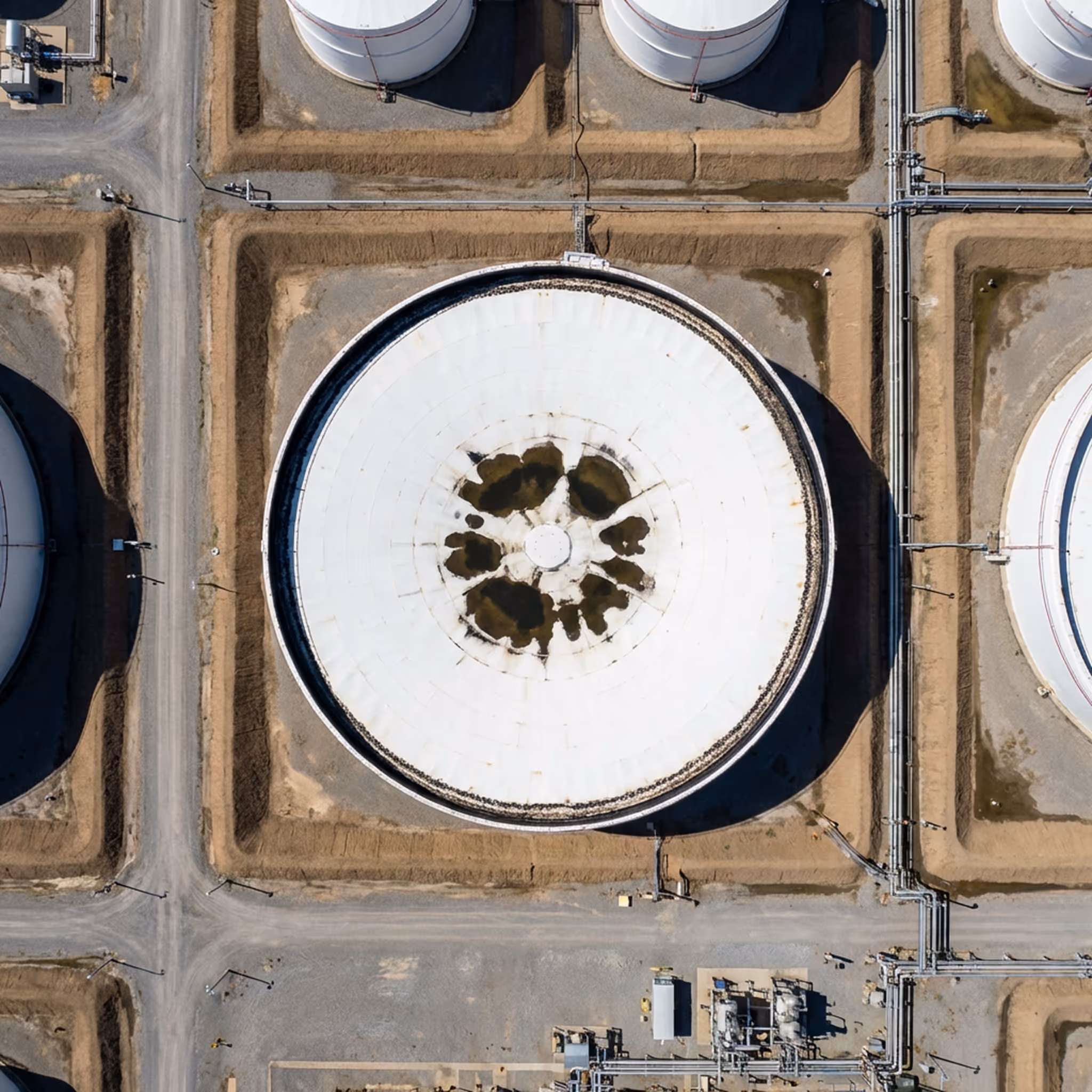
Detecte acumulaciones de agua, fugas en los sellos de los bordes y problemas estructurales sin necesidad de entrar en espacios confinados peligrosos.

Identificar el sobrecalentamiento de los conductores y las fallas en los aislantes para prevenir interrupciones en la producción e incendios forestales.
Patrullar continuamente las plataformas de perforación y las instalaciones para disuadir el robo y obtener pruebas en vídeo.

Supervise los patrones de llama y detecte fallas de combustión para cumplir con la normativa EPA 40 CFR.
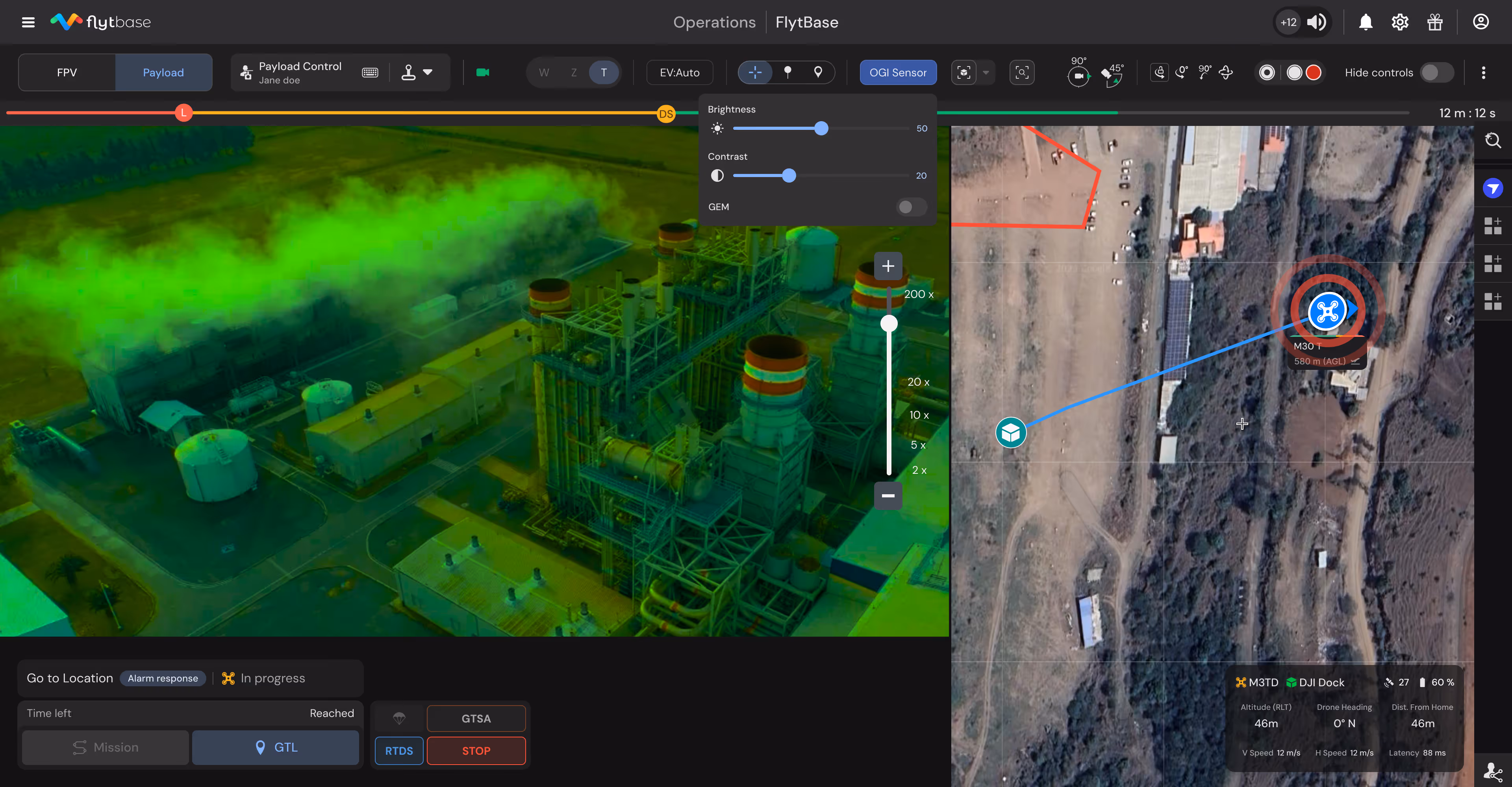
Gracias FlytBase completamos con éxito inspecciones remotas de infraestructura controladas íntegramente desde nuestro Centro de Operaciones con Drones. La perfecta integración de la plataforma con el dock, el control total mediante joystick y la monitorización en tiempo real demuestran el futuro de las inspecciones de infraestructura.

Espen Blomlie
Con FlytBase capturamos datos críticos durante los vuelos, controlamos nuestros muelles sin problemas y garantizamos operaciones de vuelo seguras. Esta tecnología nos ayuda a detectar fallas, monitorear el progreso y optimizar la ubicación de los muelles en el sitio desde el inicio de la construcción.
Thomas Stegge
Ayudar a los equipos de energía resaltando automáticamente las fugas, las fallas de los equipos y las amenazas a la seguridad durante las misiones, reduciendo la revisión manual y acelerando las decisiones críticas.

Identifique las emisiones fugitivas a partir de vídeos térmicos, etiquételas con los identificadores de los equipos y genere informes de cumplimiento automáticamente.
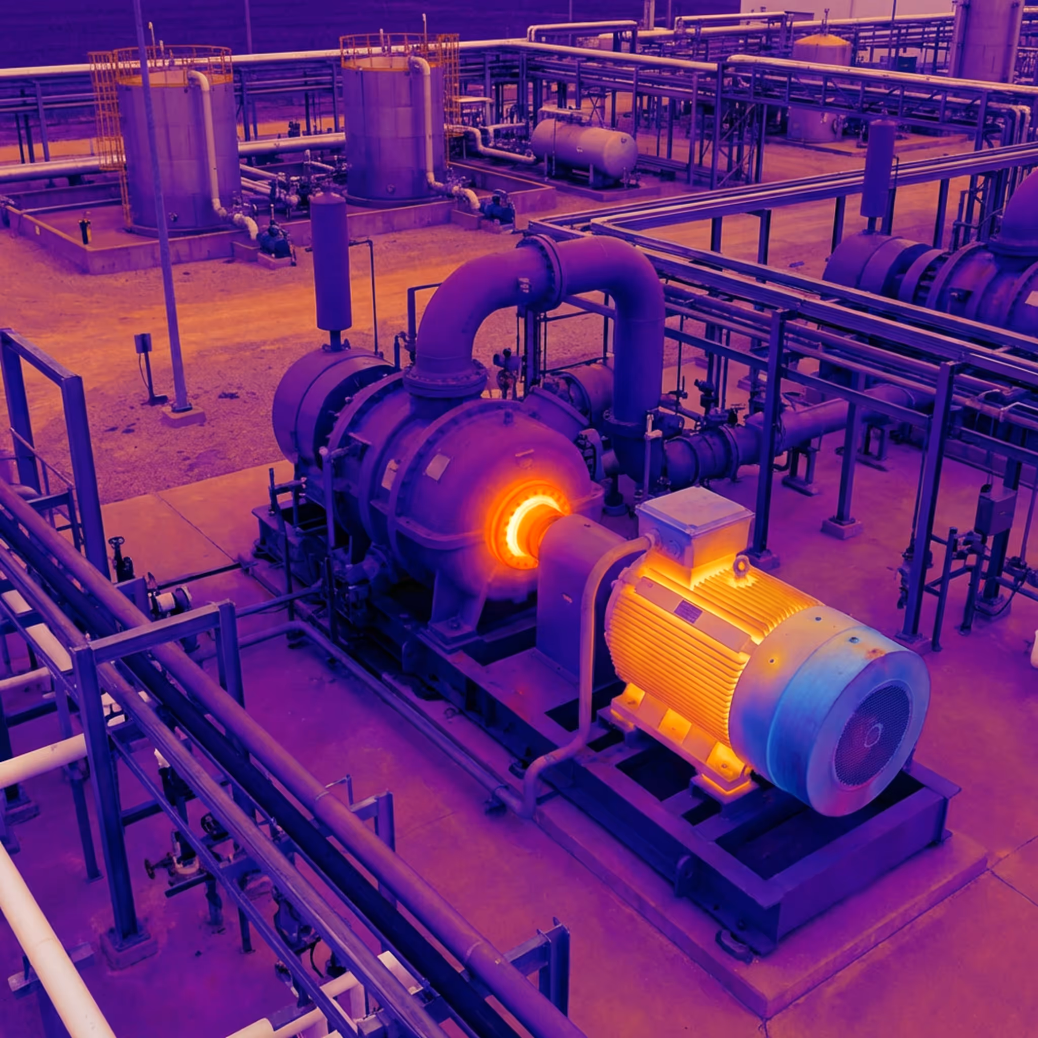
Detectar la corrosión, los daños estructurales, las fallas en los cojinetes y el sobrecalentamiento para permitir un mantenimiento predictivo y prevenir fallas.
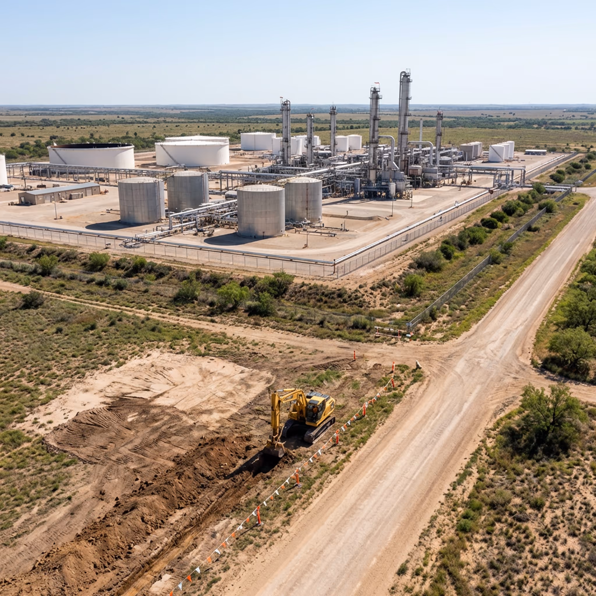
Identifique los equipos de construcción, las actividades de excavación y las infracciones de derechos de paso para prevenir daños a terceros antes de que ocurran incidentes.
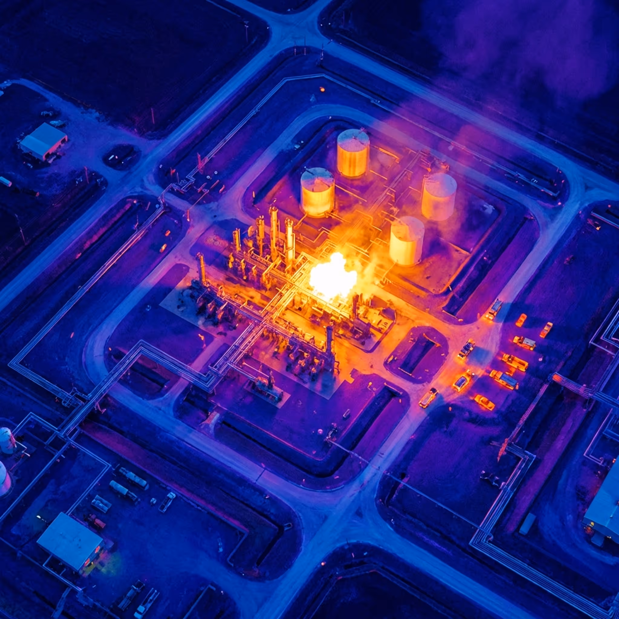
Evaluar las zonas de alto riesgo, los patrones de propagación de las llamas y las rutas de aproximación seguras durante los incidentes para tomar decisiones de mando informadas.

Detecte la acumulación de agua en techos flotantes, las fallas en los sellos del borde y la corrosión de la estructura sin necesidad de realizar inspecciones manuales peligrosas.
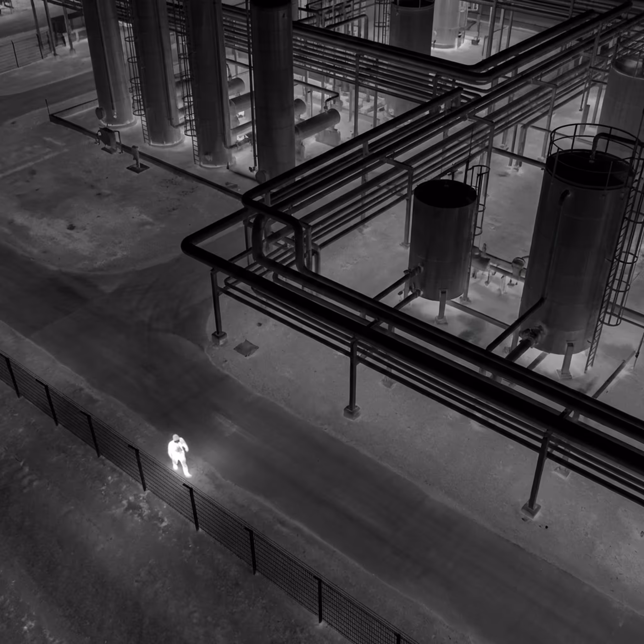
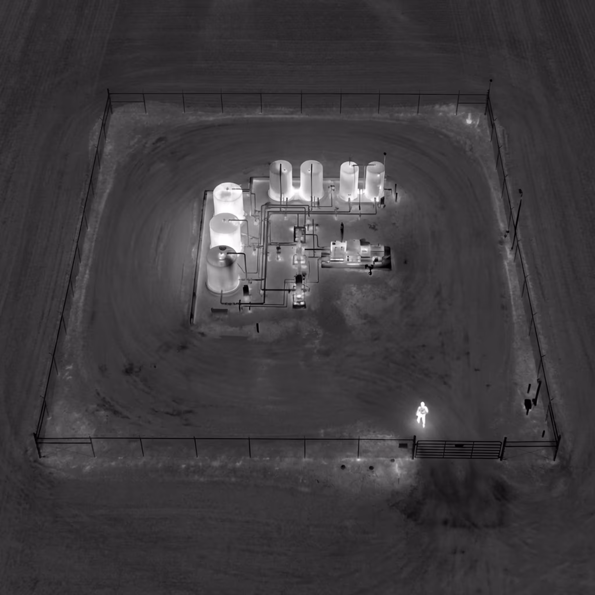
Identifique personal no autorizado, vehículos y brechas en las vallas para permitir una respuesta de seguridad rápida y la recopilación de pruebas.
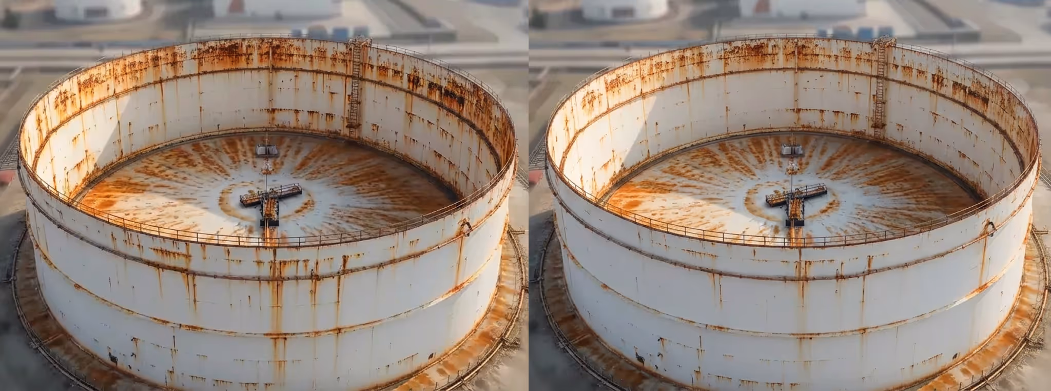
Compare las condiciones actuales con los datos históricos de referencia para identificar tendencias de deterioro y priorizar el mantenimiento en miles de activos.
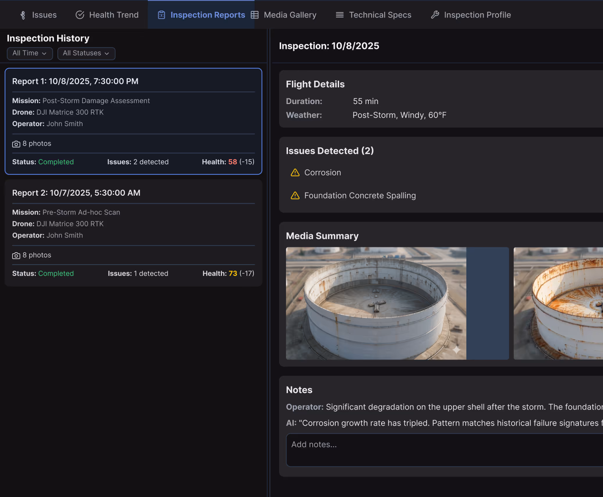
Genere registros de inspección vinculados a activos con marca de tiempo GPS que cumplan con las regulaciones de seguridad y LDAR de la EPA para un cumplimiento listo para auditoría.
Diseñado para integrarse en despliegues de petróleo y gas en drones, cargas útiles, sistemas SCADA y plataformas de seguridad sin interrumpir los flujos de trabajo operativos existentes ni requerir la sustitución de tecnología.
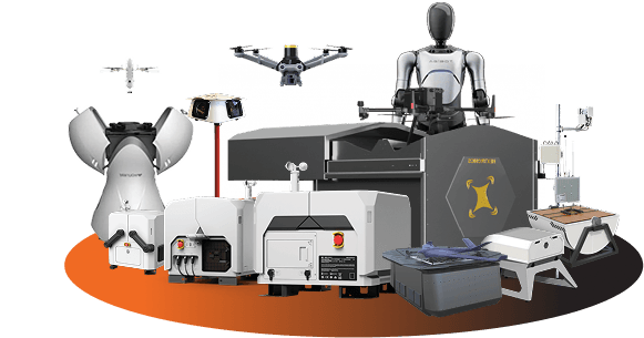
Apoye las operaciones autónomas las 24 horas del día, los 7 días de la semana, con drones de nivel empresarial, estaciones de acoplamiento resistentes a la intemperie y cargas útiles específicas para cada misión (cámaras térmicas, lentes con zoom, focos, altavoces y más), coordinadas en diversos entornos a través de una única plataforma de autonomía.
Consultar el hardware compatibleCoordina misiones, activadores de alarmas, agentes de IA y flujos de trabajo de seguridad a través de una única plataforma que gestiona operaciones en múltiples ubicaciones.
Explora la plataforma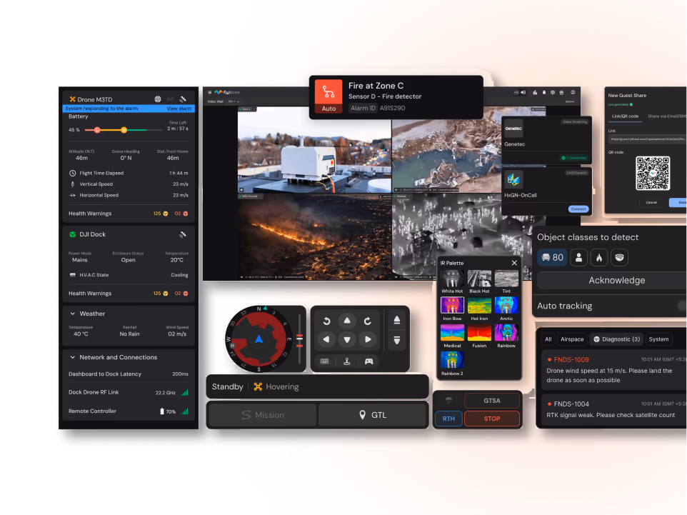
Integración con sistemas SCADA CMMS (Maximo/SAP), GIS (ArcGIS), VMS (Genetec/Milestone), HSE y gestión de alarmas para adaptarse a la infraestructura existente.
Agilice las aprobaciones que van más allá de la visibilidad directa con plantillas de documentación completas y flujos de trabajo de cumplimiento para las operaciones energéticas.
Más informaciónFlytBase proporciona la fiabilidad, la inteligencia y la madurez operativa necesarias para ejecutar programas de drones autónomos a gran escala en infraestructuras energéticas de misión crítica.
Gestionamos más de 150 despliegues de drones autónomos con un tiempo de actividad comprobado y una fiabilidad de nivel de producción.
Aplicar inteligencia artificial y visión artificial diseñadas desde cero para operaciones de petróleo y gas.
Cumpla con los estrictos requisitos de seguridad gracias al cumplimiento de la norma SOC 2 y a modelos de implementación flexibles.
Brindar soporte para la residencia de datos en el país, las necesidades de cumplimiento regional y los requisitos del idioma local.
Realice operaciones en muelle sin supervisión las 24 horas del día, los 7 días de la semana, sin necesidad de pilotaje manual ni aumento de la carga de trabajo del operador.
Cuente con asistencia para la implementación, capacitación y equipos de soporte receptivos con experiencia en operaciones energéticas.
Póngase en contacto con nuestros expertos en autonomía energética para habilitar la monitorización continua y una respuesta de emergencia más rápida en todas sus operaciones.