Los ojos puestos en escena antes de que lleguen los socorristas
Los drones acoplados automatizados brindan inteligencia aérea más rápido que las tripulaciones de tierra, por lo general entre 2 y 10 minutos después del envío, lo que transforma la respuesta de emergencia de un despliegue desinformado a decisiones informadas.
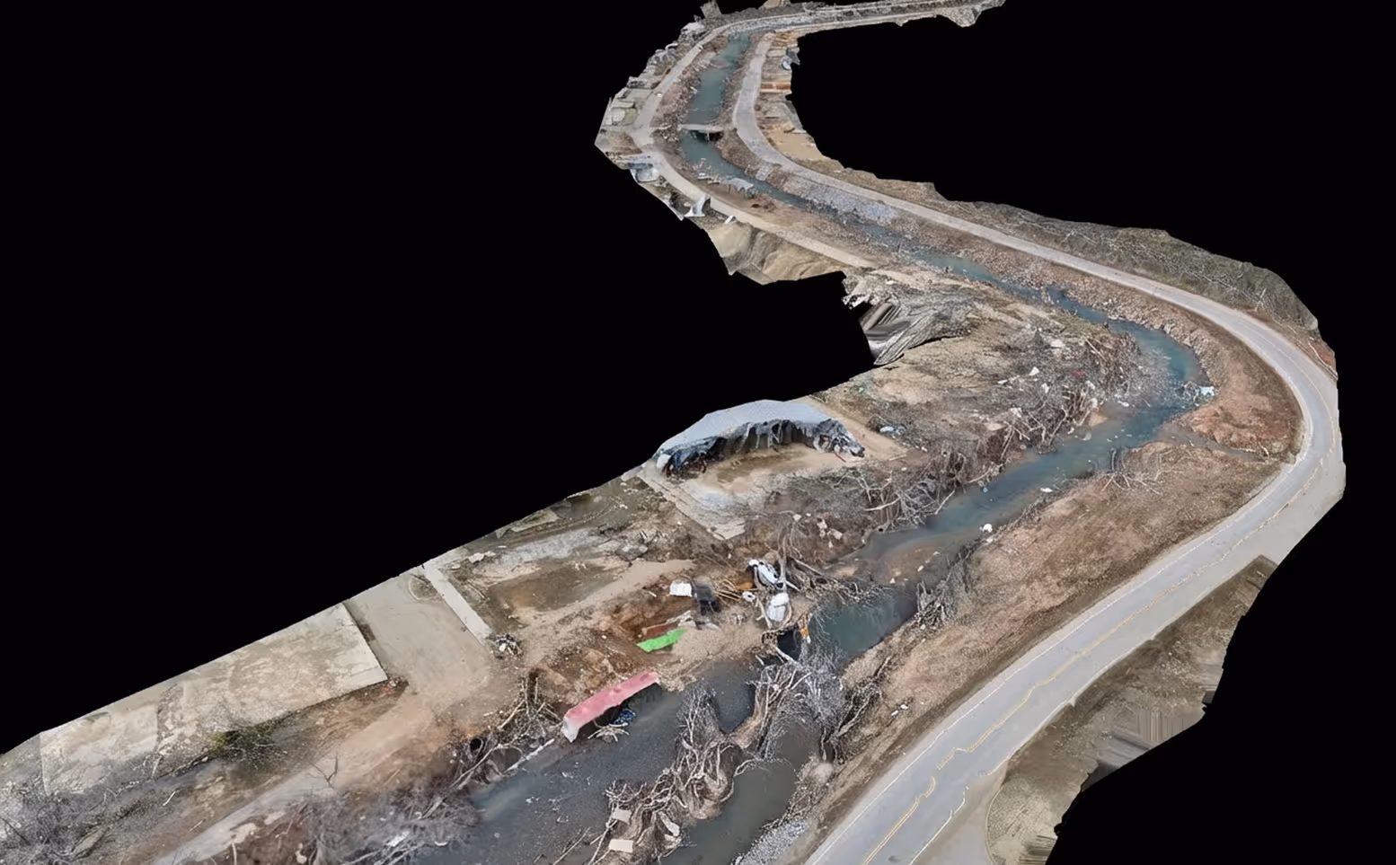
.avif)
Las principales organizaciones de seguridad pública de todo el mundo confían en nosotros


Desde el envío del 911 hasta la presentación de pruebas ante el tribunal en cuatro etapas
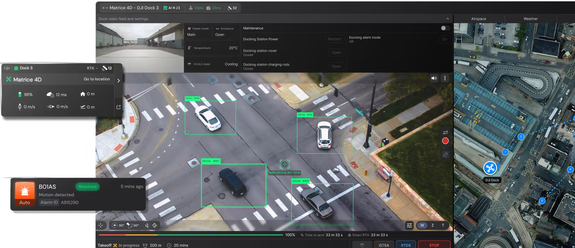
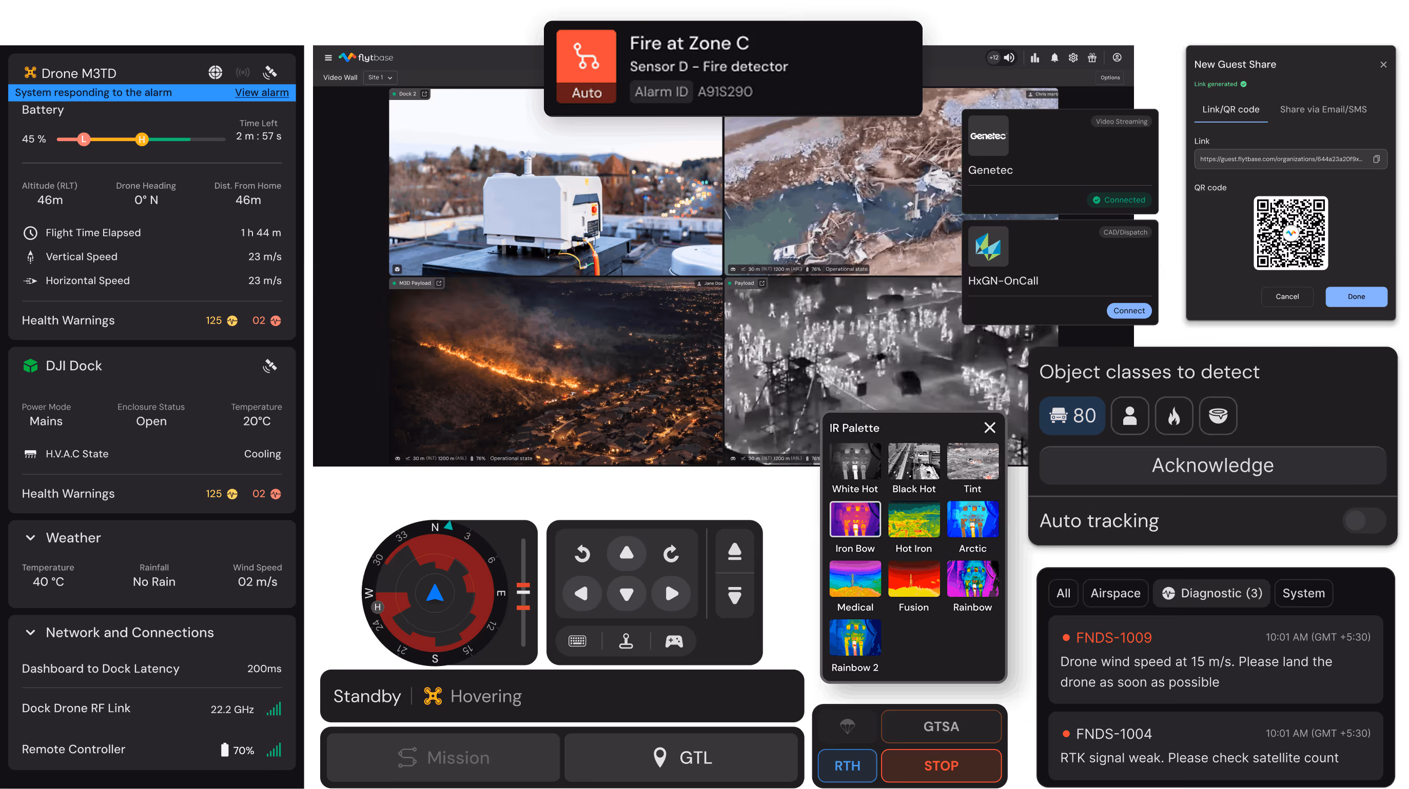
Los sistemas de despacho activan la respuesta aérea
Las llamadas al 911 de alta prioridad lanzan el dron más cercano mediante la integración de CAD. No se requiere pilotaje manual. El sistema se activa segundos después de la notificación del envío.
Respuesta rápida y colaboración en vivo
Los drones llegan a las escenas más rápido que los equipos de tierra que transmiten vídeo a los centros de mando y al personal de respuesta. Los supervisores ajustan el despliegue de la tripulación para evitar una costosa respuesta excesiva o una peligrosa falta de respuesta.
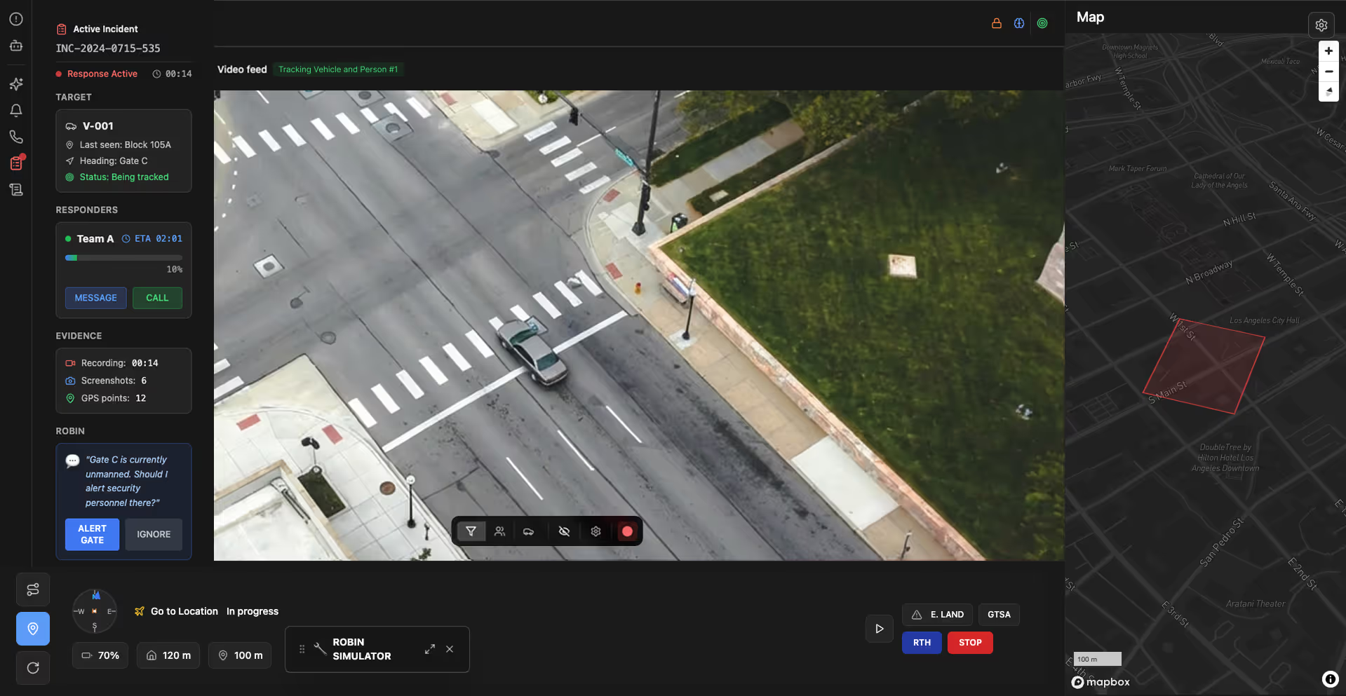
Operaciones de respuesta activa
Los operadores rastrean a los sospechosos que huyen, buscan a las personas desaparecidas por descripción y siguen los movimientos de los vehículos, proporcionando información en tiempo real a las unidades terrestres durante los incidentes activos.
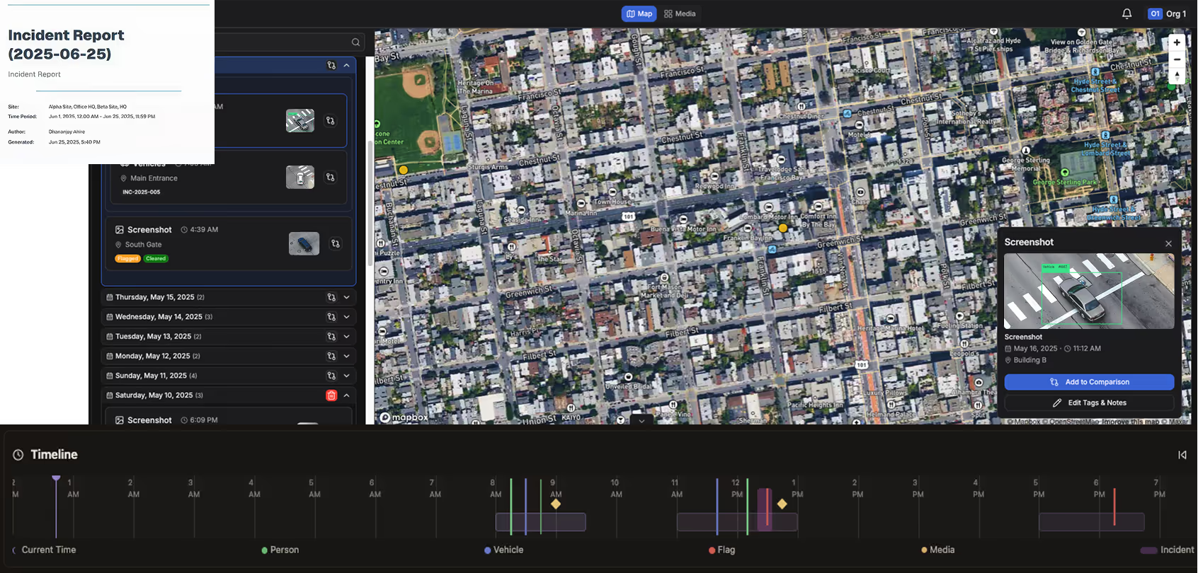
Evidencia y documentación automatizadas
Cada incidente se registra automáticamente con coordenadas GPS y marcas de tiempo. FlytBase AI convierte las notas verbales de los operadores durante las operaciones en vivo en documentación estructurada para las investigaciones y los procedimientos.
Una plataforma que apoya las principales áreas de misión de seguridad pública

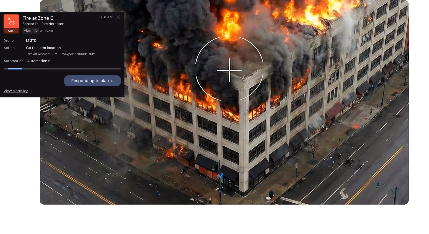
Comando de respuesta a emergencias e incidentes
Proporcione visibilidad aérea en vivo para evaluar los peligros, rastrear a los sospechosos y respaldar las decisiones tácticas antes de que los socorristas terrestres lleguen al lugar.

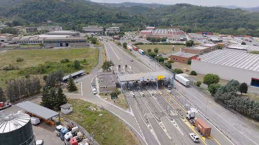
Gestión de incidentes de tráfico
Reduzca el tiempo de limpieza de accidentes en un 35% mediante una evaluación inmediata de los daños aéreos. Documente las escenas en 5 minutos, en lugar de hacerlo de forma manual en 45 minutos.

Monitorización de infraestructuras críticas
Pase de las inspecciones anuales a la supervisión automatizada semanal. Detecte los problemas estructurales 50 semanas antes y evite fallas catastróficas en la infraestructura.

Operaciones de búsqueda y rescate
Busque en más de 100 acres en 30 minutos con imágenes térmicas en lugar de en más de 50 horas de búsqueda terrestre. Implemente en menos de 5 minutos a partir del informe.

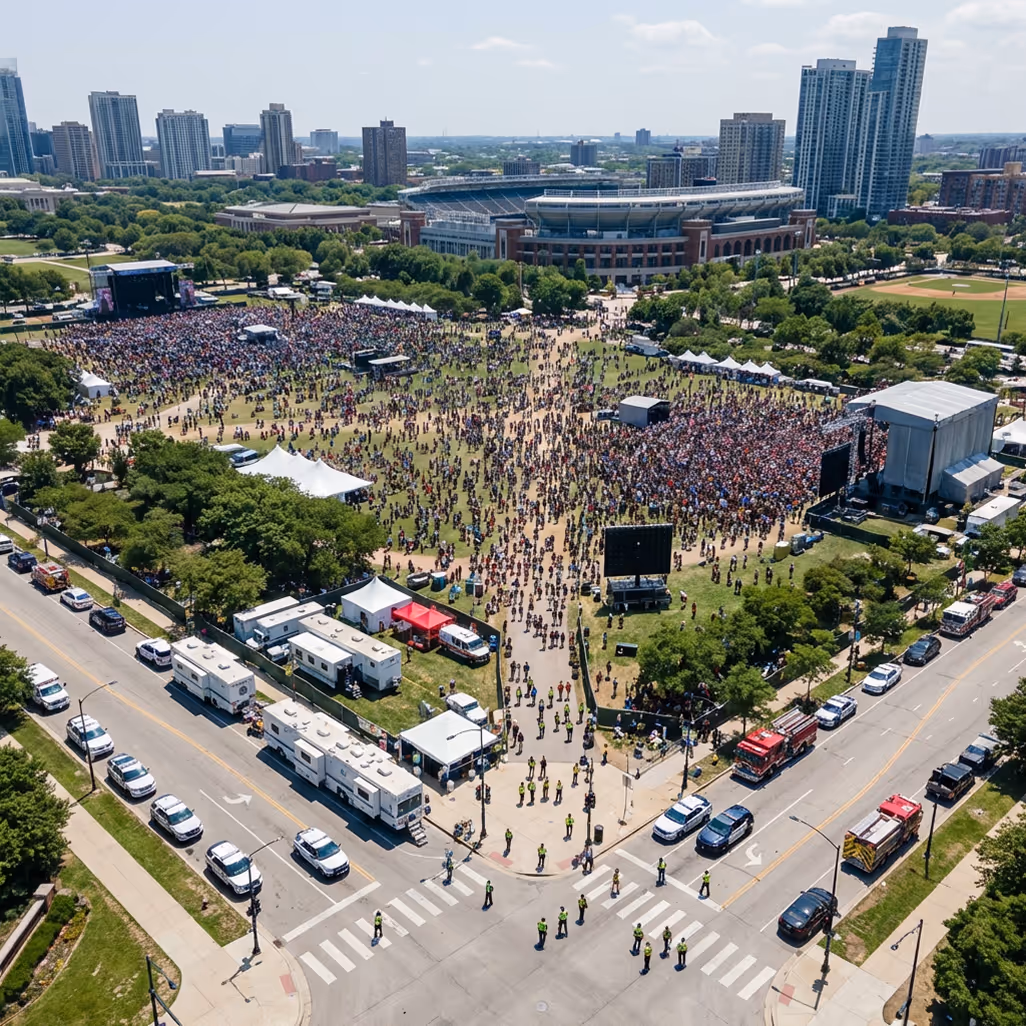
Supervisión de eventos públicos
Supervise la densidad de multitudes y detecte incidentes en 30 segundos, en lugar de los 5 a 10 minutos de los informes de los observadores terrestres, utilizando las capacidades de supervisión aérea.
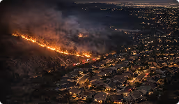
Detección y monitoreo de incendios forestales
Los incendios atrapados en menos de 1 acre tienen una tasa de contención del 90%. El monitoreo continuo muestra las amenazas en el perímetro, la dirección y la estructura de la dispersión.
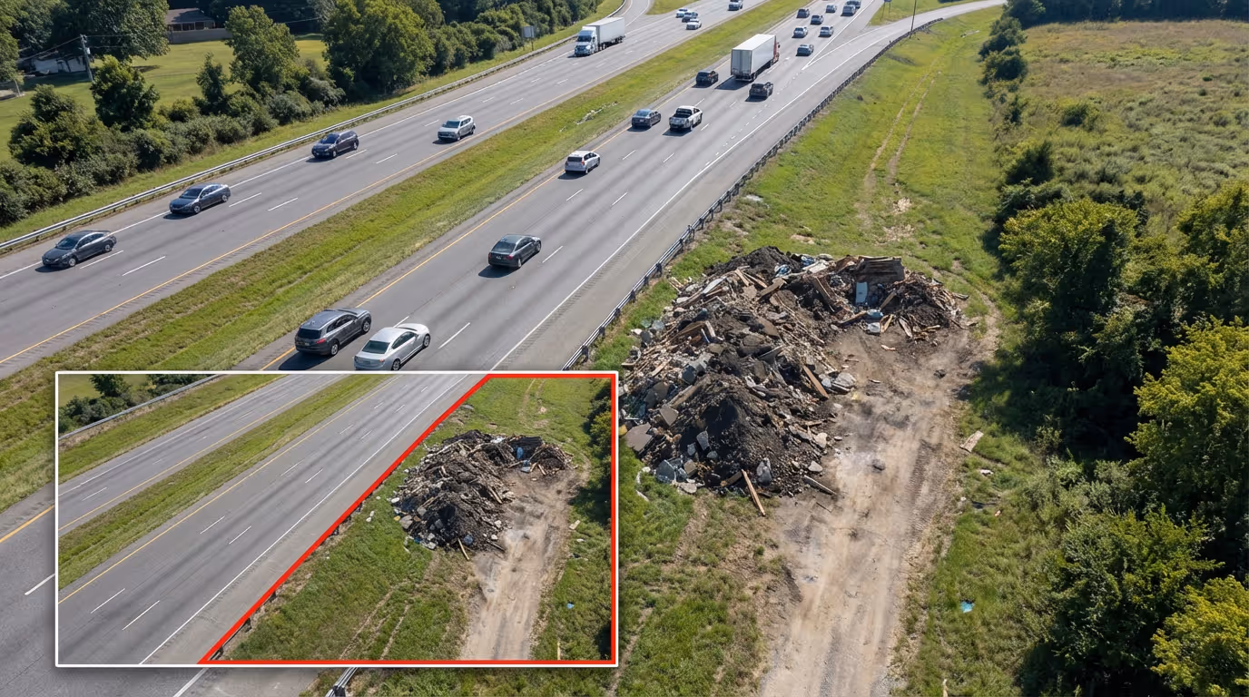
Dumping ilegal y aplicación del código
Identifique las infracciones en un plazo de 24 a 72 horas en lugar de semanas a partir de las quejas de los ciudadanos. Las pruebas georreferenciadas con fecha y hora refuerzan los casos de aplicación de la ley.
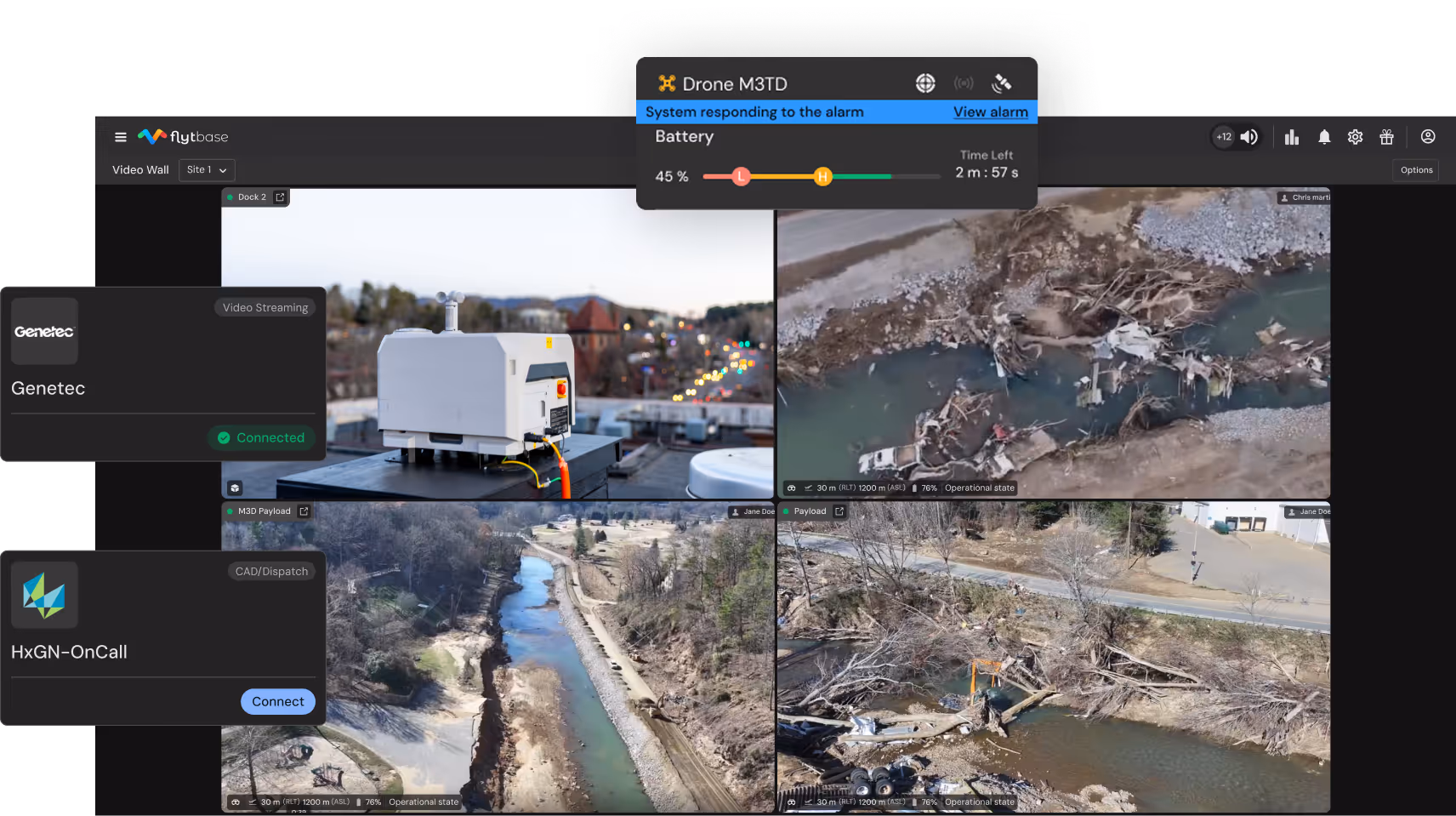
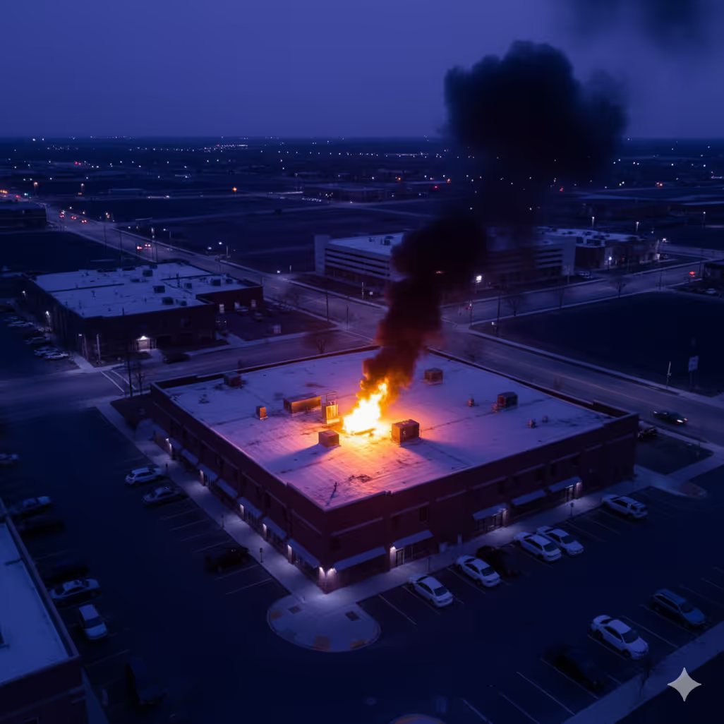
Evaluación posterior a un desastre
Evaluación completa de los daños en una o dos horas en toda la ciudad. Las imágenes térmicas identifican de forma segura a las personas atrapadas en estructuras.
Es genial entrar allí y comprobar que cada vez que hay una llamada, en uno o dos minutos, están en el lugar con el dron. Para ellos, lo que más les apasiona es poder responder en cualquier lugar de la ciudad y en cualquier momento.

Rhys Andersen
Fundador y director ejecutivo de Overwatch

Agentes de IA de FlytBase diseñados para la seguridad pública
La IA de FlytBase ayuda a los operadores al resaltar automáticamente los detalles y patrones de los objetos en las imágenes aéreas, lo que reduce la carga de la revisión manual y ayuda a los operadores a tomar decisiones informadas más rápidas.
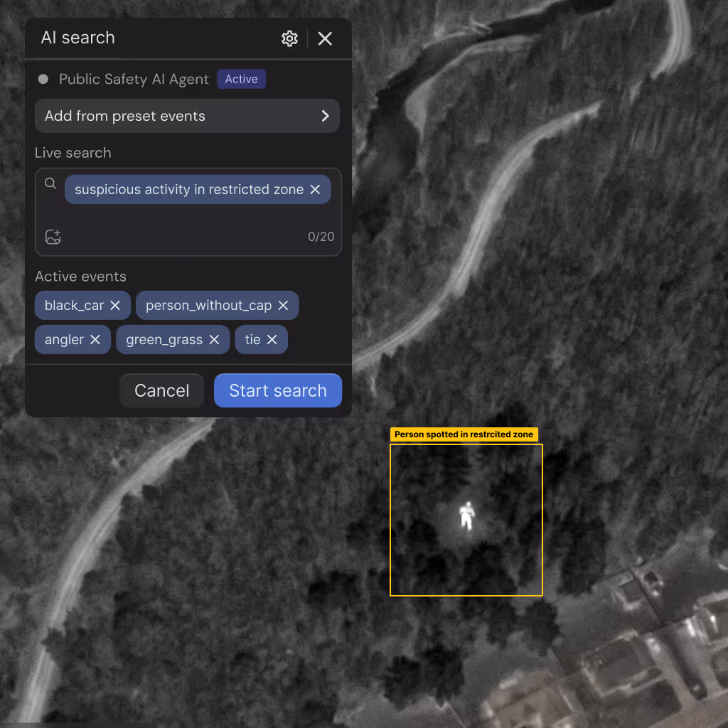
Detector de objetos multimodal
Identifica automáticamente los vehículos, las personas y las señales térmicas con los detalles del tipo de recuento y la matrícula durante las operaciones.

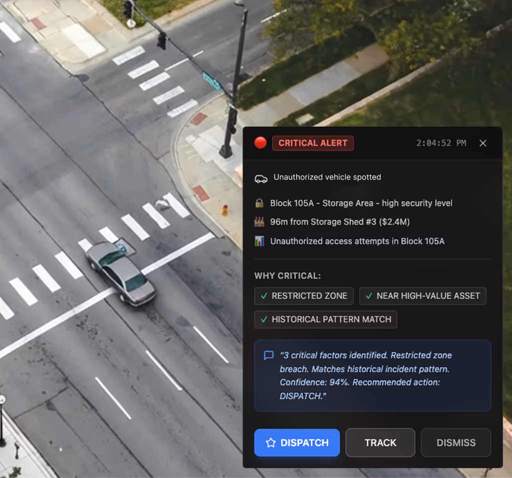
Clasificador de gravedad de incidentes
Evalúa la gravedad de los incidentes a partir de indicadores visuales que permiten tomar decisiones rápidas de clasificación y despliegue de recursos antes de la llegada a tierra.
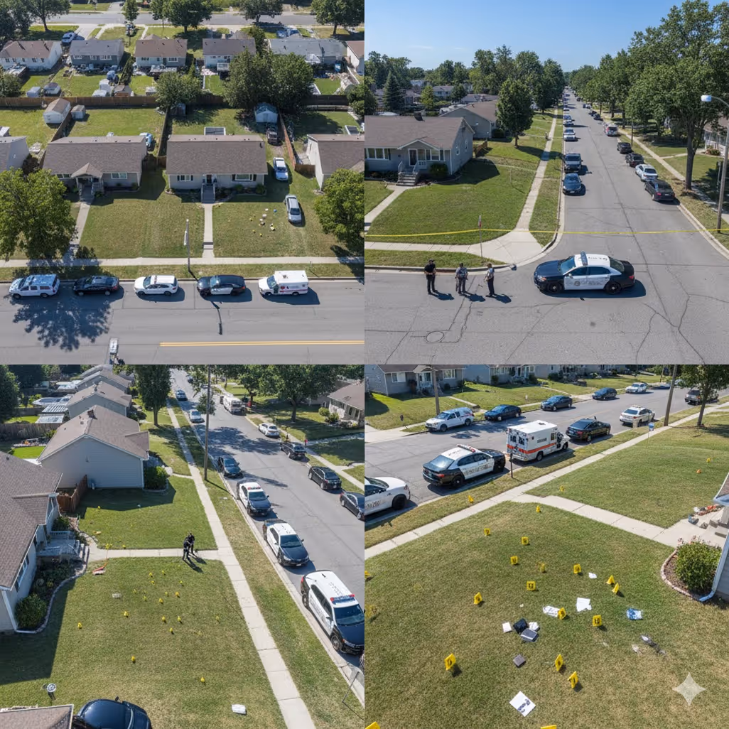
Generador de paquetes de evidencia
Combina automáticamente clips de vídeo, imágenes, coordenadas GPS y marcas de tiempo en documentación lista para el tribunal sin intervención manual.

Detector de cambios de infraestructura
Compara las imágenes actuales con las de referencia, marcando nuevas grietas, crecimiento de vegetación o cambios en el equipo que requieren atención inmediata.
Analizador de densidad de multitudes
Genera mapas térmicos de densidad en tiempo real que identifican las zonas de riesgo de hacinamiento y evita automáticamente los incidentes de aplastamiento durante los eventos públicos.
Detector de anomalías térmicas
Identifica las señales de calor de incendios, puntos eléctricos o personas invisibles para las cámaras RGB, especialmente durante la noche.
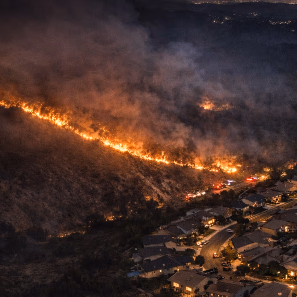
Mapeador de perímetro de incendios
Realiza un seguimiento de la propagación, la dirección, el alcance y la estructura de las amenazas, proporcionando información en tiempo real para las decisiones de seguridad de los bomberos.
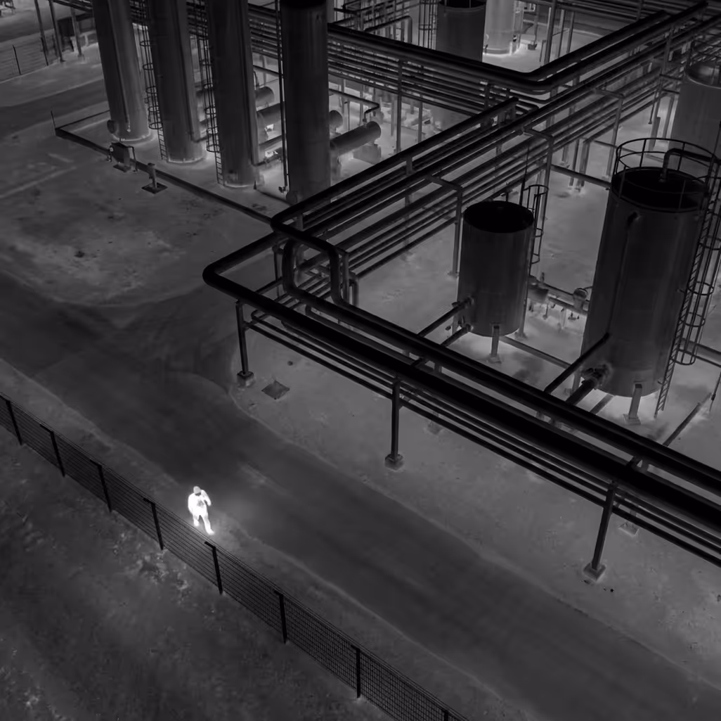
Detector de intrusión perimetral
Detección de acceso no autorizado verificada por IA con empaquetado de pruebas automatizado para la respuesta a los incidentes y la evaluación de las amenazas de seguridad.
Detector de objetos multimodal
Identifica automáticamente los vehículos, las personas y las señales térmicas con los detalles del tipo de recuento y la matrícula durante las operaciones.
Clasificador de gravedad de incidentes
Evalúa la gravedad de los incidentes a partir de indicadores visuales que permiten tomar decisiones rápidas de clasificación y despliegue de recursos antes de la llegada a tierra.
Generador de paquetes de evidencia
Combina automáticamente clips de vídeo, imágenes, coordenadas GPS y marcas de tiempo en documentación lista para el tribunal sin intervención manual.
Detector de cambios de infraestructura
Compara las imágenes actuales con las de referencia, marcando nuevas grietas, crecimiento de vegetación o cambios en el equipo que requieren atención inmediata.
Analizador de densidad de multitudes
Genera mapas térmicos de densidad en tiempo real que identifican las zonas de riesgo de hacinamiento y evita automáticamente los incidentes de aplastamiento durante los eventos públicos.
Detector de anomalías térmicas
Identifica las señales de calor de incendios, puntos eléctricos o personas invisibles para las cámaras RGB, especialmente durante la noche.
Mapeador de perímetro de incendios
Realiza un seguimiento de la propagación, la dirección, el alcance y la estructura de las amenazas, proporcionando información en tiempo real para las decisiones de seguridad de los bomberos.
Detector de intrusión perimetral
Detección de acceso no autorizado verificada por IA con empaquetado de pruebas automatizado para la respuesta a los incidentes y la evaluación de las amenazas de seguridad.
Diseñado para funcionar con su paquete de implementación
Diseñado para integrarse en las implementaciones de seguridad pública del mundo real en entornos de hardware, software y normativos sin interrumpir los sistemas existentes, los flujos de trabajo de despacho o los procedimientos operativos.
Drones y muelles
Apoye las operaciones autónomas continuas con drones y estaciones de acoplamiento de nivel empresarial en diversos entornos urbanos, suburbanos y rurales.
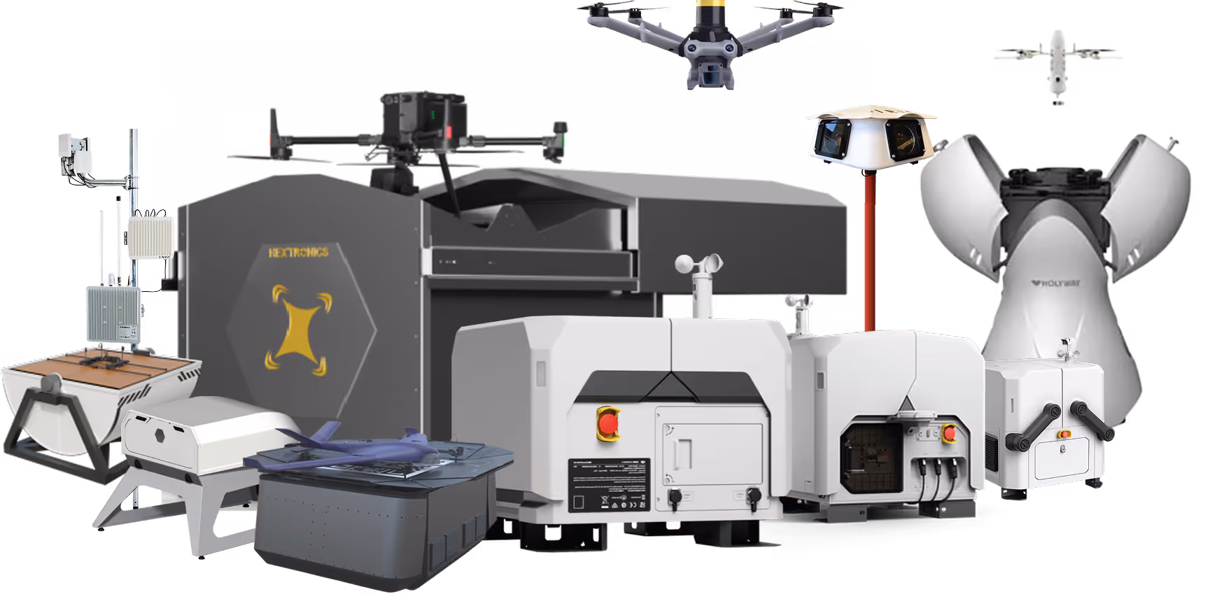
Cargas útiles y accesorios
Amplíe la capacidad operativa con cámaras térmicas, altavoces, focos y cargas útiles específicas para cada misión para una respuesta variada a los incidentes.
Plataforma de autonomía para drones FlytBase
Organice la automatización de misiones, los agentes y los flujos de trabajo de inteligencia artificial a través de una plataforma de autonomía unificada que gestione las implementaciones en varios sitios y las operaciones de flota.
Aplicaciones e integraciones
Intégrelo con los sistemas de despacho CAD, la gestión del tráfico (VMS), las herramientas de SIG (CMMS), las plataformas meteorológicas y los centros de operaciones de emergencia para adaptarse a los entornos operativos existentes.
Integración
- CAD (envío asistido por ordenador)VMS (sistemas de gestión de vídeo)Sistemas de gestión del tráficoSIG y gestión de activosCMMS/Sistemas de órdenes de trabajoSistemas meteorológicosPlataformas de gestión de emergenciasSistemas de seguridad perimetral
Aprobaciones reglamentarias
Una plataforma para la autonomía de drones de seguridad pública a escala empresarial
FlytBase proporciona la confiabilidad, la inteligencia y la madurez operativa necesarias para ejecutar programas de drones autónomos a escala en entornos de seguridad pública de misión crítica.
Probado a escala
Opere más de 150 despliegues de drones autónomos con un tiempo de actividad comprobado y una confiabilidad de nivel de producción.
Arquitectura que prioriza la IA
Aplica la inteligencia artificial y la visión artificial diseñadas desde cero para las operaciones de seguridad pública.

Seguridad y cumplimiento de nivel empresarial
Cumpla los estrictos requisitos de seguridad con modelos de implementación flexibles y de cumplimiento de SOC 2.

Soberanía local de productos y datos
Respalde la residencia de datos en el país, las necesidades de cumplimiento regional y los requisitos de idioma local.

Autonomía verdadera
Ejecute operaciones en muelles sin supervisión las 24 horas del día, los 7 días de la semana, sin necesidad de pilotar manualmente ni aumentar la carga de trabajo del operador
Soporte empresarial dedicado
Confíe en la capacitación de asistencia para el despliegue y en los equipos de apoyo receptivos con experiencia en seguridad pública.