Plataforma autónoma de drones para la seguridad minera y la excelencia operativa
Implemente inspecciones automatizadas con drones de equipos, transportadores, carreteras de transporte y zonas de explosión, lo que reduce el costoso tiempo de inactividad mediante el mantenimiento preventivo y, al mismo tiempo, permite una supervisión operativa continua.
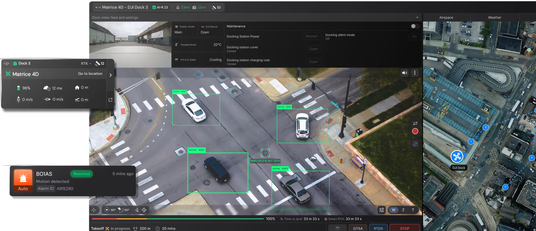
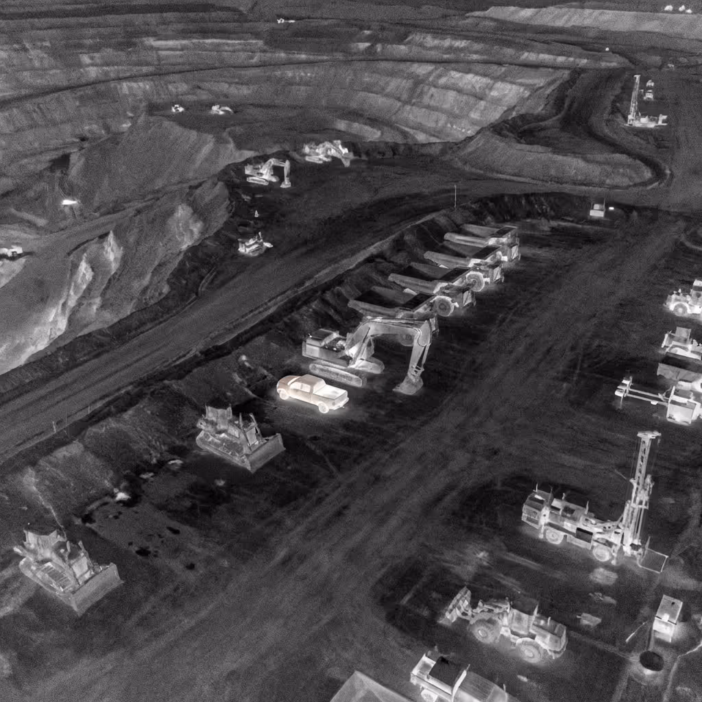
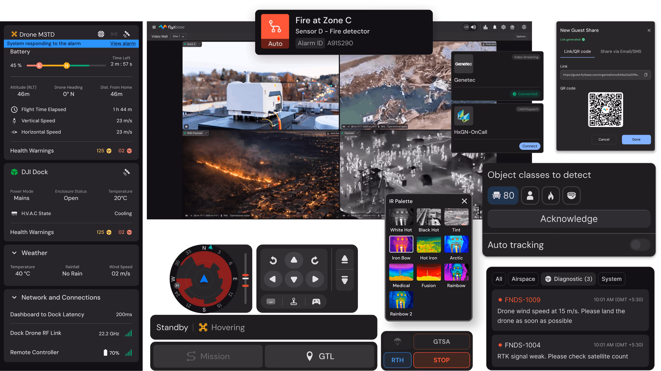
Transforme la seguridad minera de una respuesta reactiva a una supervisión continua
Reparaciones de emergencia para el mantenimiento planificado
La supervisión continua de los equipos permite programar el mantenimiento en función del estado, lo que reduce el inventario de piezas de repuesto y evita las fallas que interrumpen la producción.
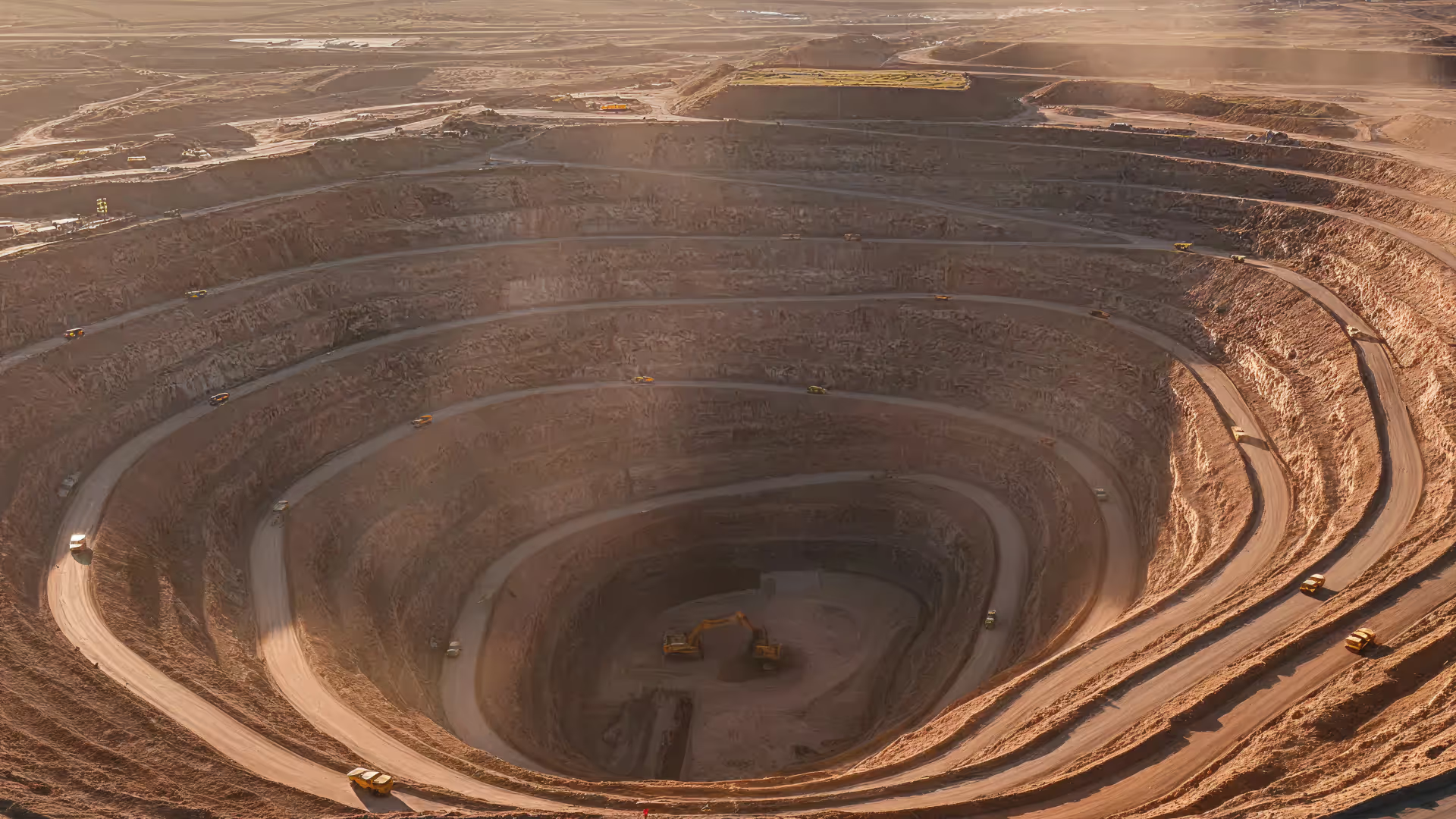
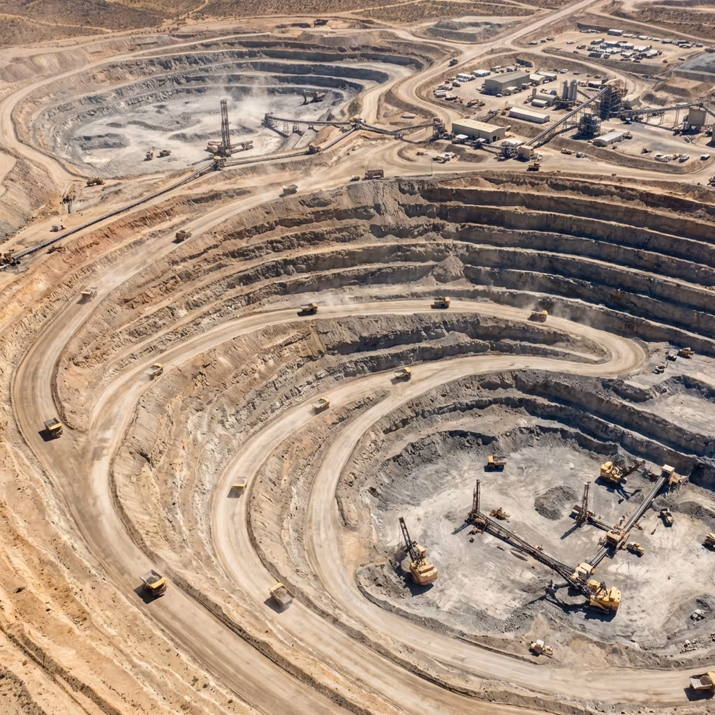
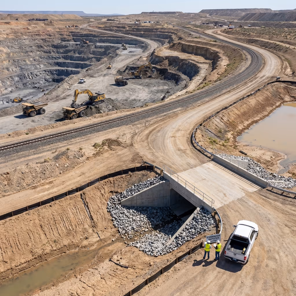
De los estudios terrestres a la inteligencia aérea
Las misiones automatizadas capturan datos completos del sitio sin movilizar a los equipos de inspección, lo que elimina las interrupciones de la producción y acelera la toma de decisiones.
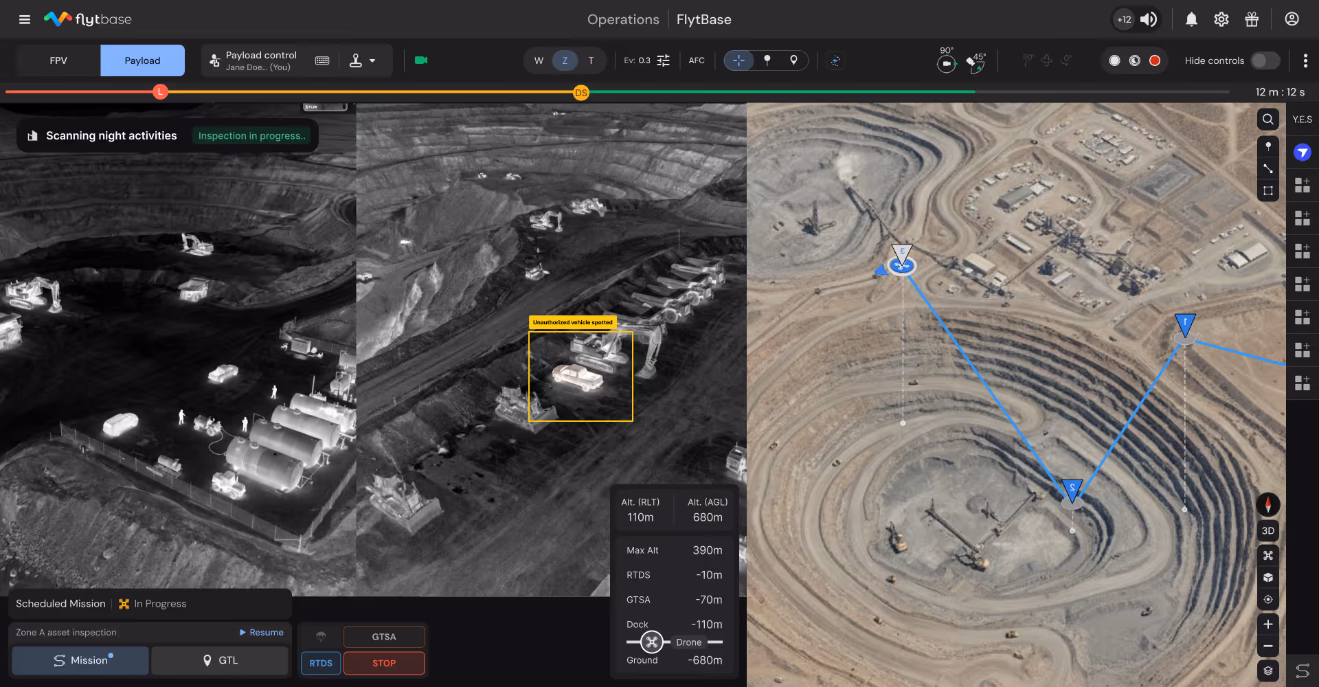
Vulnerabilidad a la protección continua fuera del horario laboral
Las patrullas perimetrales nocturnas con detección térmica identifican las intrusiones y los intentos de robo de equipos, lo que protege los activos de alto valor sin necesidad de personal de seguridad adicional.
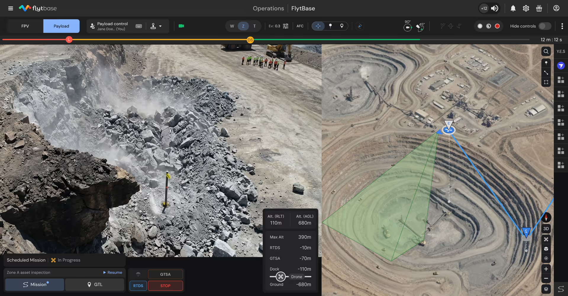
De autorizaciones lentas a una verificación rápida
La evaluación del peligro posterior a la explosión se realiza inmediatamente después de que todo esté despejado, identificando los fallos de encendido y el terreno inestable antes de que el personal vuelva a entrar y se reanude la producción.
Implemente inteligencia autónoma en operaciones mineras críticas
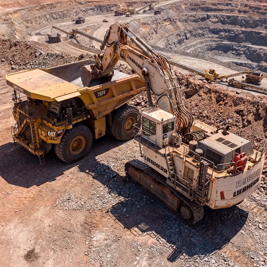
Inspecciones de equipos y activos
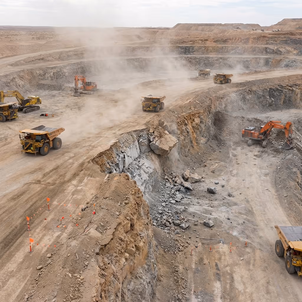
Las misiones de inspección automatizadas capturan imágenes de alta resolución de transportadores, trituradoras, camiones de transporte y excavadoras que detectan el desgaste y las fallas.
Operaciones previas y posteriores a la explosión
Los estudios aéreos sistemáticos identifican los peligros desde distancias seguras antes de que el personal vuelva a entrar, lo que acelera la autorización y, al mismo tiempo, mantiene los estándares de seguridad.
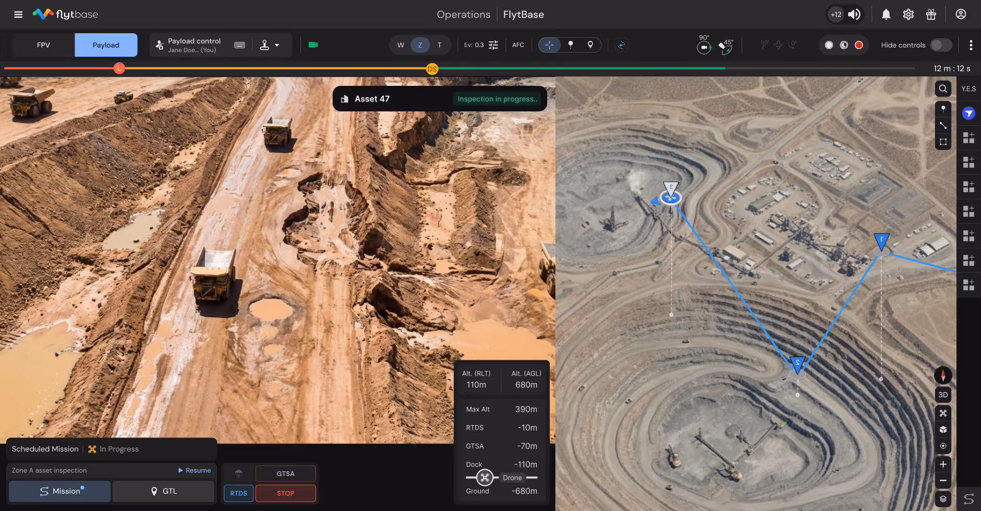
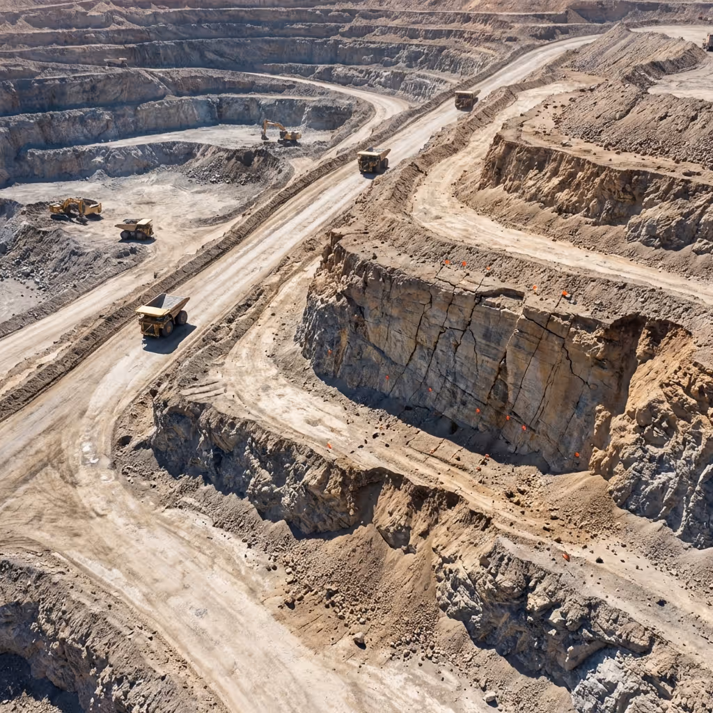
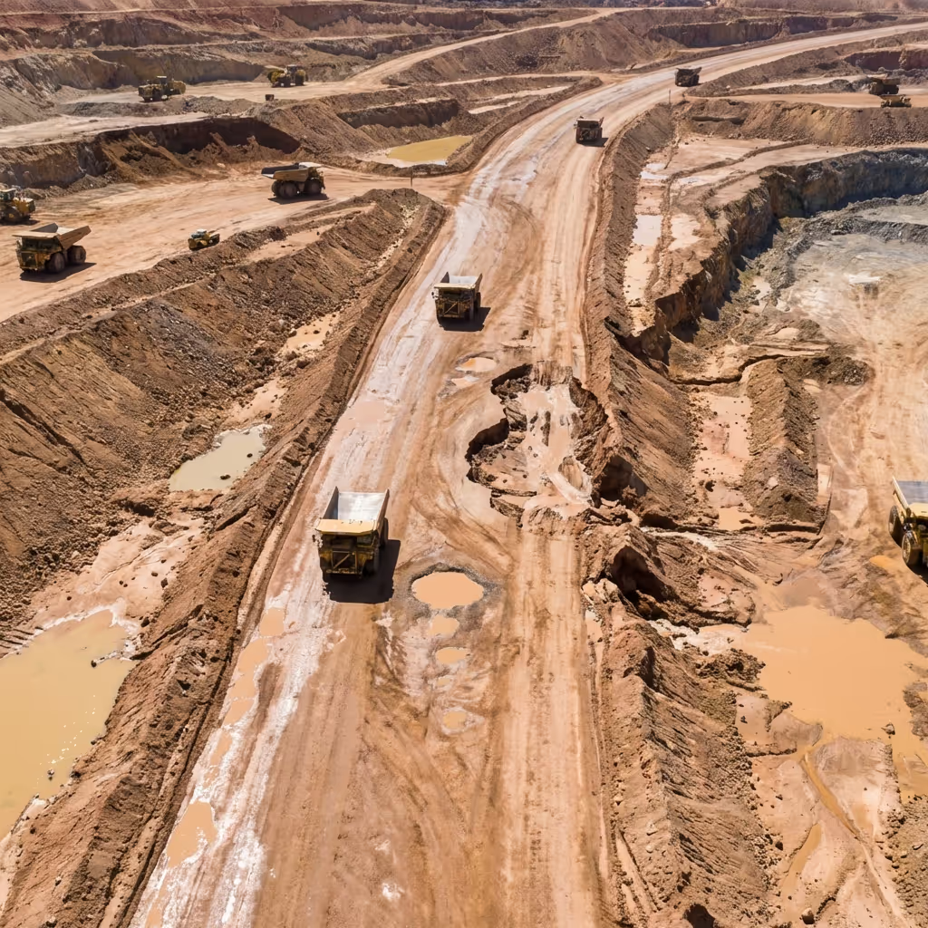
Monitorización activa de carreteras de transporte y boxes
La supervisión aérea continua de las zonas de trabajo identifica los problemas de proximidad de los equipos y los peligros en desarrollo antes de que ocurran los incidentes.
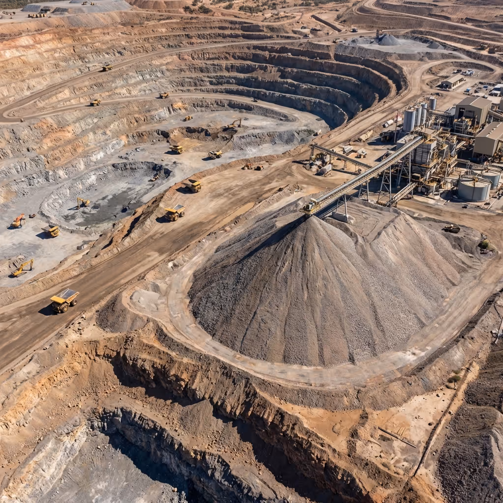
Medición del volumen de existencias
Las misiones de fotogrametría automatizadas generan cálculos de volumen precisos sin la movilización del equipo de inspección ni la interrupción de la producción, lo que elimina las demoras tradicionales en la topografía.
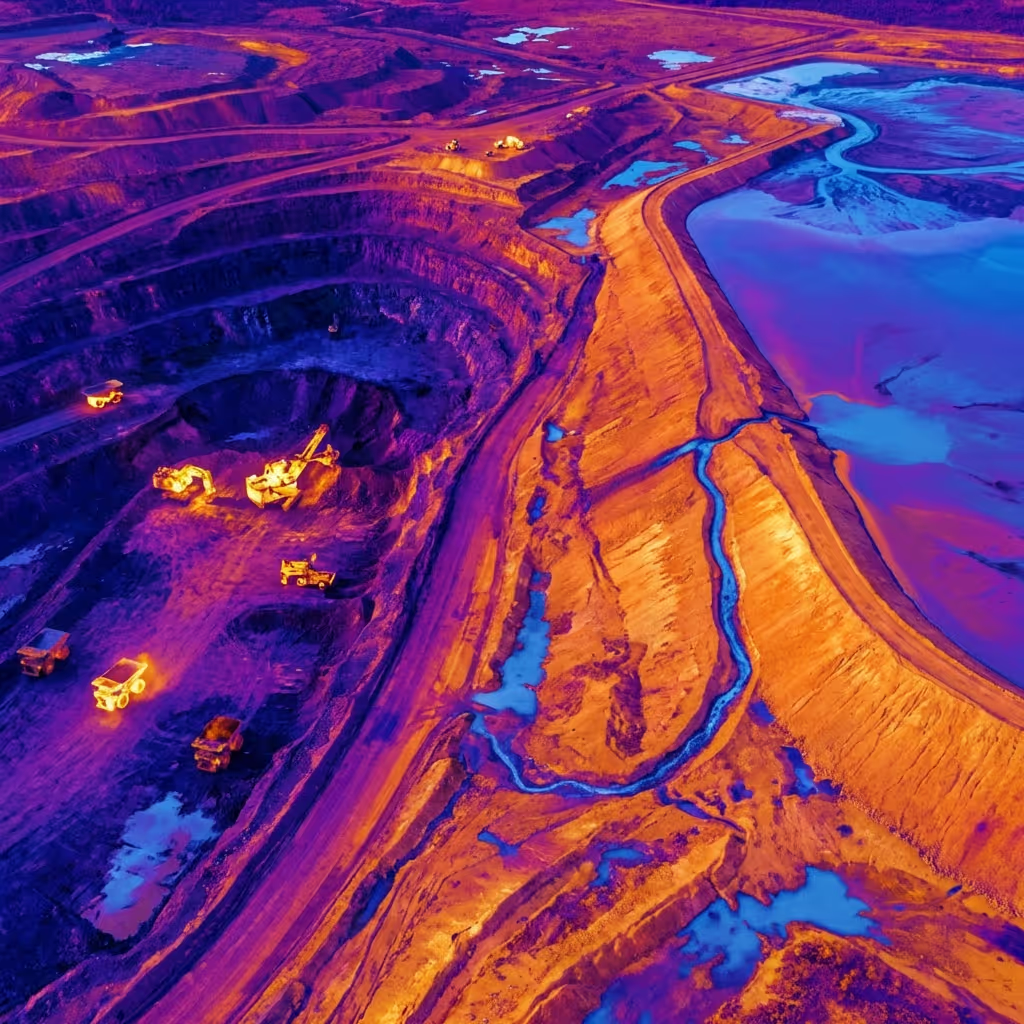
Monitorización de instalaciones de relaves
Los vuelos programados con imágenes térmicas detectan patrones de filtración y anomalías estructurales, lo que permite un mantenimiento proactivo antes de la escalada.
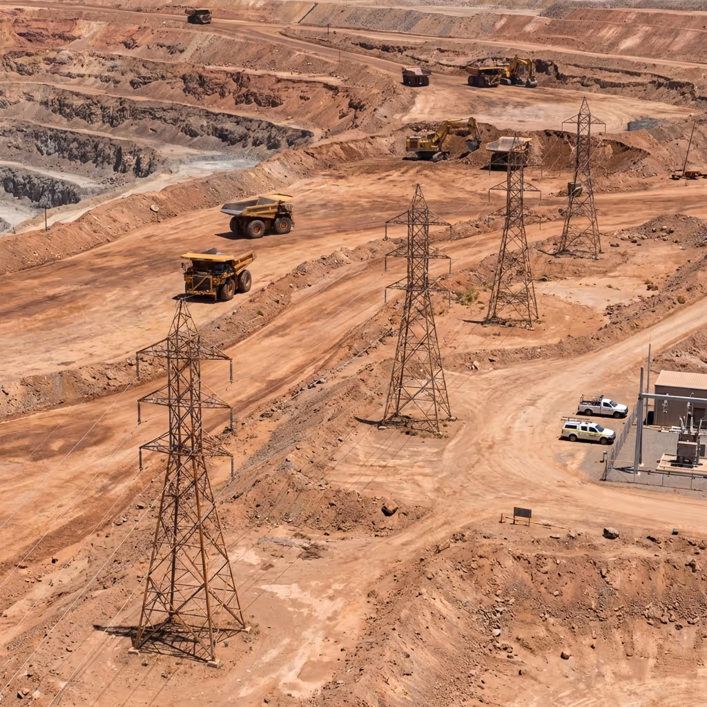
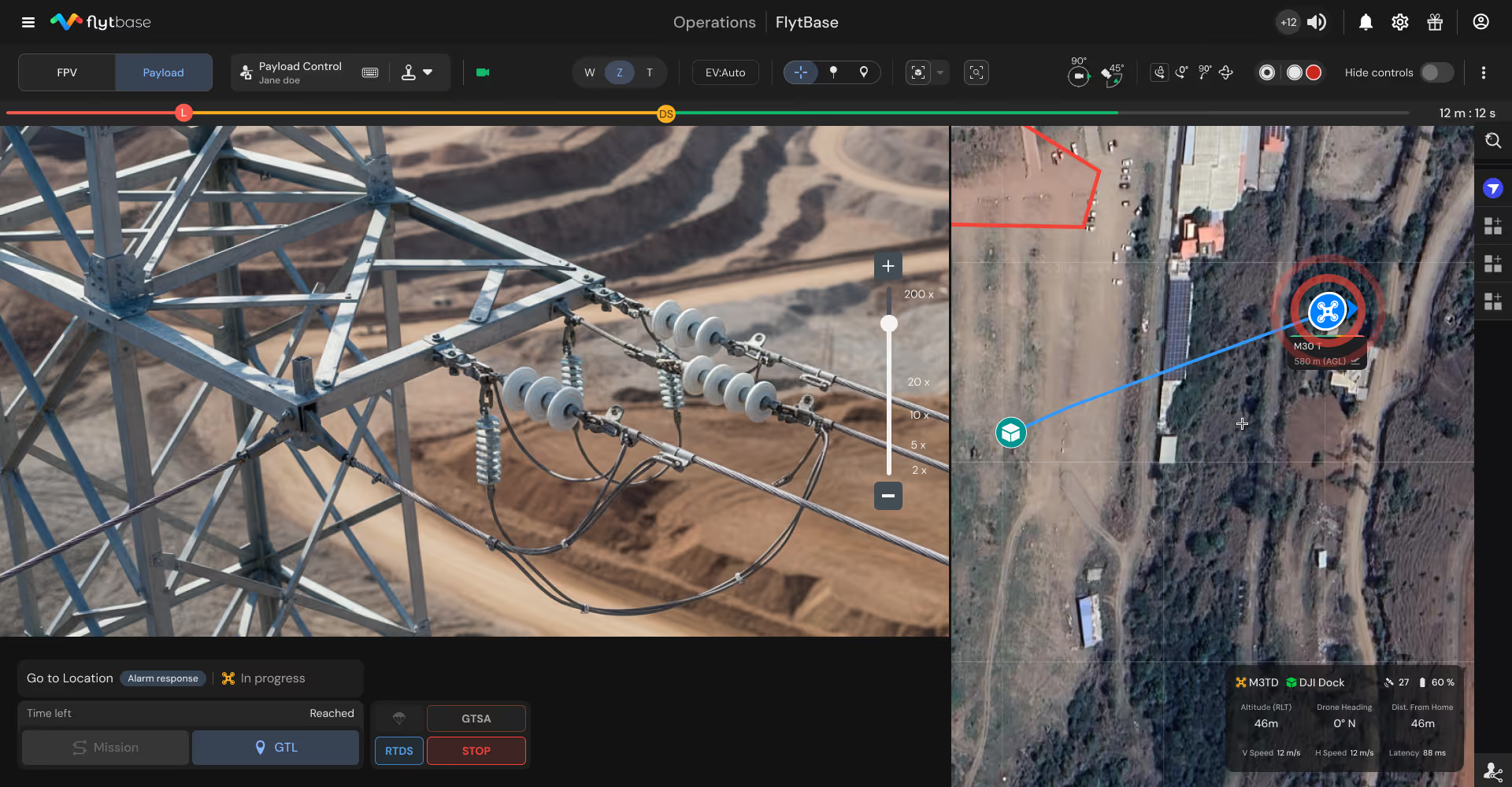
Inspección del estado de la infraestructura
Las misiones aéreas regulares inspeccionan las líneas eléctricas, las tuberías, las carreteras y las instalaciones remotas y documentan las necesidades de mantenimiento con registros visuales completos.
Coordinación de la respuesta a emergencias
El envío aéreo bajo demanda proporciona a los comandantes de incidentes un conocimiento inmediato de la situación para evaluar los peligros antes de comprometer a los socorristas.
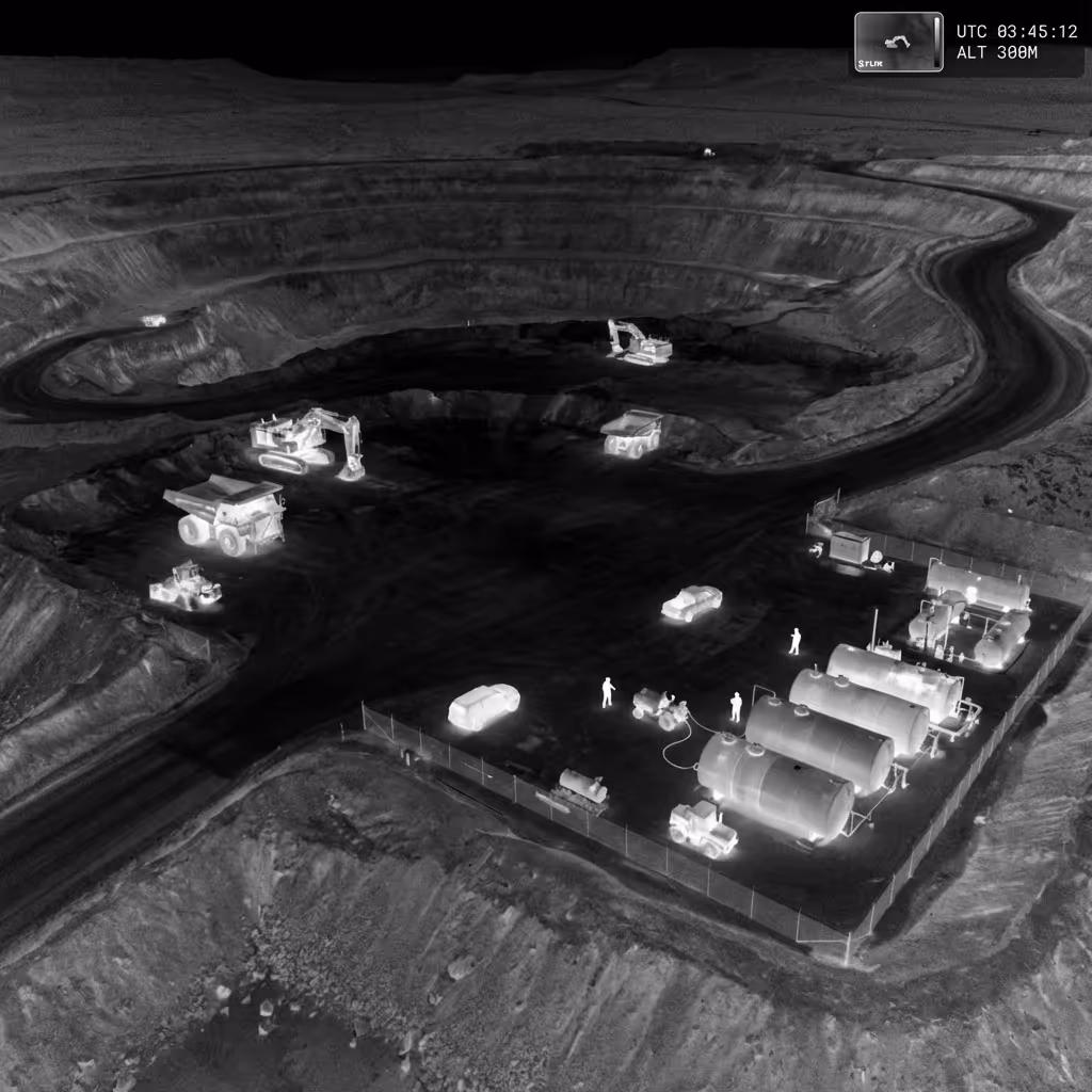
Seguridad perimetral y prevención de robos
Las patrullas nocturnas automatizadas detectan vehículos no autorizados, manipulaciones de equipos, robos de cobre y robos de combustible, lo que protege los activos de alto valor en sitios remotos.
Agentes de IA de FlytBase creados para operaciones mineras
Ayude a los equipos de operaciones y seguridad destacando automáticamente los detalles críticos durante los incidentes, reduciendo la carga de la revisión manual y ayudando a tomar decisiones más rápidas.
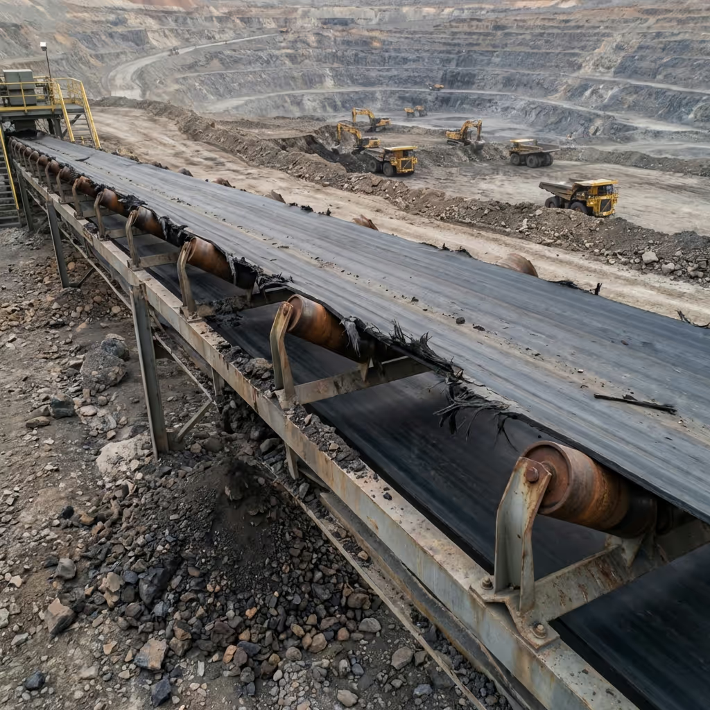
Detección de desgaste del equipo
Identifique las grietas estructurales, los daños en los componentes, el desgaste de las correas y las fallas mecánicas en transportadores, trituradoras y camiones, lo que permite un mantenimiento preventivo.

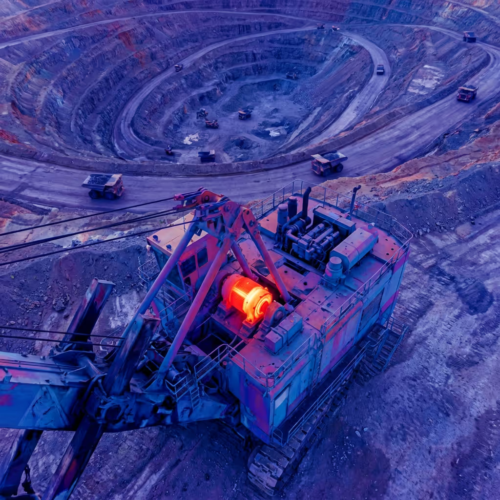
Identificación de anomalías térmicas
Detecte el sobrecalentamiento de motores, fallos en los rodamientos, puntos calientes eléctricos y averías de los equipos antes de que se produzcan fallos catastróficos y pérdidas de producción.
Detección de cambios estructurales
Compare las imágenes aéreas a lo largo del tiempo para identificar el movimiento de las pendientes, los asentamientos, los patrones de erosión y la degradación de la infraestructura que son fundamentales para el monitoreo.
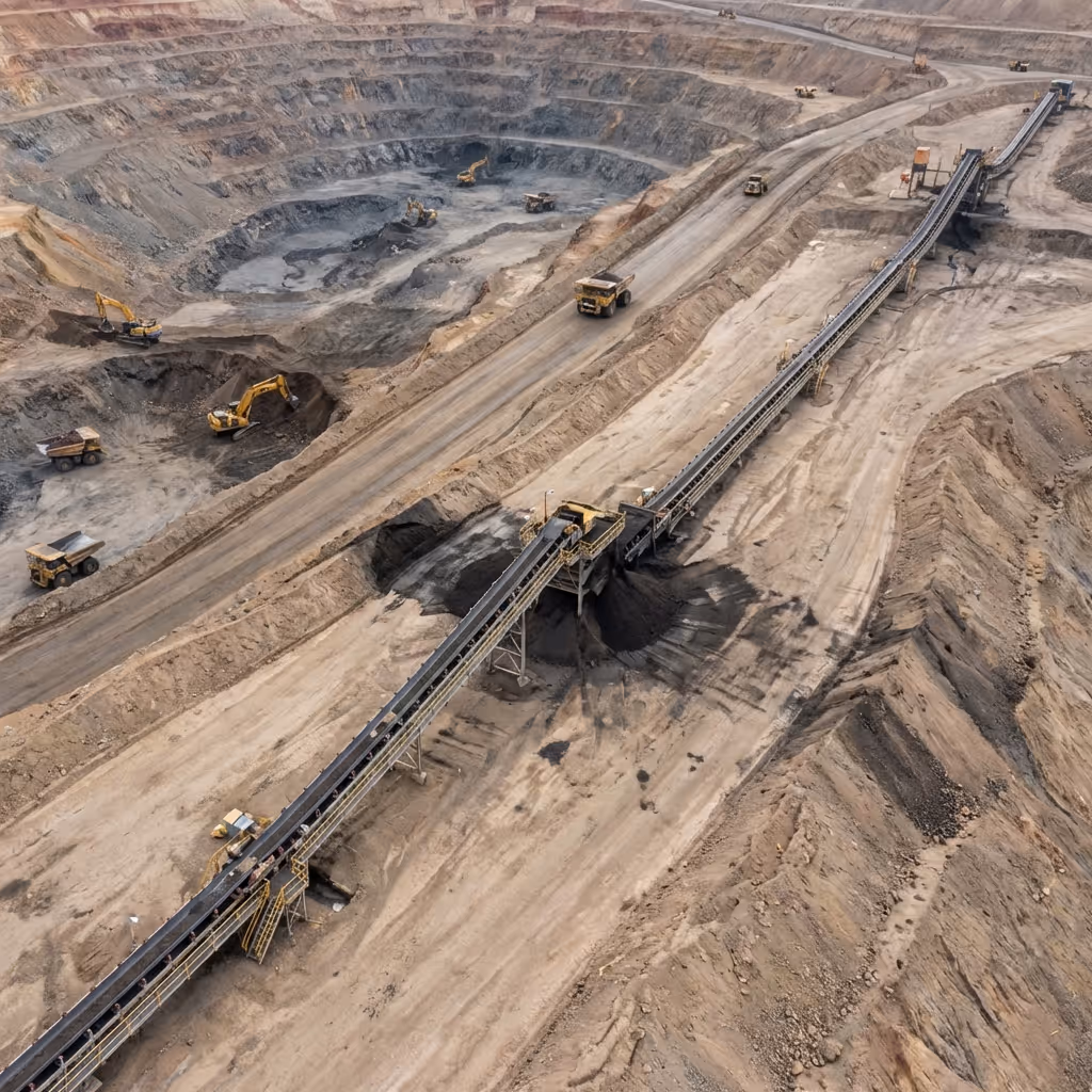
Análisis del estado del transportador
Analice la alineación de las correas, el estado de los rodillos, los derrames de material y la integridad de la estructura, automatizando la documentación de inspección de rutina y priorizando las reparaciones.
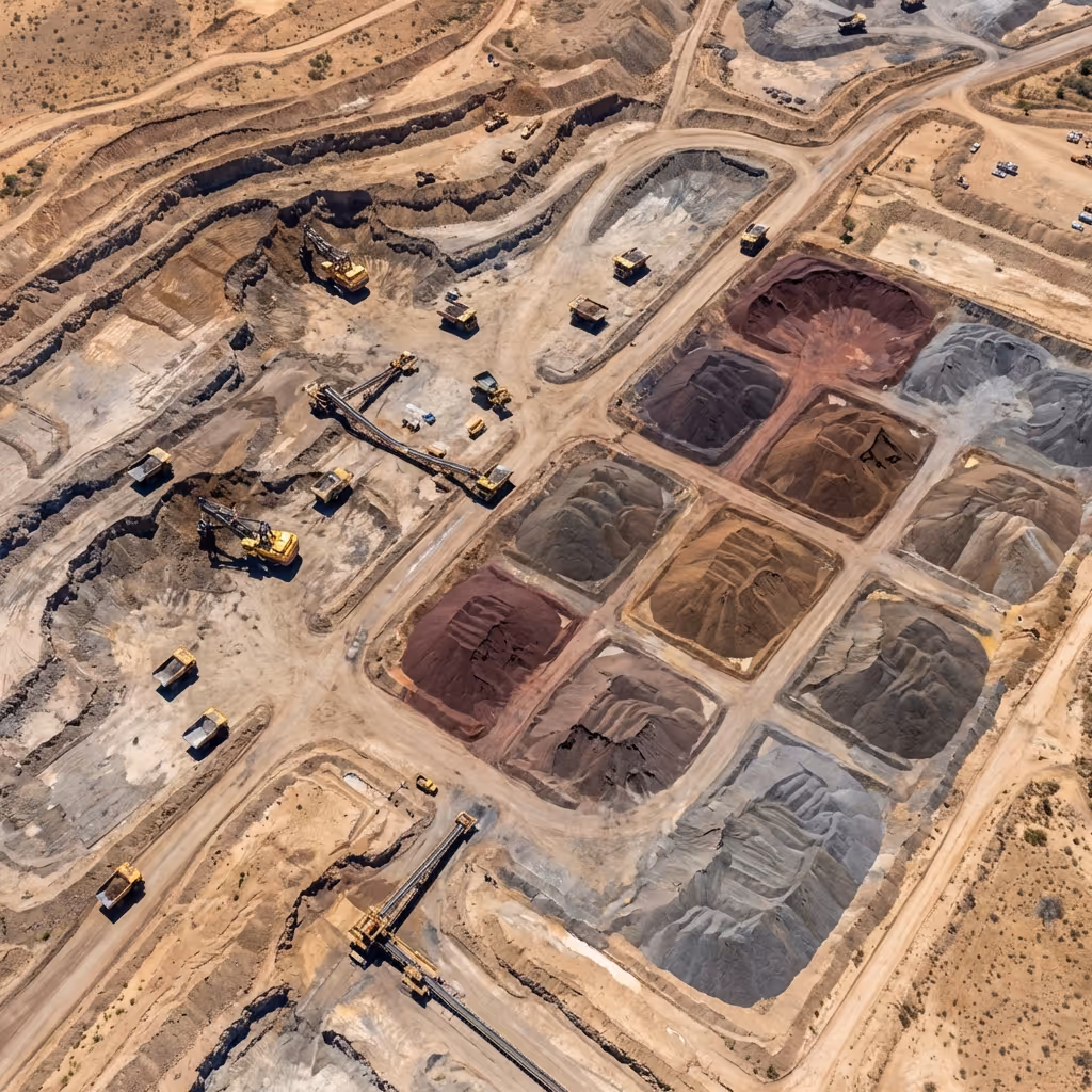
Cartografía de los límites de las existencias
Genere límites precisos de las existencias a partir de imágenes aéreas, lo que permite realizar cálculos precisos del volumen y realizar un seguimiento del inventario sin necesidad de realizar levantamientos manuales.
Evaluación de la superficie de las carreteras de transporte
Identifique los baches, los derrumbes, la acumulación de escombros y los problemas de drenaje, lo que permite un mantenimiento proactivo de las carreteras antes de que el equipo se dañe o se retrase.
Detección de amenazas de seguridad
Detecte vehículos no autorizados, personal en zonas restringidas, manipulación de equipos y actividades de robo durante las patrullas fuera del horario laboral con alertas.
Identificación del peligro en la zona de explosión
Analice las áreas posteriores a la explosión para identificar fallas de encendido, terrenos inestables, peligros de escombros y obstrucciones de acceso antes de que el personal autorice y reingrese.
Detección de desgaste del equipo
Identifique las grietas estructurales, los daños en los componentes, el desgaste de las correas y las fallas mecánicas en transportadores, trituradoras y camiones, lo que permite un mantenimiento preventivo.
Identificación de anomalías térmicas
Detecte el sobrecalentamiento de motores, fallos en los rodamientos, puntos calientes eléctricos y averías de los equipos antes de que se produzcan fallos catastróficos y pérdidas de producción.
Detección de cambios estructurales
Compare las imágenes aéreas a lo largo del tiempo para identificar el movimiento de las pendientes, los asentamientos, los patrones de erosión y la degradación de la infraestructura que son fundamentales para el monitoreo.
Análisis del estado del transportador
Analice la alineación de las correas, el estado de los rodillos, los derrames de material y la integridad de la estructura, automatizando la documentación de inspección de rutina y priorizando las reparaciones.
Cartografía de los límites de las existencias
Genere límites precisos de las existencias a partir de imágenes aéreas, lo que permite realizar cálculos precisos del volumen y realizar un seguimiento del inventario sin necesidad de realizar levantamientos manuales.
Evaluación de la superficie de las carreteras de transporte
Identifique los baches, los derrumbes, la acumulación de escombros y los problemas de drenaje, lo que permite un mantenimiento proactivo de las carreteras antes de que el equipo se dañe o se retrase.
Detección de amenazas de seguridad
Detecte vehículos no autorizados, personal en zonas restringidas, manipulación de equipos y actividades de robo durante las patrullas fuera del horario laboral con alertas.
Identificación del peligro en la zona de explosión
Analice las áreas posteriores a la explosión para identificar fallas de encendido, terrenos inestables, peligros de escombros y obstrucciones de acceso antes de que el personal autorice y reingrese.
Diseñado para funcionar con su conjunto de operaciones mineras
Diseñado para integrarse en las operaciones mineras en entornos normativos, de hardware y de software sin interrumpir los sistemas de despacho, seguridad o planificación existentes.
Drones y muelles
Apoye las operaciones autónomas continuas con drones de nivel empresarial y estaciones de acoplamiento resistentes a la intemperie en entornos mineros hostiles.
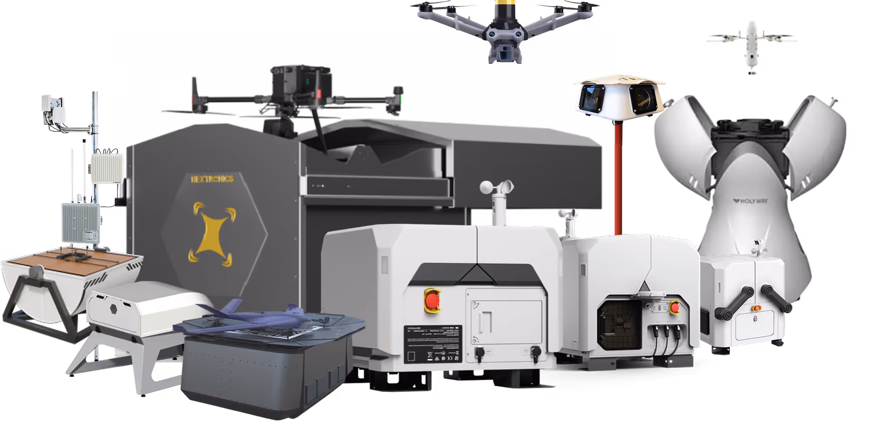
Cargas útiles y accesorios
Amplíe la capacidad operativa con cámaras térmicas, lentes de zoom, sensores LiDAR y cargas útiles específicas para cada misión para cumplir con los requisitos de inspección.
Plataforma de autonomía para drones FlytBase
Organice las misiones, la automatización, los agentes de inteligencia artificial y los flujos de trabajo a través de una plataforma de autonomía unificada diseñada para operaciones mineras ininterrumpidas.
Aplicaciones e intimidaciones
- Sistemas SCADAGestión de flotasPlataformas VMSSoftware de planificación mineraAplicaciones empresariales que se adaptan a los flujos de trabajo operativos existentes.
Aprobaciones reglamentarias
Una plataforma para la autonomía de drones de seguridad pública a escala empresarial
FlytBase proporciona la confiabilidad, la inteligencia y la madurez operativa necesarias para ejecutar programas de drones autónomos a escala en entornos de seguridad pública de misión crítica.
Probado a escala
Opere más de 150 despliegues de drones autónomos con un tiempo de actividad comprobado y una confiabilidad de nivel de producción.
Arquitectura que prioriza la IA
Aplica la inteligencia artificial y la visión artificial diseñadas desde cero para las operaciones de seguridad pública.

Seguridad y cumplimiento de nivel empresarial
Cumpla los estrictos requisitos de seguridad con modelos de implementación flexibles y de cumplimiento de SOC 2.

Soberanía local de productos y datos
Respalde la residencia de datos en el país, las necesidades de cumplimiento regional y los requisitos de idioma local.

Autonomía verdadera
Ejecute operaciones en muelles sin supervisión las 24 horas del día, los 7 días de la semana, sin necesidad de pilotar manualmente ni aumentar la carga de trabajo del operador
Soporte empresarial dedicado
Confíe en la capacitación de asistencia para el despliegue y en los equipos de apoyo receptivos con experiencia en seguridad pública.