


Public Safety
Eyes on Scene Before First Responders Arrive
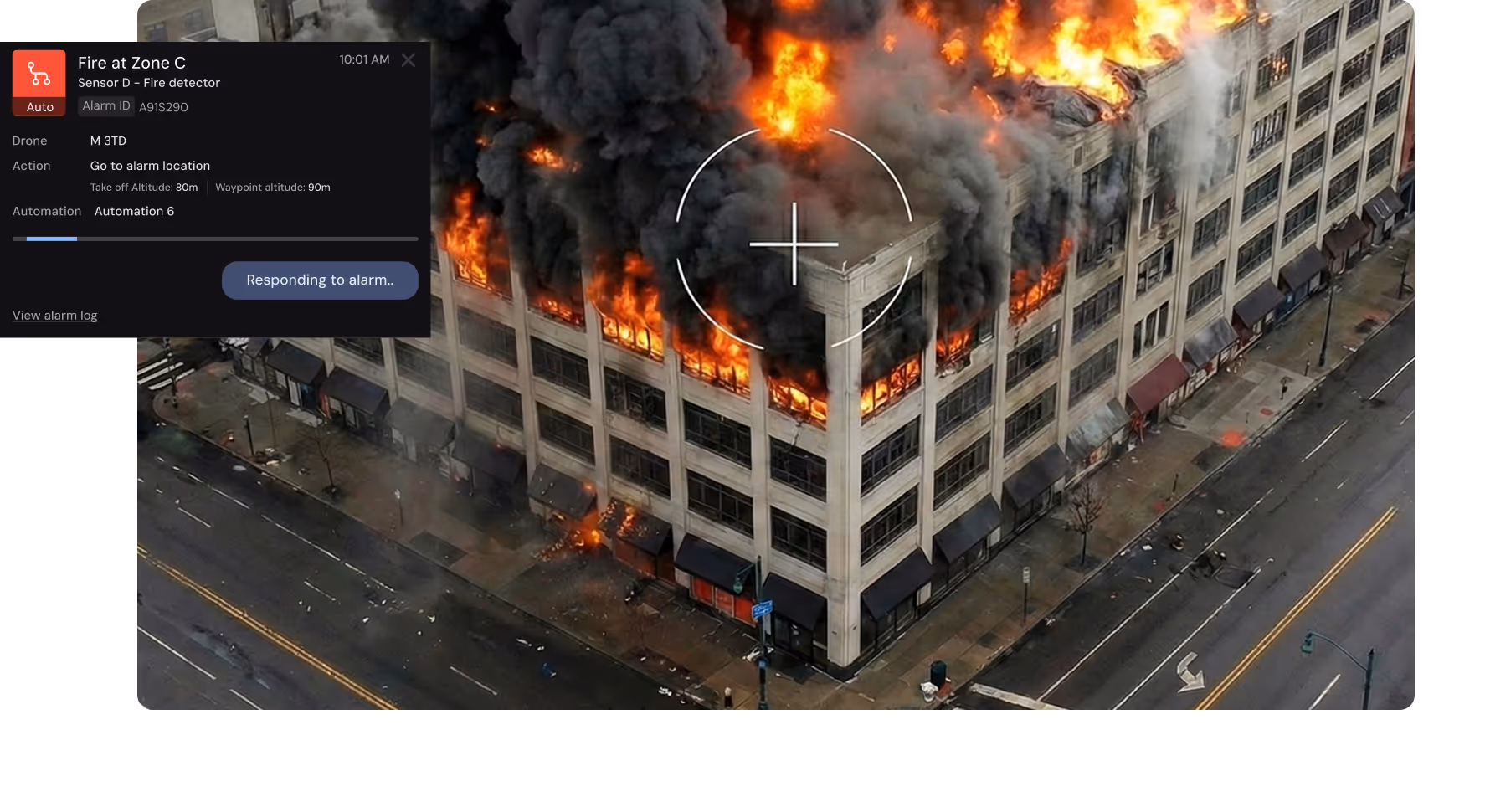
Automated docked drones deliver aerial intelligence faster than ground crews, typically 2-10 minutes from dispatch, transforming emergency response from uninformed deployment to informed decisions.
50% reduction in traffic incident intervention time
Learn More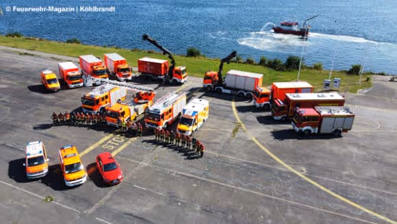
5-7 minutes of drowning rescue time saved
Learn MoreFrom 911 dispatch to court-ready evidence in four stages
One platform supporting core public safety mission areas
Emergency Response and Incident Command
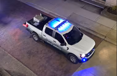
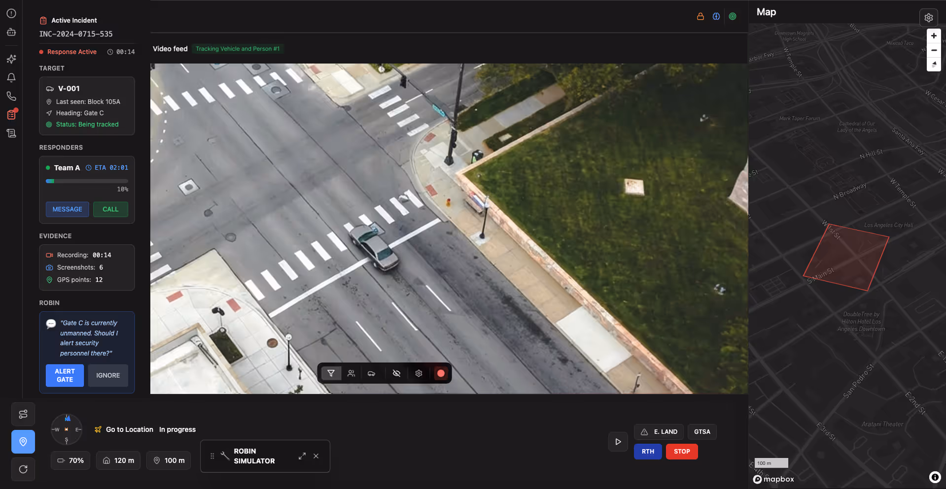
Provide live aerial visibility to assess hazards, track suspects, and support tactical decisions before ground responders arrive on scene.

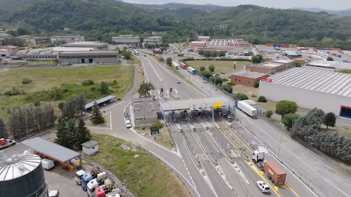
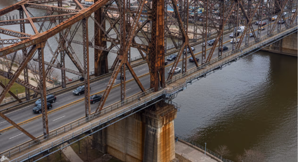
Traffic Incident Management
Reduce accident clearance time by 35% through immediate aerial damage assessment. Document scenes in 5 minutes versus 45 manual.
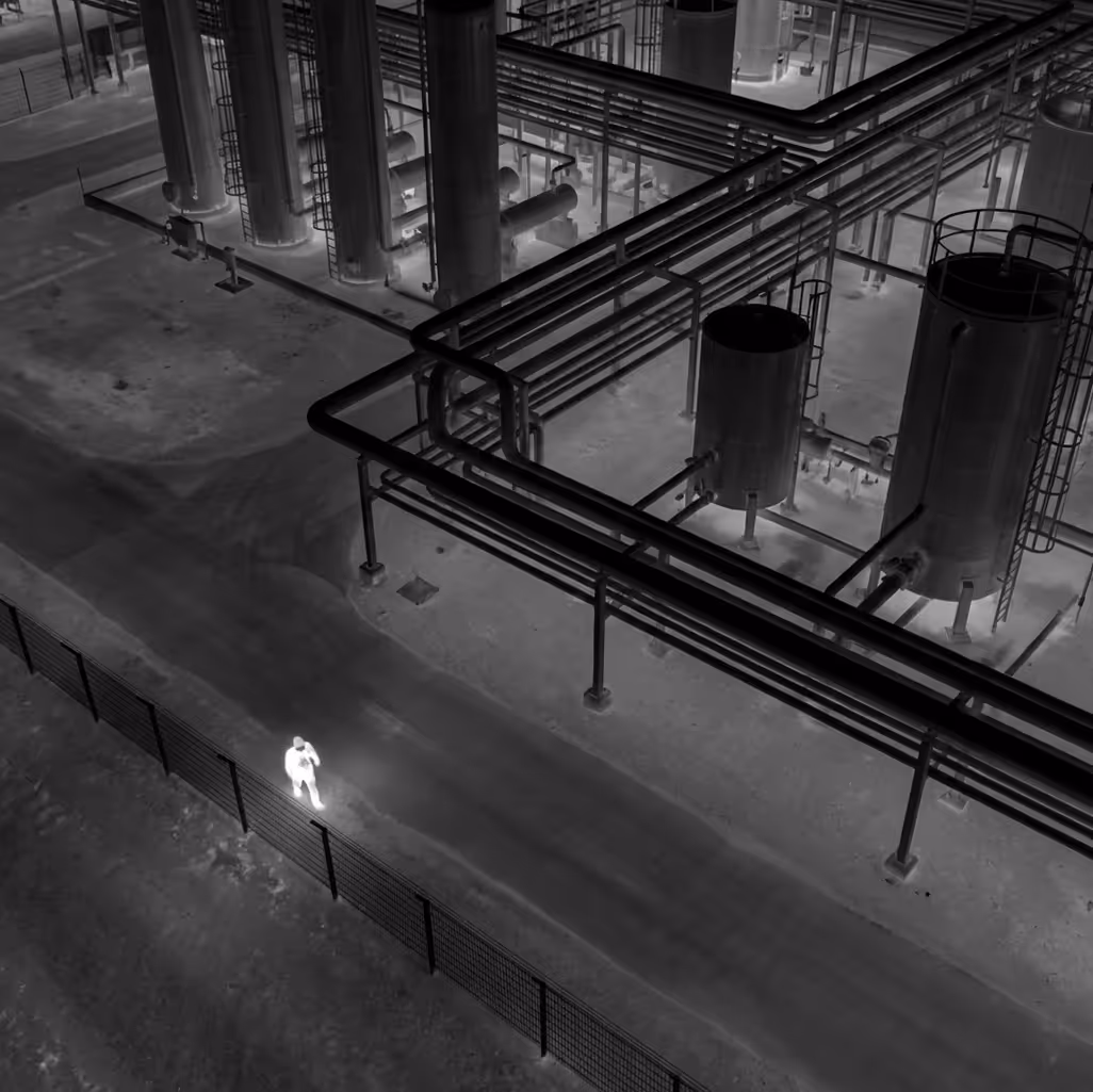
Critical Infrastructure Monitoring
Shift from annual inspections to weekly automated monitoring. Detect structural issues 50 weeks earlier, preventing catastrophic infrastructure failures.

Search and Rescue Operations
Search 100+ acres in 30 minutes with thermal imaging versus 50+ ground searcher hours. Deploy within 5 minutes of report.

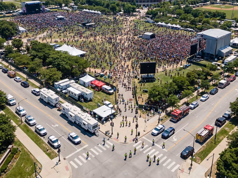
Public Event Oversight
Monitor crowd density and detect incidents within 30 seconds versus 5-10 minutes from ground observer reports using aerial oversight capabilities.
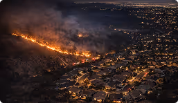
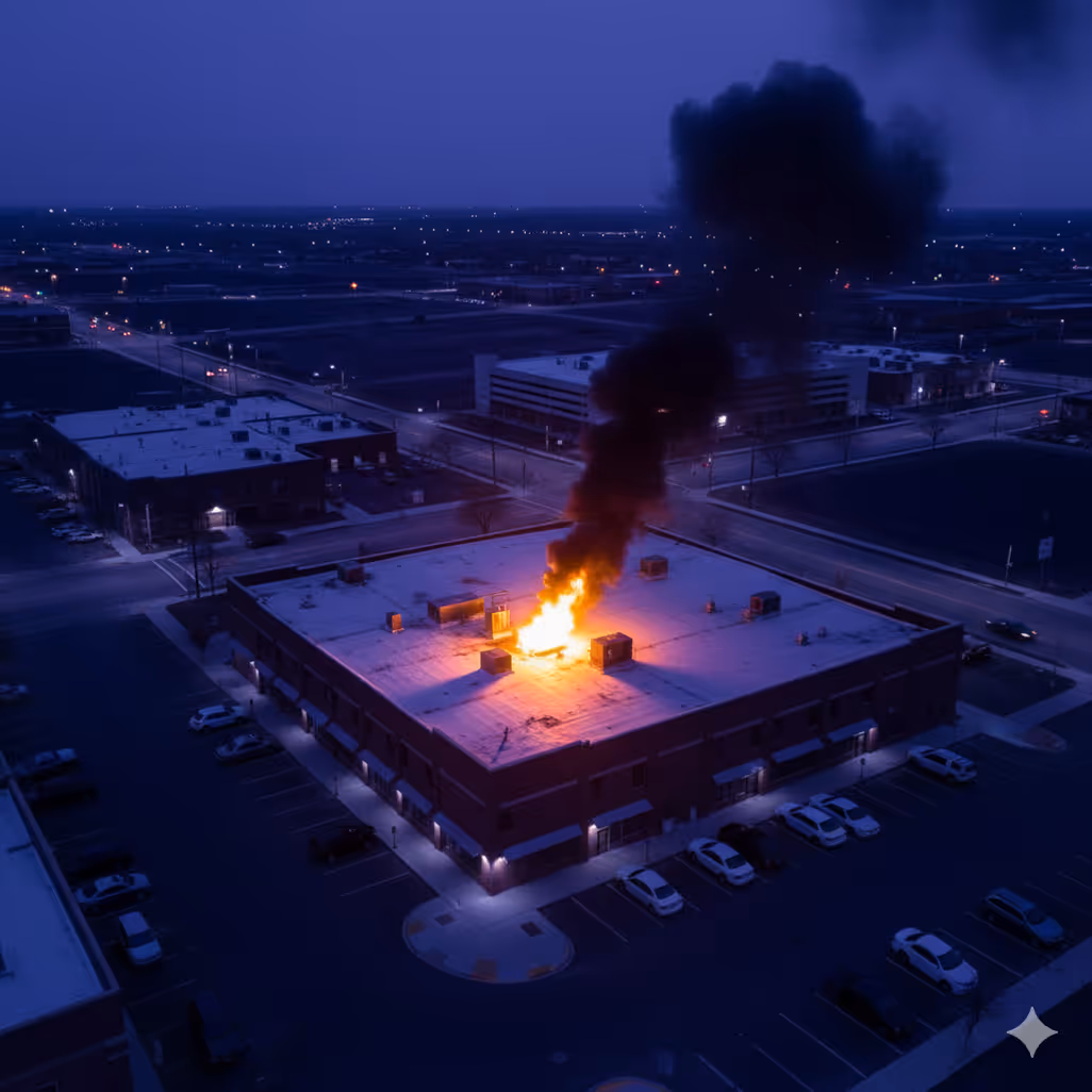
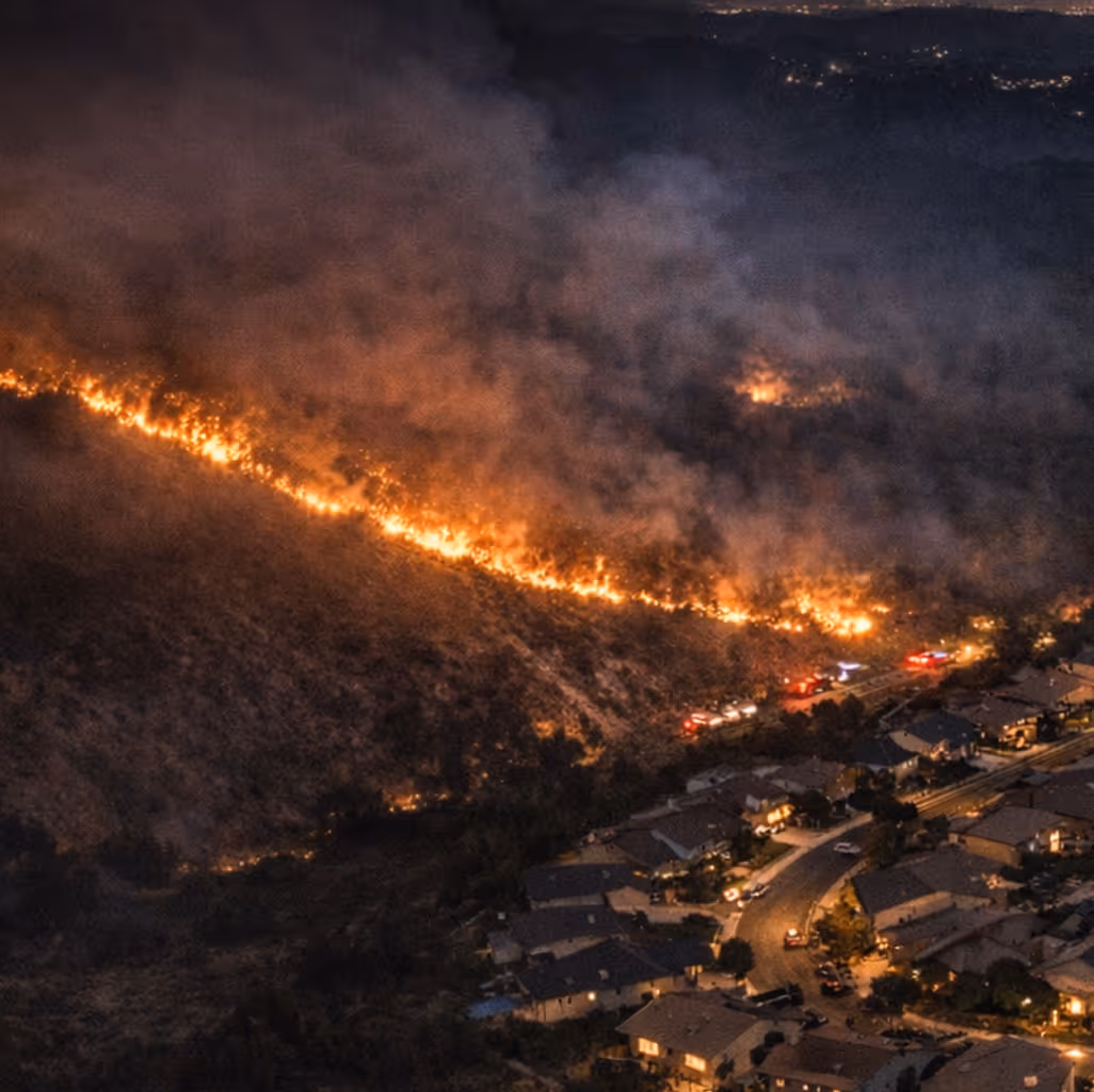
Wildfire Detection and Monitoring
Fires caught at under 1 acre have 90% containment rate. Continuous monitoring shows perimeter spread direction and structure threats.
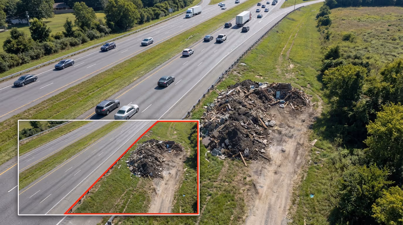
Illegal Dumping and Code Enforcement
Identify violations within 24-72 hours versus weeks from citizen complaints. Timestamped geo-referenced evidence strengthens enforcement cases.
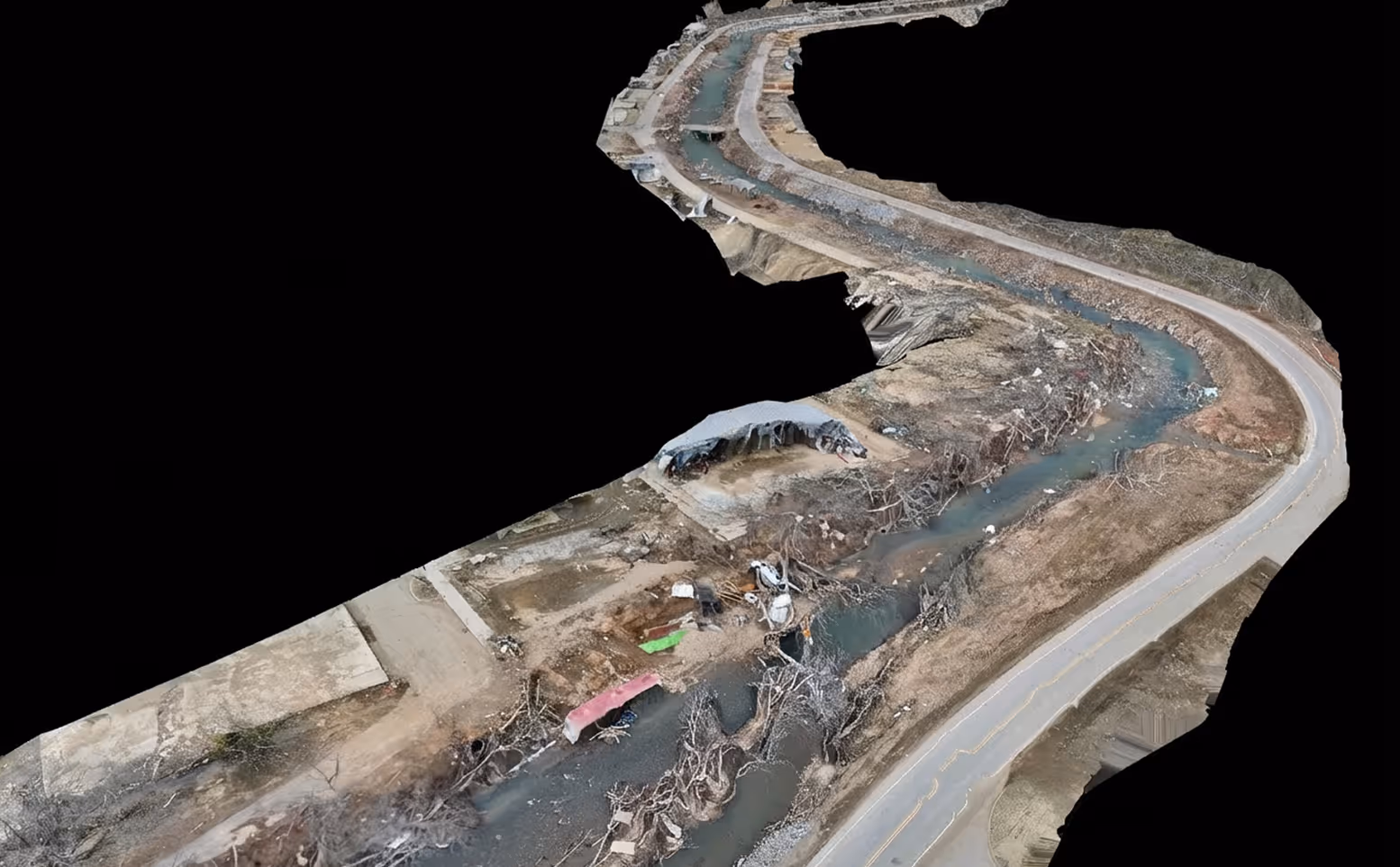
Post-Disaster Assessment
Complete damage assessment in 1-2 hours city-wide. Thermal imaging identifies people trapped in structures safely.
It's really cool to go in there and just see that anytime there's a call, within a minute or two, they're out on-site with the drone. For them, the thing that makes them the most passionate is just being able to respond anywhere in the city at any time.

Rhys Andersen
The emergency call center had a view of the incident before I was even there. No people in the water, no one trapped, and we avoided sending multiple units.

Daniel Ritter
FlytBase AI agents built for public safety
FlytBase AI assists operators by automatically highlighting objects, details, and patterns in aerial footage, reducing manual review burden and helping operators make faster, informed decisions.
Multi-Modal Object Detector
Identifies vehicles, people, and heat signatures with count, type, and license plate details automatically during operations.
Incident Severity Classifier
Assesses incident severity from visual indicators, enabling rapid triage and resource deployment decisions before ground arrival.
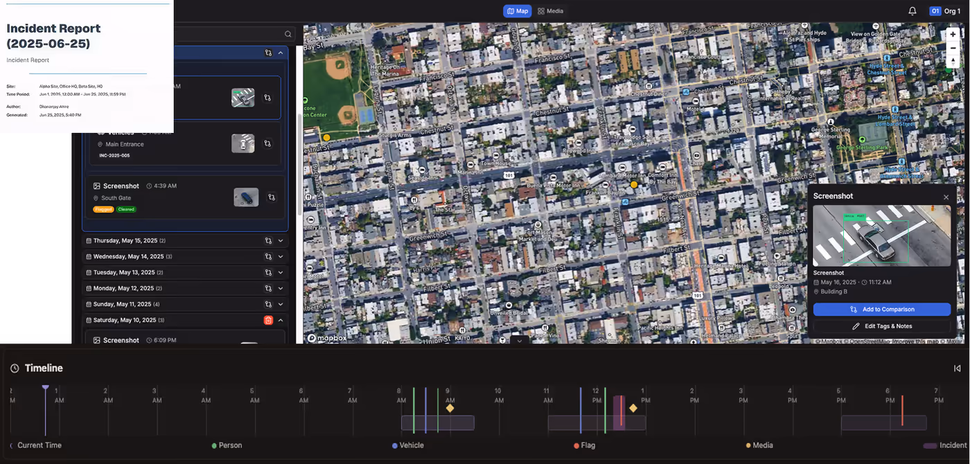
Evidence Package Generator
Combines video clips, images, GPS coordinates, and timestamps into court-ready documentation automatically without manual intervention.

Infrastructure Change Detector
Compares current imagery to baseline, flagging new cracks, vegetation growth, or equipment changes requiring immediate attention.
Crowd Density Analyzer
Generates real-time density heatmaps, identifying overcrowding risk zones, preventing crush incidents during public events automatically.
Thermal Anomaly Detector
Identifies heat signatures from fires, electrical hotspots, or people invisible to RGB cameras, especially during nighttime.
Fire Perimeter Mapper
Tracks fire spread direction, extent, and structure threats, providing real-time intelligence for firefighter safety decisions.
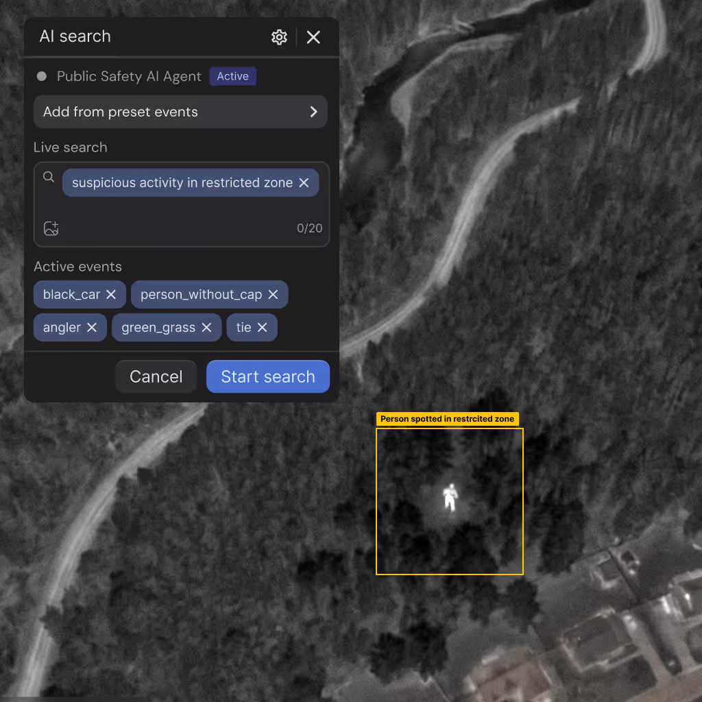
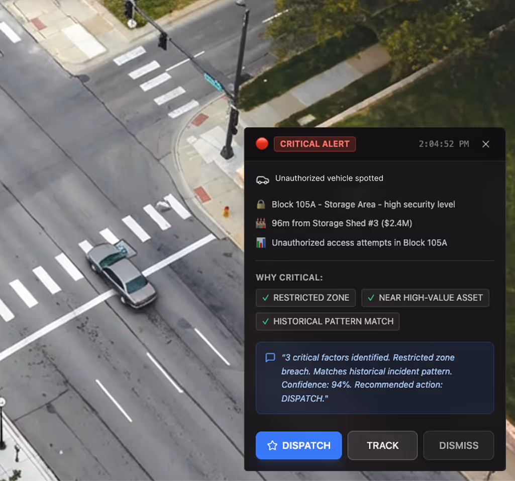
Perimeter Intrusion Detector
AI-verified unauthorized access detection with automated evidence packaging for incident response and security threat assessment.
Designed to work with your deployment stack
Built to integrate into real-world public safety deployments across hardware, software, and regulatory environments without disrupting existing systems, dispatch workflows, or operational procedures.
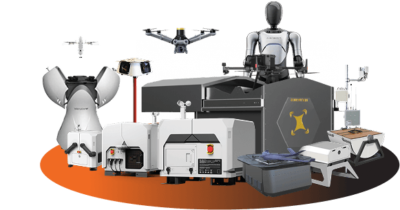
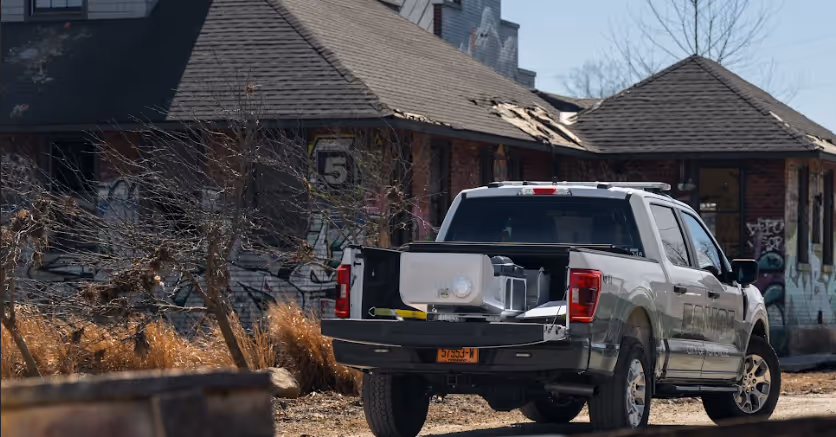
Supported Hardware
Support 24/7 autonomous operations with enterprise-grade drones, weatherproof docking stations, and mission-specific payloads — thermal cameras, zoom lenses, spotlights, loudspeakers, and more — orchestrated across diverse environments through one autonomy platform.
Browse supported hardwareFlytBase Drone Autonomy Platform
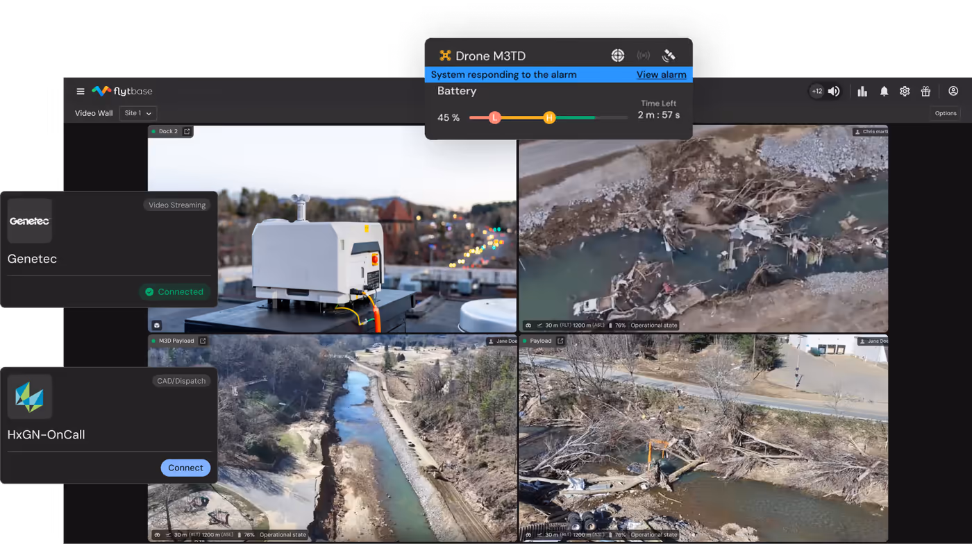
Orchestrate missions, automation, AI agents, and workflows through unified autonomy platform managing multi-site deployments and fleet operations.
Explore the platform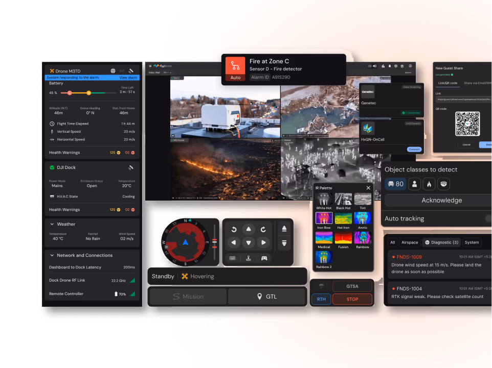
Apps and Integrations
Integrate with CAD dispatch systems, VMS, traffic management, GIS tools, CMMS, weather platforms, and Emergency Operations Centers to fit existing operational environments.
- CAD (Computer-Aided Dispatch)
- VMS (Video Management Systems)
- Traffic Management Systems
- GIS and Asset Management
- CMMS and Work Order Systems
- Weather Systems
- Emergency Management Platforms
- Perimeter Security Systems
Regulatory Approvals
Streamline BVLOS and operational approvals with comprehensive documentation templates and compliance workflows for public safety.
Learn moreOne platform for enterprise-scale public safety drone autonomy
FlytBase provides the reliability, intelligence, and operational maturity required to run autonomous drone programs at scale across mission-critical public safety environments.
Proven at Scale
Operate 150+ autonomous drone deployments with proven uptime and production-grade reliability.
AI-First Architecture
Apply AI and computer vision designed from ground up for public safety operations.
Enterprise-Grade Security and Compliance
Meet stringent security requirements with SOC 2 compliance and flexible deployment models.
Local Product and Data Sovereignty
Support in-country data residency, regional compliance needs, and local language requirements.
True Autonomy
Run 24/7 unattended dock-based operations without manual piloting or increased operator workload.
Dedicated Enterprise Support
Rely on deployment assistance, training, and responsive support teams experienced in public safety.
Deploy autonomous drone response at scale for public safety
Connect with our drone autonomy experts to enable faster emergency response and safer public safety operations across your jurisdiction.