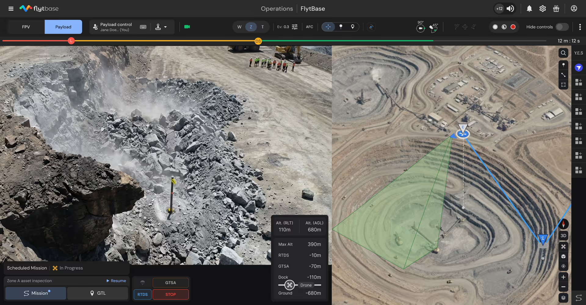
Autonomous Drone Platform for Mining Safety and Operational Excellence
Deploy automated drone inspections of equipment, conveyors, haul roads, and blast zones—reducing costly downtime through preventive maintenance while enabling continuous operational oversight.

Transform mine safety from reactive response to continuous oversight
Emergency repairs to planned maintenance
Continuous equipment monitoring enables condition-based maintenance scheduling, reducing spare parts inventory while preventing production-stopping failures.
Ground surveys to aerial intelligence
Automated missions capture comprehensive site data without mobilizing survey crews, eliminating production disruptions and accelerating decision-making.
After-hours vulnerability to continuous protection
Nightly perimeter patrols with thermal detection identify intrusions and equipment theft attempts, protecting high-value assets without additional security personnel.
Slow clearances to rapid verification
Post-blast hazard assessment happens immediately after all-clear, identifying misfires and unstable ground before personnel re-entry and production resumption.
Deploy autonomous intelligence across critical mining operations
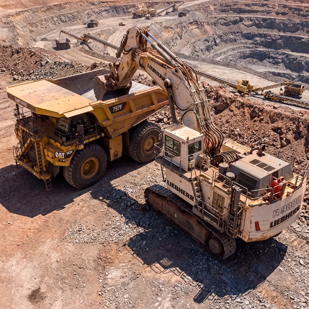
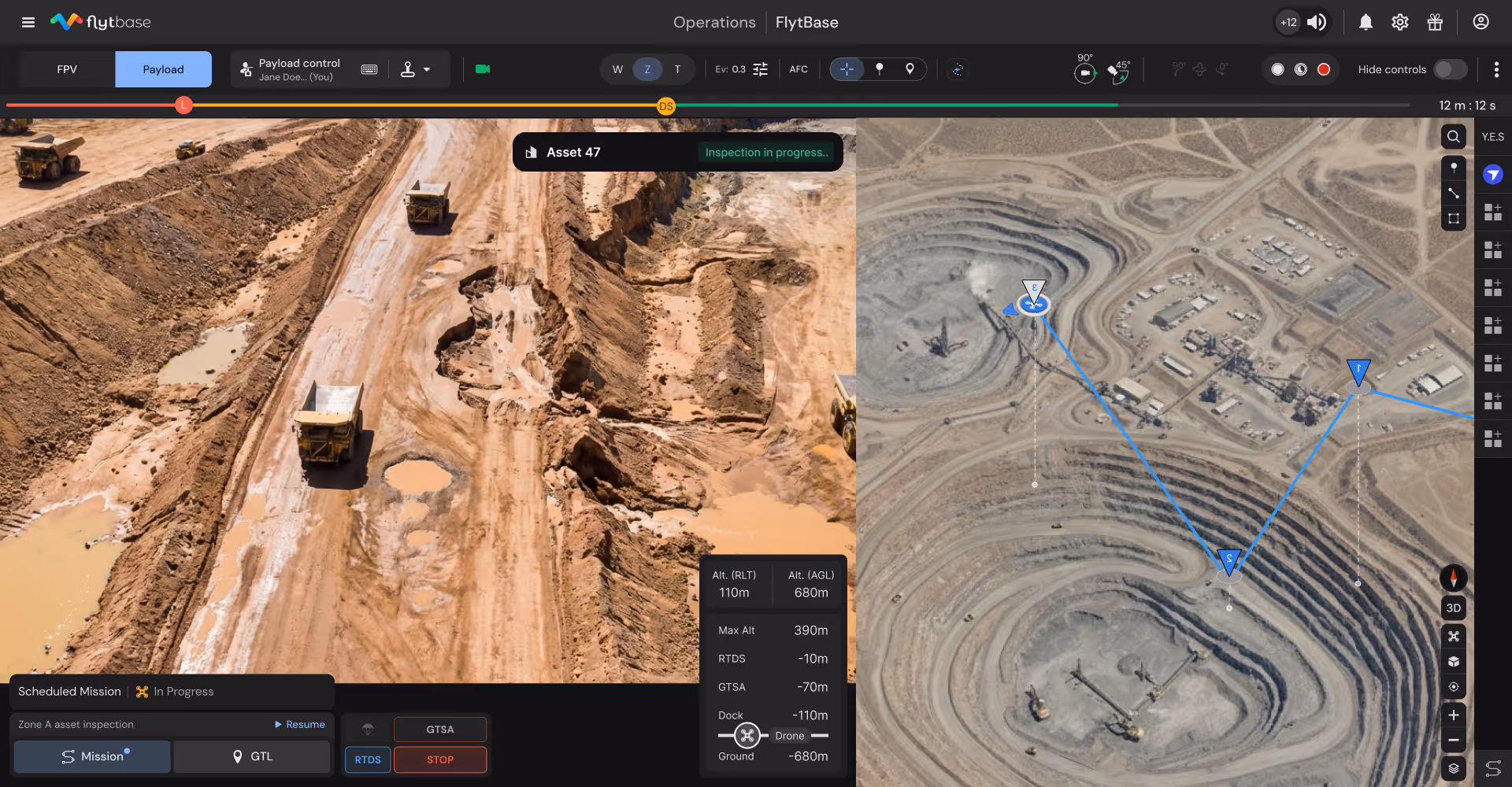
Equipment and asset inspections
Automated inspection missions capture high-resolution imagery of conveyors, crushers, haul trucks, and excavators detecting wear and failures.
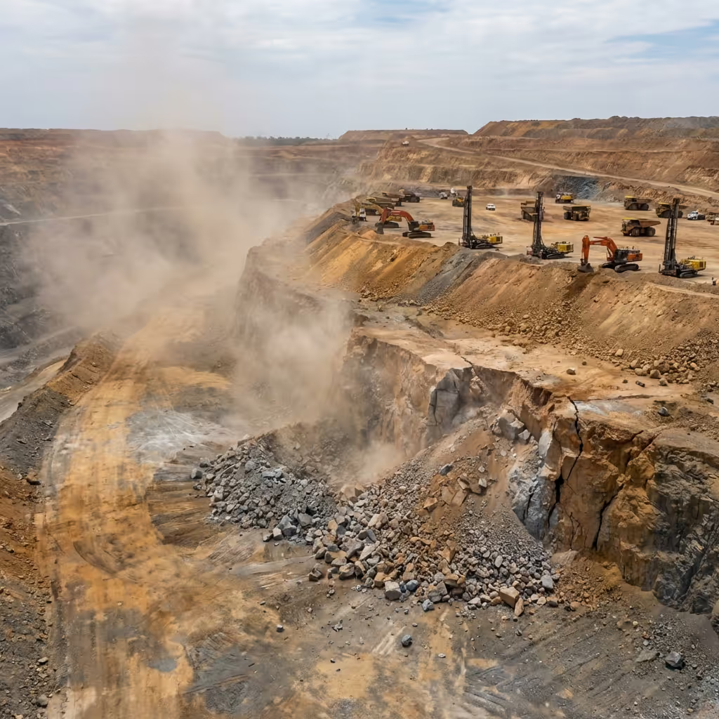
Pre-blast and post-blast operations
Systematic aerial surveys identify hazards from safe distances before personnel re-entry, accelerating clearance while maintaining safety standards.
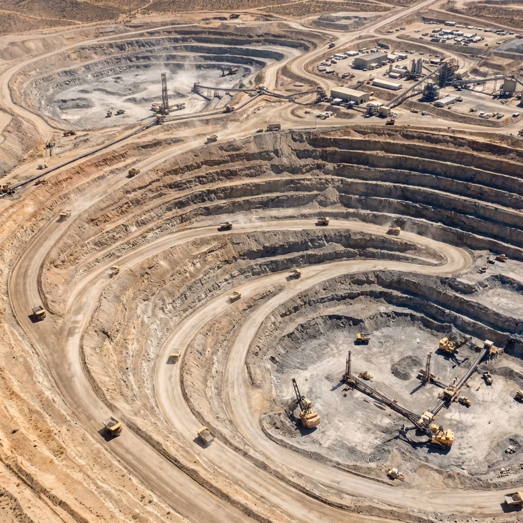
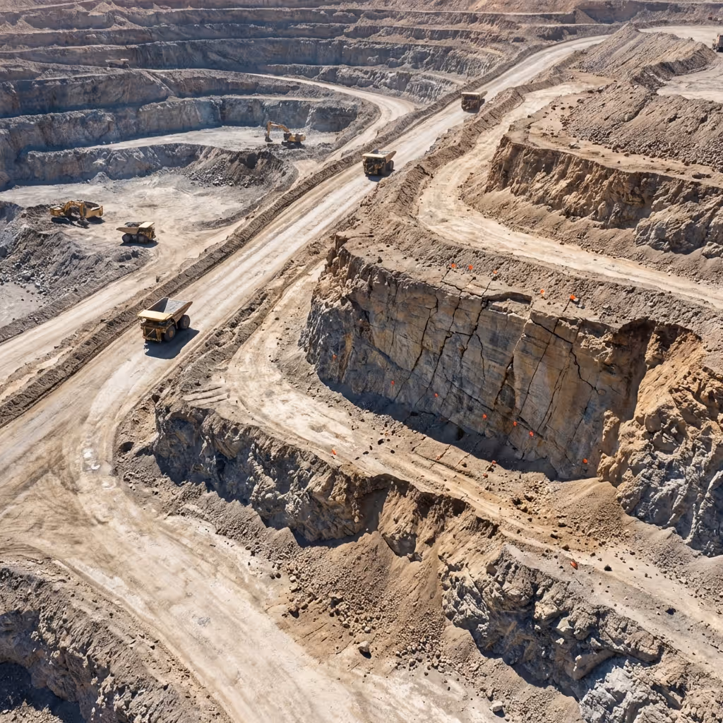
Active pit and haul road monitoring
Continuous aerial oversight of work zones identifies equipment proximity issues and developing hazards before incidents occur.
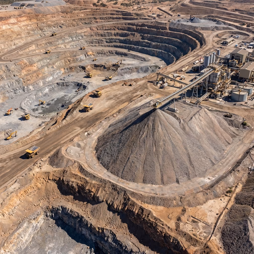
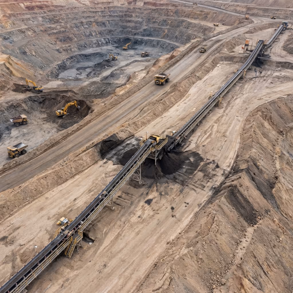
Stockpile volume measurement
Automated photogrammetry missions generate accurate volume calculations without survey crew mobilization or production disruption eliminating traditional surveying delays.

Tailings facility monitoring
Scheduled flights with thermal imaging detect seepage patterns and structural anomalies enabling proactive maintenance before escalation.
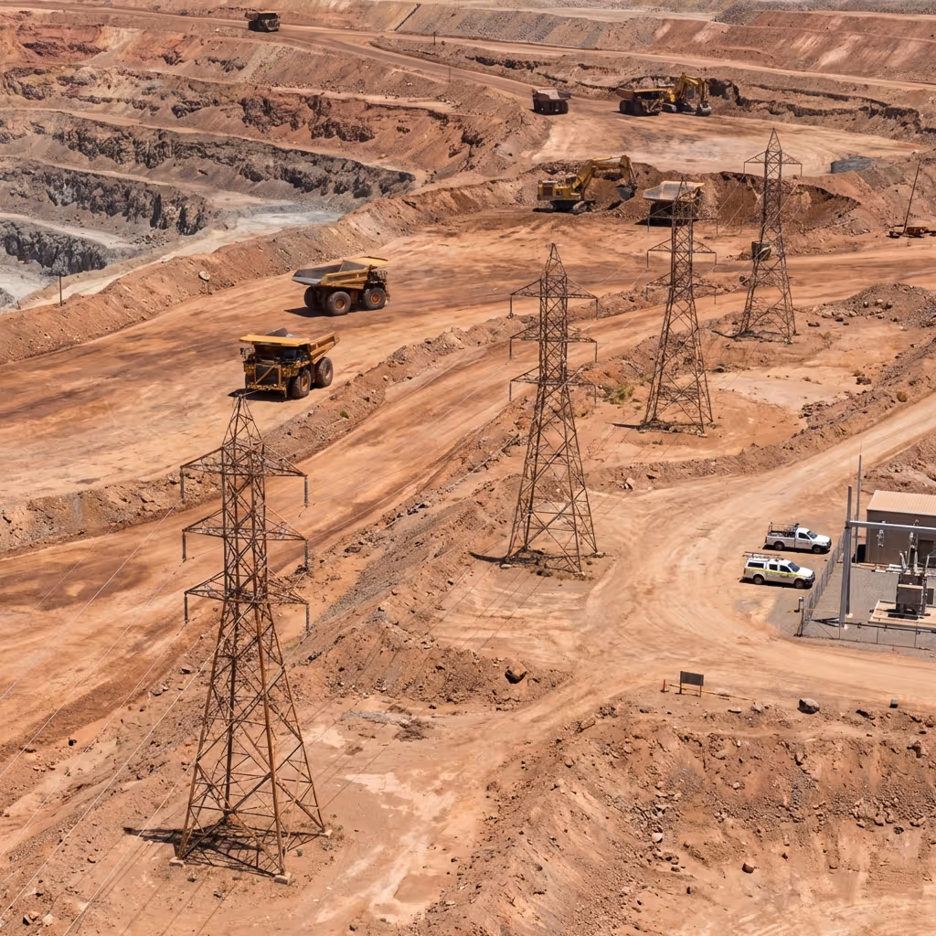
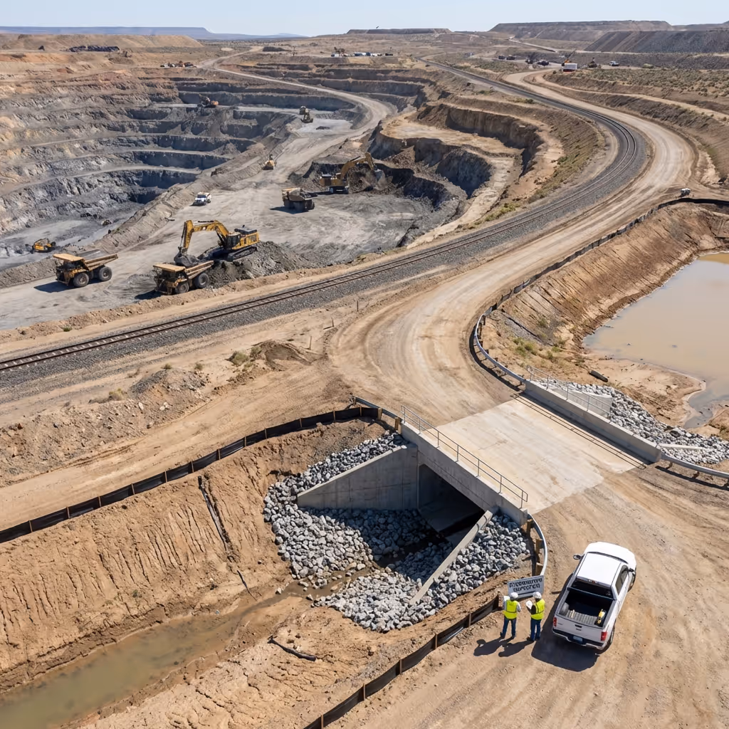
Infrastructure condition inspection
Regular aerial missions inspect power lines, pipelines, roads, and remote facilities documenting maintenance needs with comprehensive visual records.
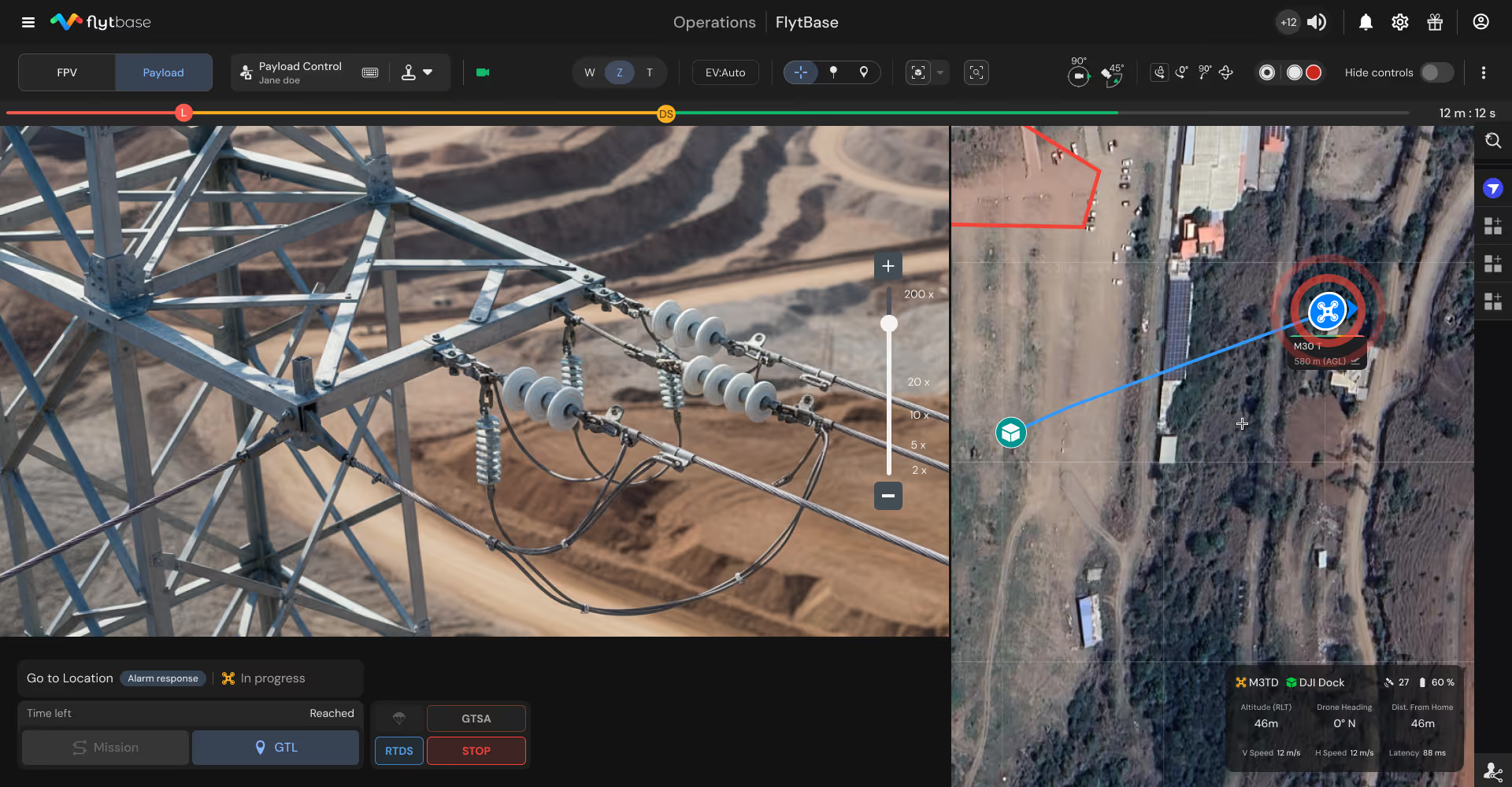
Emergency response coordination
On-demand aerial dispatch provides incident commanders with immediate situational awareness to assess hazards before committing responders.
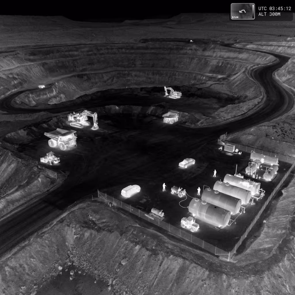
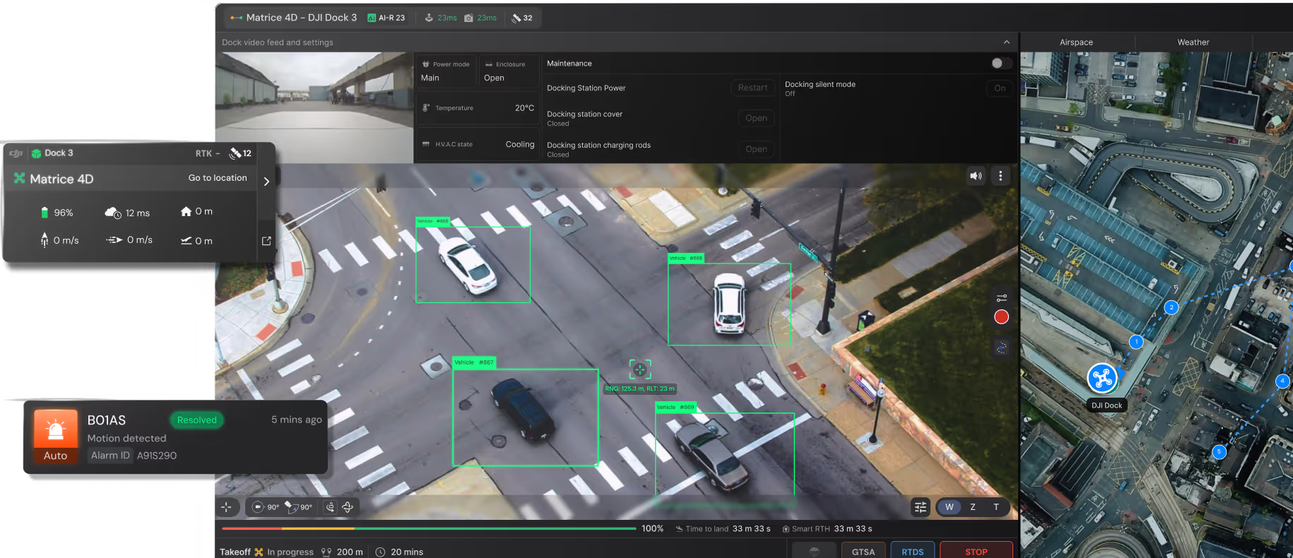
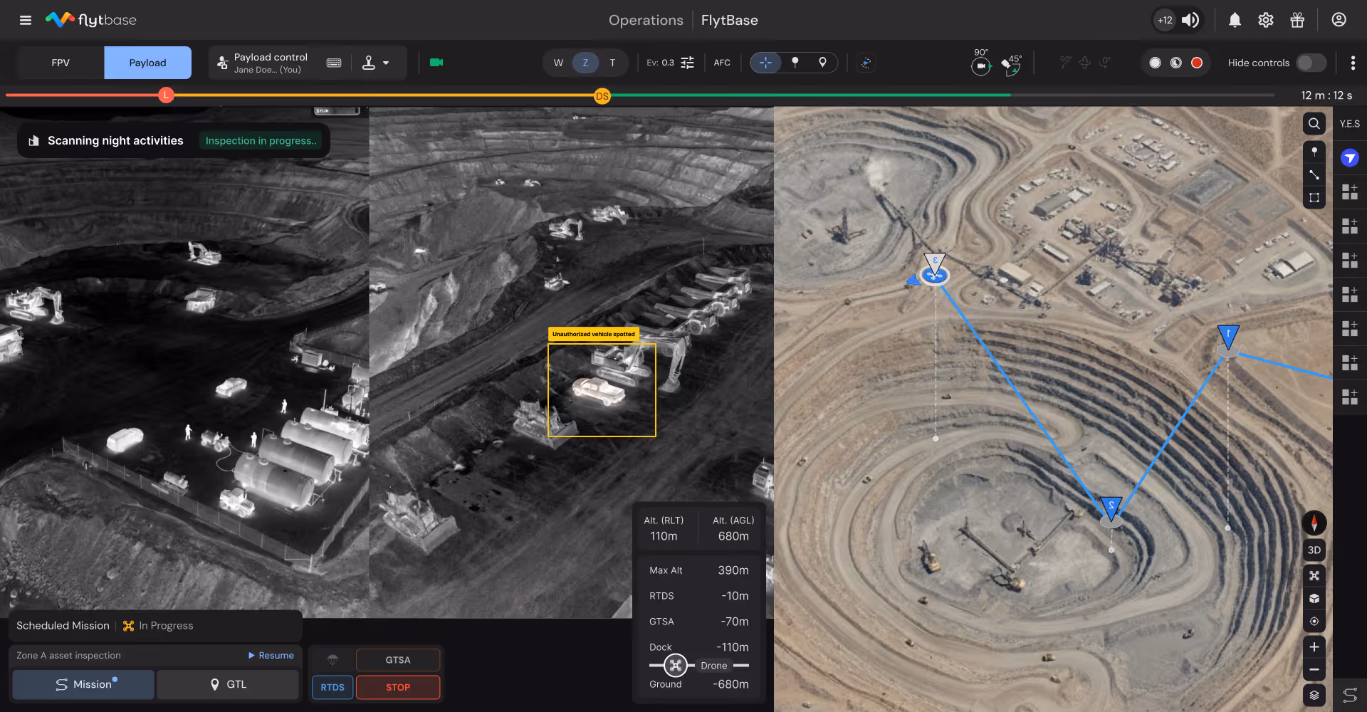
Perimeter security and theft prevention
Automated nightly patrols detect unauthorized vehicles, equipment tampering, copper theft, and fuel pilferage protecting high-value assets at remote sites.
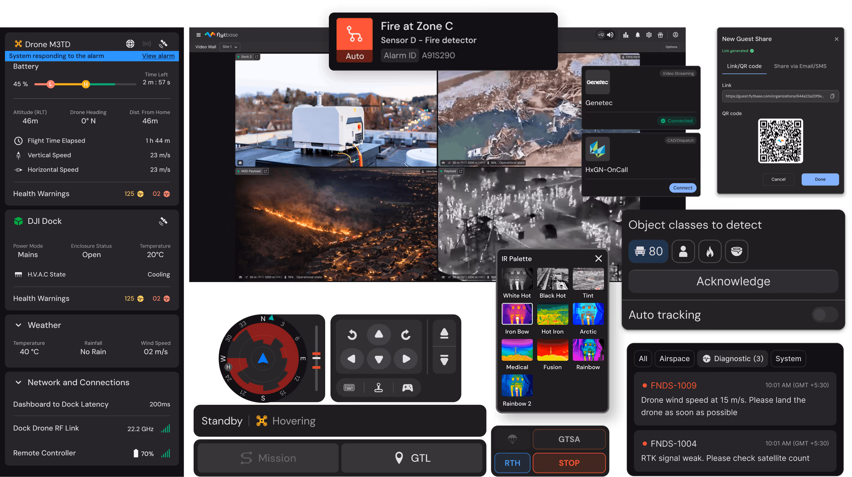
FlytBase AI agents built for mining operations
Assist operations and safety teams by automatically highlighting critical details during incidents, reducing manual review burden and supporting faster decisions.
Equipment wear detection
Identify structural cracks, component damage, belt wear, and mechanical failures on conveyors, crushers, trucks enabling preventive maintenance.

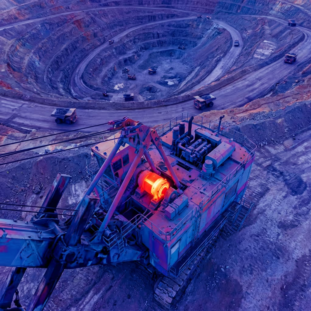
Thermal anomaly identification
Detect overheating motors, bearing failures, electrical hotspots, and equipment malfunctions before catastrophic failure and production loss.
Structural change detection
Compare aerial imagery over time identifying slope movement, settlement, erosion patterns, and infrastructure degradation critical for monitoring.
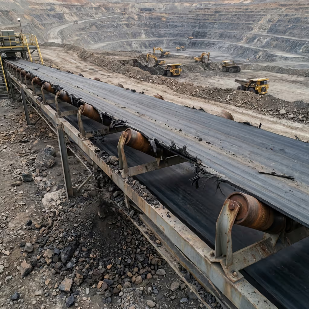
Conveyor condition analysis
Analyze belt alignment, roller condition, material spillage, and structure integrity automating routine inspection documentation and prioritizing repairs.
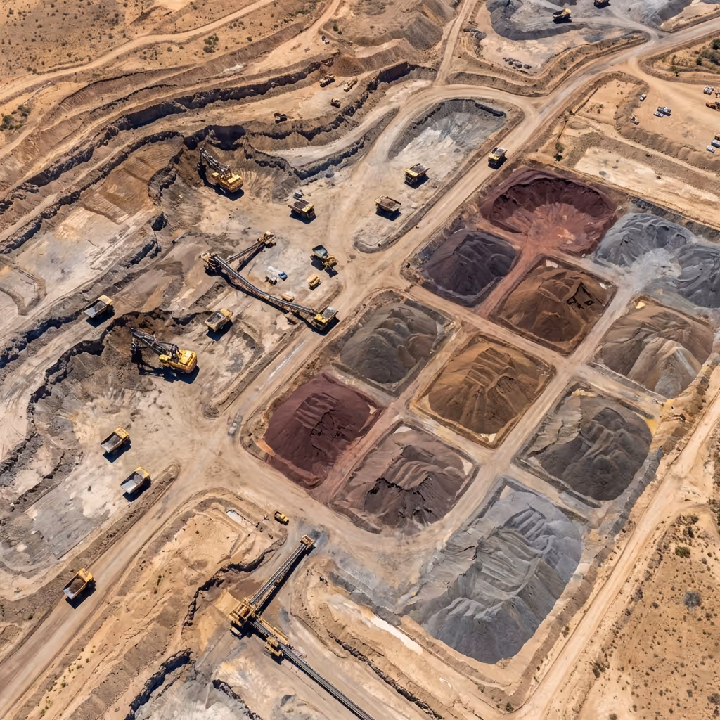
Stockpile boundary mapping
Generate precise stockpile boundaries from aerial imagery enabling accurate volume calculations and inventory tracking without manual surveying.
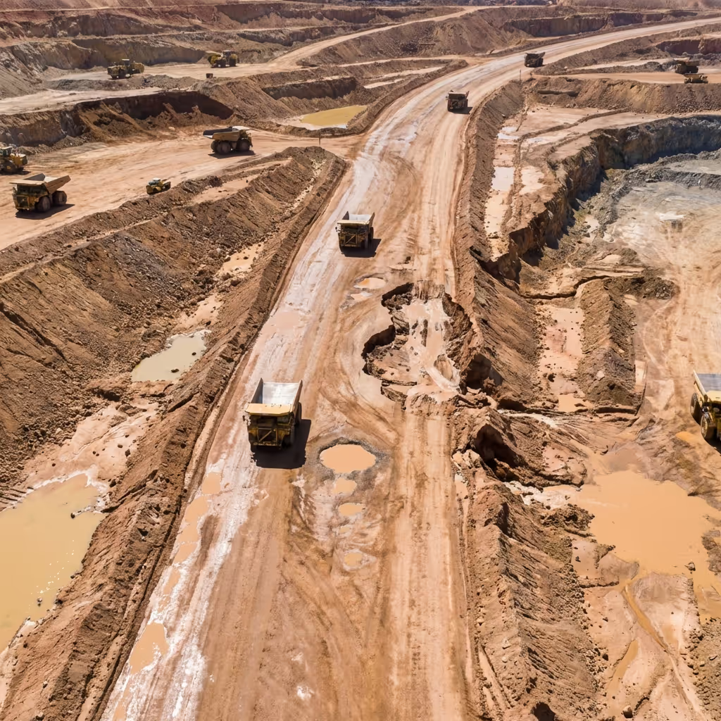
Haul road surface assessment
Identify potholes, washouts, debris accumulation, and drainage issues enabling proactive road maintenance before equipment damage or delays.
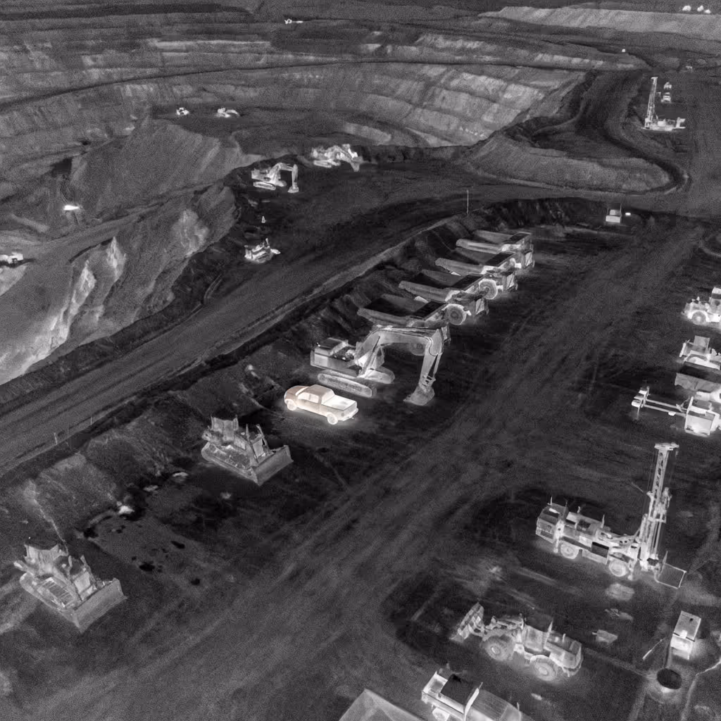
Security threat detection
Detect unauthorized vehicles, personnel in restricted zones, equipment tampering, and theft activities during after-hours patrols with alerts.
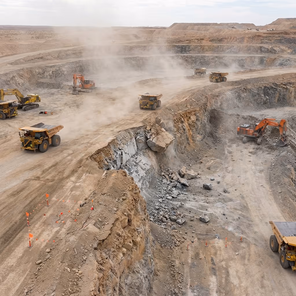
Blast zone hazard identification
Analyze post-blast areas identifying misfires, unstable ground, debris hazards, and access obstructions before personnel clearance and re-entry.
Equipment wear detection
Identify structural cracks, component damage, belt wear, and mechanical failures on conveyors, crushers, trucks enabling preventive maintenance.
Thermal anomaly identification
Detect overheating motors, bearing failures, electrical hotspots, and equipment malfunctions before catastrophic failure and production loss.
Structural change detection
Compare aerial imagery over time identifying slope movement, settlement, erosion patterns, and infrastructure degradation critical for monitoring.
Conveyor condition analysis
Analyze belt alignment, roller condition, material spillage, and structure integrity automating routine inspection documentation and prioritizing repairs.
Stockpile boundary mapping
Generate precise stockpile boundaries from aerial imagery enabling accurate volume calculations and inventory tracking without manual surveying.
Haul road surface assessment
Identify potholes, washouts, debris accumulation, and drainage issues enabling proactive road maintenance before equipment damage or delays.
Security threat detection
Detect unauthorized vehicles, personnel in restricted zones, equipment tampering, and theft activities during after-hours patrols with alerts.
Blast zone hazard identification
Analyze post-blast areas identifying misfires, unstable ground, debris hazards, and access obstructions before personnel clearance and re-entry.
Designed to work with your mining operations stack
Built to integrate into mining operations across hardware, software, and regulatory environments without disrupting existing dispatch, safety, or planning systems.
Drones and Docks
Support continuous autonomous operations using enterprise-grade drones and weatherproof docking stations across harsh mining environments.
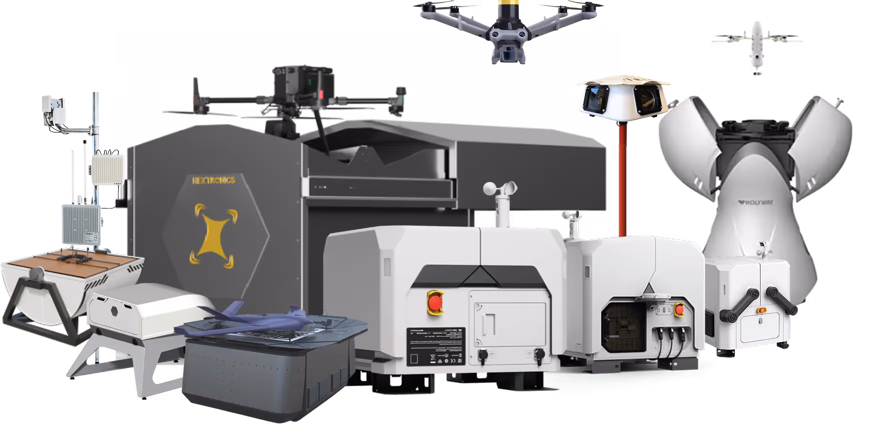
Payloads and Accessories
Extend operational capability with thermal cameras, zoom lenses, LiDAR sensors, and mission-specific payloads for inspection requirements.
FlytBase Drone Autonomy Platform
Orchestrate missions, automation, AI agents, and workflows through a unified autonomy platform designed for 24/7 mining operations.
Apps and Integrations
- SCADA systemsFleet managementVMS platformsMine planning softwareEnterprise applications to fit existing operational workflows.
Regulatory Approvals
One platform for enterprise-scale public safety drone ops
FlytBase provides the reliability intelligence and operational maturity required to run autonomous drone programs at scale across mission-critical public safety environments.
Proven at Scale
Operate 150+ autonomous drone deployments with proven uptime and production-grade reliability.
AI-First Architecture
Apply AI and computer vision designed from ground up for public safety operations.

Enterprise-Grade Security and Compliance
Meet stringent security requirements with SOC 2 compliance and flexible deployment models.

Local Product and Data Sovereignty
Support in-country data residency regional compliance needs and local language requirements.

True Autonomy
Run 24/7 unattended dock-based operations without manual piloting or increased operator workload.
Dedicated Enterprise Support
Rely on deployment assistance training and responsive support teams experienced in public safety.