


Automate Drone Surveys and Data Collection
Cloud-based drone survey planning and data collection solution to remotely conduct & automate large-scale mapping. Deploy a drone fleet, schedule missions, capture images at waypoints, and store them on the cloud for further processing. Integrate 3rd party or your own data processing and analysis solution.
Schedule Demo

Why use FlytNow for Surveys?
Improve Operational Efficiency Through Autonomous Drone Operations and Data Collection

Features in a Nutshell
Fleet Management
Carry out 3D photogrammetric surveys by deploying autonomous hybrid drone fleet to collect geotagged images relayed to an unified dashboard.
Schedule & Split Missions
Upload, create and schedule unique flight-plans, make way-point corrections, split missions automatically among the fleet of drones deployed on field.
Live Telemetry Updates
Receive real-time insights — live drone fleet mission status, geolocation, payload data, overlapping images and low latent HD video feed.
Integrate with UTMS
3rd-party Unmanned Traffic Management services can be integrated to know your airspace, authorizations, locations, permissions, and points of interest.
Plug & Play Sensors
Conduct complex UAV surveys, create maps and 3D models by seamless integration of RGB, LiDAR, multispectral and thermal sensors.
Secure Team Collaboration
Manage role-based permissions for data access anytime on any platform. Annotate, comment and share with all your collaborators.
Save Operational Costs & Time, Cover Larger Areas
FlytNow for Survey is exclusively built for Drone Service Providers looking to automate and scale their manual drone data acquisition process. The cloud-based solution allows you to deploy drone fleets remotely, controlled from a single web-based dashboard, to capture overlapping multi-sensor images which can be utilized to create orthomosaics, topography maps, Digital Surface Models (DSM), Digital Terrain Models (DTM), contour mapping, and GIS Analysis.

How Does It Work?
FlytNow acts as a one-stop software solution to support photogrammetric experts in autonomous image collection which can be further used by service-providers for post-processing and image analytics. Drones follow a gridded intelligent flight-path, capture images with appropriate overlaps and required GSD and relay them to the central command & control center through 4G/LTE/5G connectivity.

Build Drone Applications Faster with FlytNow APIs
FlytNow provides access to a set of APIs to quickly assemble your custom drone applications that are agnostic to drone hardware. It also allows you to connect your business applications with drones, securely, to create completely automated workflows. Ready-to-use intelligence modules, like, collision avoidance, precision landing, & integration with drone-in-a-box systems, further helps you shorten your time to market. FlytNow is trusted by thousands of developers and powers a wide-range of automated commercial drone applications.

Use Cases
Agriculture
Capture multispectral data autonomously to map your fields and ranches, analyse crop health, identify water stress early, detect pests and weeds, create vegetation indices maps to estimate biomass and crop yield.

Mining & Quarries
Conduct automated lease-boundary surveys, track site conditions, improve efficiency and production in pits, dumps and stockpiles, measure mine progress and receive real-time intel on a cloud.

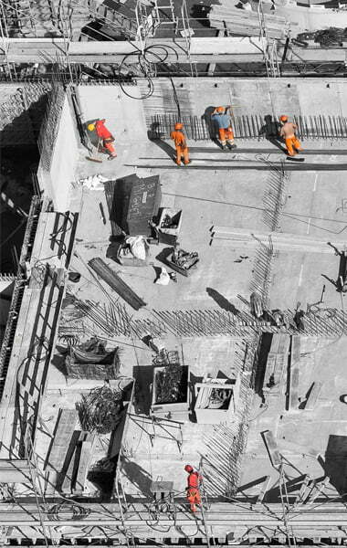
Construction
Carry out pre-scheduled and repeated autonomous missions to monitor, track construction progress and measure cut & fill volumes. Compare against project plans, as-built surveys to identify delays.
Forestry & Environment
Autonomously survey and map forest boundaries, canopy surfaces and wildlife habitats with minimal human interference for tree species identification and change detection to asses deforestation and map encroachments.

Urban Planning
UAVs can accelerate topographic surveys intended for city planning and management. Autonomously capture oblique images and produce survey-grade deliverables such as base maps and 3D models for design and construction.

Integrate Drone-in-a-Box
For Fully-Autonomous Operations
Manual operations are inefficient and time-consuming; Drone-in-a-Box technology coupled with our intelligent software, can provide drastic time and cost reduction whereby incrementing the ROI significantly. Subject Matter Experts can monitor and supervise multiple operations and initiate suitable response accordingly from a distance, in real time.

Supported Drones
FlytNow Solution is compatible with all major drones such as DJI, Ardupilot, and PX4.
Sign up for 7-day free FlytNow trial
Stream live data from your drone and make
well-informed decisions

.png)

.png)