FlytBase Blogs
Leverage your drone for automated operations. Read all guides on how to automate security, oil & gas inspection, public safety, etc operations at scale.
Latest Featured Blogs
Key reads on autonomous drones, AI workflows, and real-world enterprise deployments.
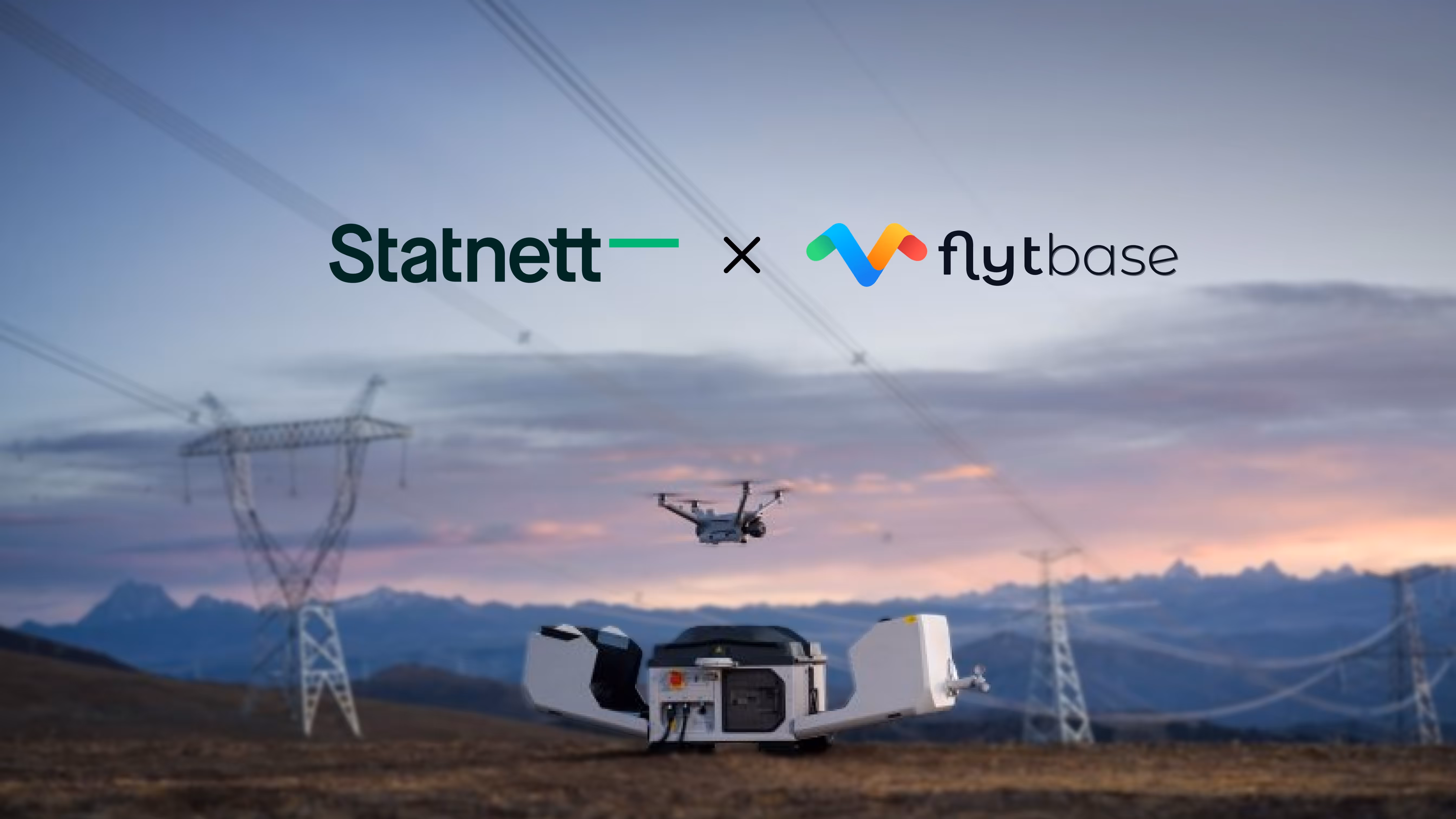
%20(1).jpg)
Anglo American Deploys Drone-in-a-box Solution at Quellaveco Mine Powered by FlytBase
Anglo American Peru, one of the world’s leading mining companies, has deployed a fully autonomous drone system at its Quellaveco mine, making it the first mining project in Peru to adopt automated drone operations. The drone-in-a-box solution, powered by FlytBase, now performs scheduled aerial inspections of key infrastructure without the need for on-site pilots.
This deployment was executed in close collaboration with UAV Latam, FlytBase’s regional solutions partner, whose on-ground expertise played a critical role in enabling seamless integration and operational success.
From Manual Missions to Remote Autonomy
Traditionally, aerial inspections at Quellaveco required manual drone operations, demanding time, specialized personnel, and access to difficult terrain. With FlytBase’s drone-in-a-box solution, Anglo American has transitioned to a fully automated workflow. This eliminates operational friction while increasing flight frequency, enabling the mine’s operations team to gain deeper insights, faster, and safely.
Through FlytBase’s centralized dashboard, remote operators at Anglo American can program flight routes, define safe operating zones, monitor live telemetry and video feeds, and automatically store collected data in the cloud, all while maintaining high digital security standards.
Automated Data Processing with FlytBase Flinks
As part of this deployment, Anglo American is also leveraging Flinks: FlytBase’s one-click third-party integrations to automate the data processing workflow for all aerial data collected. Through a seamless integration with Pix4D, high-resolution images captured during autonomous missions are automatically synced to generate detailed 3D maps and models directly into the Pix4D Cloud. These maps and models are crucial for various critical tasks like topographic analysis, structural analysis, change detection, and accurate volumetric measurements.
Instead of manual uploads and scattered file transfers, Pix4D Flink automates the entire data pipeline, giving the team rapid access to processed outputs for better decision-making.
.jpg)
The Future of Automated Mining Operations
This successful deployment at Quellaveco shows how autonomous drones can streamline routine inspections while reducing the need for personnel in high-risk areas. By automating aerial data collection, mining teams gain more frequent, consistent insights that support faster decision-making and safer site operations.
As the mining industry moves toward greater automation, Anglo American’s implementation offers a clear example of how drone-in-a-box systems, paired with integrated data workflows like Pix4D, can deliver measurable improvements in safety, efficiency, and operational visibility.
FlytBase powers Peru’s first autonomous mining drone system for Anglo American Peru, streamlining aerial data collection, analysis, and safety monitoring.

%20(1).jpg)
Anglo American Peru, one of the world’s leading mining companies, has deployed a fully autonomous drone system at its Quellaveco mine, making it the first mining project in Peru to adopt automated drone operations. The drone-in-a-box solution, powered by FlytBase, now performs scheduled aerial inspections of key infrastructure without the need for on-site pilots.
This deployment was executed in close collaboration with UAV Latam, FlytBase’s regional solutions partner, whose on-ground expertise played a critical role in enabling seamless integration and operational success.
From Manual Missions to Remote Autonomy
Traditionally, aerial inspections at Quellaveco required manual drone operations, demanding time, specialized personnel, and access to difficult terrain. With FlytBase’s drone-in-a-box solution, Anglo American has transitioned to a fully automated workflow. This eliminates operational friction while increasing flight frequency, enabling the mine’s operations team to gain deeper insights, faster, and safely.
Through FlytBase’s centralized dashboard, remote operators at Anglo American can program flight routes, define safe operating zones, monitor live telemetry and video feeds, and automatically store collected data in the cloud, all while maintaining high digital security standards.
Automated Data Processing with FlytBase Flinks
As part of this deployment, Anglo American is also leveraging Flinks: FlytBase’s one-click third-party integrations to automate the data processing workflow for all aerial data collected. Through a seamless integration with Pix4D, high-resolution images captured during autonomous missions are automatically synced to generate detailed 3D maps and models directly into the Pix4D Cloud. These maps and models are crucial for various critical tasks like topographic analysis, structural analysis, change detection, and accurate volumetric measurements.
Instead of manual uploads and scattered file transfers, Pix4D Flink automates the entire data pipeline, giving the team rapid access to processed outputs for better decision-making.
.jpg)
The Future of Automated Mining Operations
This successful deployment at Quellaveco shows how autonomous drones can streamline routine inspections while reducing the need for personnel in high-risk areas. By automating aerial data collection, mining teams gain more frequent, consistent insights that support faster decision-making and safer site operations.
As the mining industry moves toward greater automation, Anglo American’s implementation offers a clear example of how drone-in-a-box systems, paired with integrated data workflows like Pix4D, can deliver measurable improvements in safety, efficiency, and operational visibility.
FlytBase powers Peru’s first autonomous mining drone system for Anglo American Peru, streamlining aerial data collection, analysis, and safety monitoring.
Anglo American Deploys Drone-in-a-box Solution at Quellaveco Mine Powered by FlytBase
.jpg)
San Jose, California (USA), April 18, 2025: FlytBase, a leading drone autonomy software platform, announced the launch of FlytBase Pro, an enterprise-grade subscription plan designed to help organizations scale their autonomous drone operations with a flexible, pay-as-you-go pricing model. This offering addresses key challenges in enterprise drone dock deployments while providing data security, integration capabilities, and advanced mission-planning features required to transition from pilot programs to production deployments. Now users can purchase Pro directly from FlytBase's website - https://flyt.link/Oy6rs5q
Until now, businesses didn’t have access to a reliable yet affordable solution to properly test remote drone pilot programs before committing to a full enterprise solution. This gap has forced many to either make significant upfront investments before proving value or to remain stuck in limited pilot phases that can't demonstrate the full potential of dock drone operations. FlytBase Pro directly addresses this challenge with a comprehensive platform designed to enable proper evaluation and scaling at an accessible price point.
"Organizations implementing autonomous drones face significant challenges in transitioning from pilot programs to full production deployments," said Nitin Gupta, CEO and Founder of FlytBase. "With FlytBase Pro, we're removing these barriers by providing enterprise-grade capabilities that allow companies to scale at their own pace without rigid commitments."
Capabilities
FlytBase Pro addresses four critical challenges that have previously hindered enterprise drone adoption:
- Enhanced Data Security & IT Compliance
The platform, powered by FlytBase Shield, provides ISO 27001, SOC 2 Type 2, and GDPR compliance. Additionally, with protocols like AES-256 and TLS 1.3, the platform ensures that both data at rest and in transit are secure.
- Seamless Enterprise Integrations
FlytBase Pro includes "Flinks and Flows" for custom integrations, enabling alarm-triggered autonomous drone dispatch, video streaming to third-party existing video management software like Genetec and Milestone, and automated data processing workflows with software like Pix4D, DroneDeploy, and Strayos.
- Advanced Mission Planning
The platform's 5D Mission Planner allows complete flight path recording, including gimbal movements, angles, and altitude, enabling consistent, repeatable mission execution for asset monitoring, security patrols, and emergency response.
- Intelligent Data Analysis
FlytBase Pro supports integration with AI-R Edge hardware (an Accelerated Compute Unit (ACU) designed to enhance drone autonomy by bringing AI processing to the edge), which enables real-time AI analytics capabilities for object detection, counting, and anomaly identification. This hardware integration converts drone data into actionable intelligence for security, inspection, and monitoring applications.
FlytBase Pro enables advanced use cases across multiple industries:
- Security: Autonomous perimeter security with AI-powered intrusion detection and automated alerts
- Critical Infrastructure: Regular inspection missions with consistent imagery for comparative analysis
- Construction: Automated progress monitoring through integration with data processing software like Pix4D and Drone Deploy
- Emergency Response: Rapid automated drone deployment to incident scenes with live video feeds to command centers
FlytBase Pro is available at $99/month globally ($999 /year when billed annually) through FlytBase’s website, with no limit on the number of docks or users in an organization. Additional services are available on a pay-as-you-go basis, allowing organizations to start small and scale as needed.
This plan supports all DJI Docks. For more information about FlytBase Pro or to purchase the plan, visit https://flyt.link/Oy6rs5q
FlytBase Pro bridges the gap from pilot programs to full-scale docked drone operations with a new subscription model
FlytBase Launches Pro Plan to Scale Remote Drone Operations for $99 /month

Statnett SF, Norway's state-owned power grid operator, has successfully completed their first fully remote drone inspection flight between Aura and Viklandet, including a detailed examination of the Viklandet substation. The entire operation was controlled from their Drone Operations Center in Sunndalsøra, demonstrating the practical benefits of autonomous drone operations for infrastructure monitoring.
This implementation shows how power utilities can improve inspection efficiency and data quality while reducing operational costs and enhancing worker safety.
Custom ADS-L Transponder for Airspace Safety
A notable aspect of this implementation is Statnett's deployment of their custom-developed ADS-L (Automatic Dependent Surveillance – Light) transponder. This proprietary solution weighs only 30 grams and measures 17x30x50 mm, featuring sealed USB/SMA connectors and conformal-coated PCB for weather resistance.
ADS-L technology serves a similar function to ADS-B systems in manned aviation but is specifically adapted for unmanned aircraft. It contributes to situational awareness in shared airspace, helps with airspace deconfliction between multiple aircraft, and supports integration with UAS Traffic Management (UTM) systems, particularly in regions with both drone and manned aircraft activity.
Integration with Drone-in-a-Box and FlytBase
The inspection operation utilized a drone docking station with FlytBase software. This technology combination enabled remote launch, landing, and charging capabilities fully integrated into Statnett's operations platform. The mission was supervised using joystick control alongside real-time software monitoring.
This integration allows for expanded operational capabilities, which can significantly improve the scope and efficiency of critical infrastructure inspections.
As stated by Espen Blomlie “The inspection flight was executed using Dock and FlytBase, with full support for remote launch, landing, and charging, integrated into our operations platform. The mission was supervised using joystick control and real-time software monitoring – a true showcase of the future of infrastructure inspections.”
Contributing to Airspace Safety
Statnett is actively participating in Norway's national drone strategy and the development of policy frameworks for emerging air mobility solutions. Their implementation of technologies like the ADS-L transponder demonstrates their commitment to advancing drone operations safety.
Practical Applications for Infrastructure Monitoring
This successful remote inspection demonstrates the potential for power utilities to transform their infrastructure monitoring processes. With autonomous drone technology, companies can perform more frequent asset inspections while reducing the need for personnel to access hazardous locations, ultimately improving both operational efficiency and safety outcomes.
As utilities continue to adopt autonomous drone technology, implementations like Statnett's provide valuable real-world examples of effective technical integration and safety-focused operations.
Source: https://www.linkedin.com/feed/update/urn:li:activity:7316468403005743104
Discover how Statnett, Norway’s TSO, completed its first fully remote drone inspection using FlytBase. Learn how automated drone operations are transforming powerline inspections and substation monitoring.
Statnett Deploys First Fully Remote Drone-in-a-Box Solution For Powerline Inspection with FlytBase

In today’s fast-paced business landscape, enterprises are under constant pressure to optimize operations, reduce costs, and improve safety. Drone technology has emerged as a powerful tool to meet these demands, but managing drone fleets manually can be resource-intensive. The integration of DJI Dock 3 with FlytBase offers a solution by delivering a fully automated drone system tailored to enterprise needs. The DJI Dock 3 and DJI Matrice 4D/4TD have been rigorously tested in a controlled test environment to ensure reliable performance and validate product claims. DJI Dock 3 is a durable docking station that keeps drones charged and ready for action, while FlytBase provides the software to plan missions, execute flights, and manage data seamlessly. Together, they enable businesses to perform tasks like infrastructure inspections, security monitoring, and aerial mapping with minimal human oversight, driving efficiency and cutting operational expenses.
A Robust Foundation with DJI Dock 3
DJI Dock 3 is engineered to meet the demands of enterprise drone programs. It acts as a self-contained hub that charges, shelters, and prepares drones for immediate deployment. Built with an IP56 rating, it withstands dust and water, making it reliable for outdoor use in challenging environments. The dock operates effectively in extreme temperatures ranging from –30°C to 50°C, ensuring consistent performance across diverse climates. One of its key strengths is its ability to launch drones in just 15 seconds, minimizing downtime and enabling rapid response to operational needs. Its innovative 8° tilted design prevents water and snow buildup, reducing maintenance and keeping the system ready even in adverse weather. For businesses requiring mobility, the dock can be mounted on a vehicle, offering flexibility to deploy drones across multiple sites without a complex setup.
Seamless Drone Integration
DJI Dock 3 is tailored to support two advanced drones: the DJI Matrice 4D and the DJI Matrice 4TD. Each drone is optimized for specific enterprise applications while sharing key features that enhance their performance and reliability.
The Matrice 4D
Best Suited For: High-precision mapping, surveying, and detailed surface inspections.
Key Features:
- Equipped with a wide-angle camera (4/3-inch CMOS, 20 MP), a medium telephoto camera (1/1.3-inch CMOS, 48 MP), a telephoto camera (1/1.5-inch CMOS, 48 MP), and a laser rangefinder.
- Supports smart oblique capture with a 5-direction approach, ideal for efficient mapping and data collection.
- Designed for tasks requiring rich imaging and precise measurements.
The Matrice 4TD
Best Suited For: Public safety, emergency response, infrastructure inspections, and thermal imaging.
Key Features:
- Features a wide-angle camera (1/1.3-inch CMOS, 48 MP), a medium telephoto camera (1/1.3-inch CMOS, 48 MP), a telephoto camera (1/1.5-inch CMOS, 48 MP), an infrared thermal camera, and a laser rangefinder.
- Includes an NIR auxiliary light for enhanced visibility in low-light conditions.
- Perfect for applications needing both visible and thermal imaging, such as search-and-rescue or infrastructure monitoring.

Both Matrice 4D and Matrice 4TD share a robust set of features that make them highly versatile and dependable for enterprise applications. Both drones are equipped with an IP55 protection level, ensuring they are dust and water-resistant, which allows them to operate reliably in harsh environments. They boast an extended flight time of up to 54 minutes, enabling longer missions with less downtime for battery changes. With a maximum speed of 47 mph, these drones can cover large areas rapidly, making them ideal for tasks like mapping and inspections.
The integrated RTK module provides advanced positioning, ensuring precise landings on the DJI Dock 3, which is crucial for automated operations. Safety is enhanced through omnidirectional obstacle sensing and advanced vision systems, allowing the drones to navigate complex environments with minimal risk. Additionally, their batteries offer up to 400 cycles, improving efficiency and reducing long-term operational costs. These shared attributes, combined with their specialized camera systems, make the Matrice 4D and 4TD adaptable to a wide range of operational needs.
Versatile Applications Across Industries
The DJI Dock 3 and FlytBase integration supports a wide range of enterprise applications:
- Mapping and Surveying: Drones autonomously capture detailed imagery to create accurate topographical maps, sparing teams from labor-intensive fieldwork.
- Public Safety: Rapid aerial surveillance during emergencies provides real-time insights to guide response efforts.
- Infrastructure Management: Regular inspections of assets like bridges or power lines identify issues early, preventing costly failures.
- Construction and Mining: Monitor progress and ensure safety compliance across large areas.
- Security: Automated patrols detect threats quickly.
FlytBase: The Software Powerhouse
FlytBase enhances the DJI Dock 3 system by delivering enterprise-grade software designed to control and scale drone operations effectively. Its robust suite of features ensures security, streamlines workflows, and provides actionable insights, making it an indispensable tool for businesses leveraging drone technology. Here are the key features of FlytBase, each expanded to highlight its value:
- FlytBase Shield:
FlytBase Shield ensures top-tier data security with AES-256 encryption, safeguarding all drone data during transmission and storage. It supports OAuth 2.0 and Single Sign-On (SSO) for secure user authentication, minimizing the risk of unauthorized access. Compliance with rigorous standards like SOC2 Type II, ISO 27001, and GDPR makes it a trusted choice for industries such as utilities and public safety, handling sensitive or regulated data. - Flinks:
Flinks enables seamless integration with third-party apps and devices, allowing drone data to be shared effortlessly with systems like alarm management, live streaming platforms, and mission logging software. It automates workflows by connecting drone operations to real-time actions, such as sending alerts or updating dashboards, eliminating manual data transfers. This enhances operational efficiency, reduces errors, and ensures drone insights are readily available across the enterprise ecosystem. - AI-R:
AI-R provides real-time analytics by processing drone data during the flight, delivering immediate insights that accelerate decision-making during missions. Its AI-powered capabilities, including object detection, anomaly identification, and predictive analytics, enable drones to adapt autonomously mid-flight, boosting accuracy and efficiency. This feature is particularly valuable for time-sensitive operations like search-and-rescue or infrastructure inspections, where instant data is critical. - 5D Mission Planning:
The 5D Mission Planning, captures detailed flight records, including telemetry data, video feeds, and operator actions, creating a comprehensive log for post-mission analysis. It empowers operators to review mission performance, identify areas for improvement, and refine strategies for future operations. For regulated industries, this feature also supports compliance by providing auditable records of all drone activities, ensuring transparency and accountability. - FlytBase Pro:
Priced at $999 per year, FlytBase Pro offers advanced fleet management, enabling enterprises to oversee multiple drones and docks from a centralized platform. It includes autonomous navigation features that allow drones to execute complex missions with minimal human intervention, alongside real-time data processing for instant insights. This cost-effective solution helps businesses scale their drone programs efficiently, avoiding the need for significant upfront investments in hardware or software.
Key Benefits for Enterprises
The combination of DJI Dock 3 and FlytBase delivers measurable advantages:
- Efficiency: Automates drone missions, cutting time and effort for tasks like inspections or surveillance.
- Data Security: FlytBase Shield’s robust protections safeguard sensitive information, a must for regulated industries.
- Workflow Integration: Flinks ensure seamless connection with existing tools, avoiding disruptions.
- Regulatory Compliance: Supports beyond-visual-line-of-sight (BVLOS) operations, enabling legal and safe expansion.
These benefits reduce costs, minimize errors, and position drones as a practical, everyday tool for business success. Looking ahead, businesses adopting this solution can expect up to a 40% reduction in deployment times, translating directly into operational savings.
Conclusion
For enterprises seeking to streamline operations and gain a competitive edge, the DJI Dock 3 and FlytBase integration offers a reliable, efficient, and secure drone automation solution. Faster deployment, enhanced data protection, and seamless system integration make it a valuable asset across industries like public safety, infrastructure, and security.
To learn how this DJI Dock 3 powered by FlytBase, can transform your drone program, contact us for a deeper dive into its capabilities.
Discover how DJI Dock 3 and FlytBase streamline enterprise drone operations with automation, security, and seamless integration. Boost efficiency and cut costs.
Automating Drone Operations for Enterprises with DJI Dock 3 and FlytBase
%20(1).png)
FlytBase Partners with Aeronex to Deliver Advanced Drone Autonomy Solutions Across the MENA Region
FlytBase, a leading enterprise drone autonomy software platform, has announced a strategic partnership with Aeronex, a prominent drone solutions provider specializing in the oil and gas and public safety sectors across the MENA region. Under this partnership, Aeronex will serve as a master distributor of FlytBase solutions throughout the region, enabling organisations to automate their drone operations with the FlytBase platform.
Tackling the Challenges of Manual Drone Operations
Organizations across various industries in the Middle East and Africa face significant challenges with traditional drone operations. Manual workflows often require a human in the loop, involve time-consuming mission planning, and suffer from inconsistent data collection. This leads to higher operational costs, increased safety risks, and reduced scalability. Moreover, multiple systems that lack integration can create data silos, hindering the full potential of aerial intelligence.
Streamlined Autonomy with FlytBase and Aeronex
Through this partnership, FlytBase and Aeronex offer a comprehensive solution that addresses these operational challenges. FlytBase’s enterprise-grade drone autonomy platform enables fully autonomous drone operations with remote mission control, allowing organizations to deploy drone fleets efficiently and consistently. Aeronex complements this with deep regional expertise, industry knowledge, and established customer relationships, ensuring seamless deployments across the MENA region. As the master distributor for both FlytBase and DJI Enterprise, Aeronex provides a unified solution for customers looking to scale their drone operations while maintaining the highest levels of safety and operational efficiency.
Integrated Aerial Intelligence for Critical Applications
FlytBase also offers Flinks, one-click integrations with third-party apps and devices, allowing seamless connectivity with industry-standard tools like Pix4D and DroneDeploy for mapping, and security platforms like Genetec and Milestone for live video feeds. This ensures that drone data can be directly integrated into existing enterprise systems, reducing manual data handling and enabling more efficient data management, which is critical for large-scale, data-driven operations.
“As the master distributor for both DJI Enterprise and FlytBase, we can offer integrated hardware-software solutions. FlytBase’s remote mission control, app integrations via Flinks, and data security features in FlytBase Shield meet the MENA region’s need for reliable, compliant technologies. This collaboration will boost customer efficiency and safety while unlocking new aerial intelligence possibilities in data-driven industries. We’re committed to driving regional digital transformation and shaping the future of drone automation together.” Said Binson Xu, President of Aeronex
"This partnership with Aeronex represents a significant step in expanding access to drone automation technologies throughout the MENA region. By establishing Aeronex as our Master Distributor in the region, we are combining our platform's capabilities with their regional expertise and industry knowledge to enable organizations to implement scalable, secure drone programs that deliver measurable business value," said Nitin Gupta, Founder & CEO of FlytBase.
Additionally, the FlytBase platform includes FlytBase Shield, a comprehensive data security framework designed to protect the sensitive drone data collected during operations. It offers robust, on-premises deployment options ideal for the MENA region, where data sovereignty and control are critical. With role-based access controls, AES-256 encryption, and compliance with ISO 27001, SOC 2 Type II, and GDPR, FlytBase Shield ensures secure data management for industries like oil and gas, public safety, and critical infrastructure, minimizing the risk of breaches and ensuring uninterrupted operations even in the most demanding environments.
FlytBase announces a strategic partnership with Aeronex to deliver scalable, secure, and autonomous drone solutions for oil & gas, public safety, and critical infrastructure across the MENA region.
-min.png)
Customize Horizontal Flight Altitude with FlytBase’s Task Altitude
In the world of autonomous drone operations, altitude isn’t just a number on your screen, it’s a critical decision that affects safety, efficiency, and mission success. Whether you're flying over rugged terrain, navigating urban rooftops, or patrolling industrial sites, one challenge remains constant: How do you ensure your drone maintains the optimal altitude throughout its flight? Which is why we’re excited to introduce Task Altitude, a powerful new feature in FlytBase’s mission planning toolkit that gives drone operators unprecedented control over horizontal cruising altitude. Designed for professionals who demand precision, Task Altitude allows you to configure the exact height your drone should maintain between takeoff and destination, even across complex landscapes.
If you're searching for advanced drone mission planning software, better drone altitude control, or smarter terrain-following drone capabilities, this feature update is for you.
What is Task Altitude?
Task Altitude is the altitude your drone maintains during horizontal travel from its current position to a destination waypoint. It acts as a cruising altitude, distinct from the drone’s Safe Takeoff Altitude or final Waypoint Altitude.
This feature gives drone operators the ability to:
- Avoid mid-flight altitude dips that could lead to collisions or inefficiencies
- Maintain a safe and consistent height over variable terrain or obstacles
- Customize altitude paths without compromising speed, safety, or data accuracy
In simpler terms: Task Altitude is the missing piece in most UAV flight planning tools, giving you intelligent altitude control between points A and B.
Why Traditional Flight Planning Falls Short
Most drone operators rely on basic altitude settings: Safe Takeoff Altitude (the initial height after launch) and Waypoint Altitude (the final height at the destination). But what about everything in between?
In real-world environments, this “start and end only” approach often creates critical problems:
- Altitude Dips in the middle of a mission increase the risk of collision with buildings, cranes, trees, or terrain.
- Inefficient Detours waste time and battery life as drones take unnecessarily cautious routes.
- Limited Flexibility prevents in-flight altitude changes based on real-time conditions.
This becomes especially dangerous in:
- Industrial zones with vertical structures
- Open-pit mines with elevation changes
- Urban areas with inconsistent building heights
- Hilly farms or forests with uneven terrain
That’s where Task Altitude comes in, giving operators control over the entire flight path, not just the beginning and end.
How Task Altitude Works
Task Altitude bridges the gap between takeoff and destination by allowing you to define the altitude your drone should maintain during horizontal flight. It works alongside two familiar parameters, Safe Takeoff Altitude and Waypoint Altitude, to create a fully optimized 3D flight path.
Here's how it behaves:
- If Task Altitude is higher than both the takeoff and destination altitudes: The drone will ascend to the task altitude, cruise horizontally, and then descend vertically to reach the destination.
- If Task Altitude is lower than both the takeoff and destination altitudes: The drone will fly diagonally from its current position to the waypoint, optimizing speed and efficiency.
- If one altitude is higher and the other is lower: The drone adjusts intelligently, using Task Altitude when it enhances safety or operational consistency.
.avif)
Flexible Configuration:
- Set a default Task Altitude per device in the FlytBase dashboard.

- Alter the altitude value as per the required mission within the Go To Location planning interface.
.jpeg)
- Modify it mid-flight without stopping or restarting the operation, which will be applied to the next subsequent GTL mission command.
FlytBase also provides real-time terrain visualization, displaying Task Altitude as a distinct horizontal line within the terrain profile. It includes visual alerts when the defined path approaches too close to terrain or obstacles, enabling better decision-making.
Where It Matters Most: Industries & Use Cases
Industry | Use Case | How Task Altitude Helps |
---|---|---|
Oil & Gas | Monitoring pipelines and flare stacks | Allows cruising height to be set above hazardous infrastructure, improving safety and automation |
Mining | Surveying open-pit mines and tailings dams | Maintains consistent elevation over uneven terrain to avoid dips and reduce crash risk |
Construction | Navigating sites with cranes and scaffolding | Prevents collision with temporary structures by holding safe cruising altitude |
Security & Surveillance | Perimeter patrols around compounds or facilities | Ensures level flight over walls and vehicles, maintaining line of sight and avoiding obstructions |
Critical Infrastructure | Inspections near energy plants, substations, or dams | Improves safety and predictability when flying near sensitive or high-value assets |
Ready to Take Control of Your Altitude?
With Task Altitude, drone operators no longer have to compromise between safety and efficiency. Whether you're navigating around industrial assets, flying over rugged terrain, or conducting precise inspections, this feature gives you the confidence to define your flight path with clarity and control.
Built for real-world missions and trusted by enterprises across oil & gas, mining, construction, and critical infrastructure—Task Altitude is now available in your FlytBase dashboard.
Book a live demo: flytbase.com/contact
Read through FlytBase Documentation: docs.flytbase.com

BVLOS Drone Operations: Complete Guide to Point Cloud and Elevation Map Overlays (2025)
For enterprises operating drones beyond visual line of sight (BVLOS), accurate terrain understanding is critical for safety and efficiency. Traditional 2D maps often fall short when pilots cannot visually assess terrain conditions, potentially compromising both operational safety and data quality.
FlytBase's new Point Cloud and Elevation Map Overlays address this challenge by bringing advanced 3D terrain visualization to BVLOS drone mission planning and execution, enabling centimeter-level accuracy and comprehensive terrain awareness.
Point Cloud and Elevation Map Overlays provide 3D terrain visualization for BVLOS drone operations, delivering centimeter-level accuracy and comprehensive terrain understanding when pilots cannot see the drone directly.
What is the Difference Between DTM, DSM, and Point Clouds
Understanding these mapping concepts is essential for effective BVLOS operations:
Digital Terrain Models (DTM)
Represents bare ground surface without vegetation, buildings, or structures.
Best for BVLOS operations:
- Safe altitude planning and flight path optimization
- Flood analysis for emergency response missions
- Infrastructure corridor mapping for utility inspections
- Baseline terrain analysis for construction projects
Digital Surface Models (DSM)
Includes all surface features like buildings, vegetation, and power lines at actual heights.
Critical for autonomous drones:
- Urban obstacle avoidance and building height data
- Vegetation canopy analysis for agricultural operations
- Line-of-sight calculations for communication towers
- Complete environmental awareness for safe navigation
Point Clouds
Millions of precise 3D coordinate points (X, Y, Z) with centimeter-level accuracy.
Generated through:
- LiDAR sensors: Direct laser measurement using professional LiDAR systems
- Photogrammetry: Processing overlapping aerial images with advanced algorithms
- Hybrid methods: Combining multiple data sources for comprehensive coverage
Feature | DTM | DSM | Point Cloud |
---|---|---|---|
Shows Ground | ✅ Only ground | ✅ Ground + objects | ✅ All classified points |
Shows Obstacles | ❌ Removed | ✅ Full height | ✅ Detailed structure |
Accuracy | Sub-meter | Sub-meter | Centimeter-level |
Best Use | Flood modeling | Obstacle avoidance | Detailed analysis |
Which File Formats Does FlytBase Support
FlytBase supports comprehensive terrain data formats for professional BVLOS operations, expanding beyond traditional drone-in-a-box capabilities:
Point Cloud Formats
LAS (.las) Files
- Industry standard for high-precision 3D point clouds
- Typical accuracy: Centimeter-level precision
- Best for: Professional LiDAR survey data
- File sizes: 50MB - 2GB per square kilometer
LAZ (.laz) Files
- Compressed LAS format with no quality loss
- File size reduction: Up to 80% smaller
- Best for: Large-scale deployments and cloud storage
- Processing: Faster upload and download times

Elevation Map/Terrain Formats
TIFF/GeoTIFF (.tif/.tiff)
- High-resolution, georeferenced imagery
- Supports all major coordinate systems
- Best for: Precision agriculture and construction
- Resolution: Sub-meter to centimeter accuracy
DEM (.dem) Files
- Digital Elevation Models for terrain profiling
- Regular grid format with elevation values
- Best for: Infrastructure planning and analysis
- Applications: Slope calculations and watershed analysis
IMG (.img) Format
- Optimized for large-area datasets
- Efficient handling of regional mapping data
- Best for: Remote sensing workflows
- Compatible with major GIS software

Standard Reference Formats
- PNG/JPG: Visual reference overlays and historical comparisons
- Additional GeoTIFF: Georeferenced maps and orthophotos
Format Guide: Use LAS/LAZ for detailed 3D analysis, TIFF/GeoTIFF for elevation mapping, DEM for terrain profiling, and PNG/JPG for visual reference.
How Do You Add Point Cloud Data to FlytBase
Adding terrain data to FlytBase is designed for drone operators without GIS expertise:
Step-by-Step Implementation Process
1. Access Map Overlays
- Open FlytBase Dashboard navigation drawer
- Select "Map Overlays" from the feature list
- Access the overlay management interface

2. Upload New Data
- Click the "+" icon to start import process
- Choose data type: 2D Imagery, Terrain Data, or Point Cloud
- Assign operational sites where overlay will be visible
- Upload files directly or provide downloadable links
- Name your overlay and complete upload

3. Configure Display Settings
- Adjust opacity using the slider (0-100% transparency)
- Toggle overlays on/off for specific missions
- Use search and filtering to organize multiple datasets
- Edit site assignments and descriptions as needed

4. Execute a Flight with GTL
- Open with M enabled
- Select the location where you want to send the drone on the map
- Set altitude margins using AGL based on terrain and obstacle heights
- Click and launch and watch the drone follow a safe mission path adapting to the terrain and obstacles
User will also be able to plan mission in 3D with advanced terrain visualization (coming soon).
Processing and Access Times
- Upload processing: 5-10 minutes for most datasets
- Visualization ready: Immediate after processing
- Team access: Instant sharing across authorized users
- File size support: Up to 10GB with LAZ compression
What Industries Benefit Most from Point Cloud Mapping
Point Cloud and Elevation Map Overlays deliver measurable results across multiple sectors:
Construction & Mining
Applications:
- Stockpile volume calculations with 99 %+ accuracy
- Progress tracking through automated change detection
- Cut/fill analysis for excavation planning optimization
Energy & Utilities
Applications:
- Solar farm optimization using DTM for panel placement
- Transmission line planning with terrain-aware flight paths
- Wind turbine site assessment for maximum efficiency
Agriculture
Applications:
- Field drainage optimization for erosion control
- Precision irrigation design using detailed topography
- Crop health monitoring combined with elevation data
Public Safety & Emergency Response
Applications:
- Disaster area mapping with accurate 3D visualization
- Search and rescue planning with terrain awareness
- Flood modeling for evacuation route planning
Getting Started: Quick Implementation Guide
Successfully implementing point cloud and terrain mapping requires systematic planning:
Phase 1: Preparation (Week 1)
Data Assessment:
- Inventory existing terrain data and identify gaps
- Evaluate current drone equipment compatibility
- Assess team training needs and skill levels
- Define success metrics and ROI expectations
Data Source Options:
- Government datasets: Free USGS LiDAR data (1-2m accuracy)
- Commercial providers: $2-25 per acre for custom surveys
- In-house collection: Drone-based photogrammetry or LiDAR
Phase 2: Setup and Configuration (Week 2)
FlytBase Implementation:
- Complete your FlytBase onboarding
- Upload and configure terrain data overlays
- Set up site assignments and team access permissions
- Integrate with existing mission planning workflows
Phase 3: Training and Deployment (Week 3)
Team Enablement:
- Complete FlytBase training (4-8 hours typical)
- Execute a pilot project on a representative site
- Validate results against traditional methods
- Refine procedures based on initial outcomes
Success Metrics to Track
- Mission planning time reduction
- Safety incident decreases
- Survey accuracy improvements
- Cost savings achievement
- Team adoption rates
Implementation Timeline: Most organizations achieve full deployment within 3-4 weeks and ROI within 6-12 months.
Transform Your BVLOS Operations Today
Point Cloud and Elevation Map Overlays represent a significant advancement in enterprise BVLOS drone operations. By enabling true 3D terrain visualization, organizations achieve:
- Enhanced safety through comprehensive terrain awareness
- Improved efficiency with faster, more accurate mission planning
- Reduced costs through automated surveying and analysis
- Better decision-making based on precise 3D data
Ready to elevate your BVLOS drone operations with advanced terrain visualization?
Enhance BVLOS drone operations with FlytBase's Point Cloud and Elevation Map Overlays. Get 3D terrain visualization, centimeter-level accuracy, and automated mission planning for $99/month.

Introducing Reports: Automate Post-Flight Reporting with FlytBase
In the age of autonomous drone security, capturing real-time aerial footage is no longer the hard part. The real operational friction lies in what comes next, documenting those shifts and incidents in a way that’s standardized, shareable, and stakeholder-ready. Until now, security teams had to juggle screenshots, WhatsApp messages, and manual PDF tools just to piece together a single report. It was slow, error-prone, and far from scalable.
Why Are Operators Still Creating Drone Reports Manually?
The task of creating shift and incident reports remains surprisingly manual across remote drone operators. Operators still resort to screenshots, WhatsApp forwards, and cobbled-together PDFs, making the process slow, error-prone, and inconsistent. But beyond just inefficiency, this becomes a serious liability during emergencies.
In the event of a failed mission, suspicious activity, or a security breach, having a detailed, standardized report is critical. These documents are what teams rely on to debrief, analyze the chain of events, and prevent future failures. Without a reliable reporting system, teams are not just wasting time, they're risking operational oversight when it matters most.
How Can Operators Create Reports Efficiently?
To eliminate the friction of manual documentation, FlytBase has introduced the Reports, a built-in tool that brings automation and structure to post-flight reporting. Whether you're covering a routine shift or responding to a critical event, this feature enables security teams to create polished, evidence-backed reports in minutes. The users can log observations, annotate drone-captured media, and export standardized PDFs with just a few clicks. It’s everything you need to turn raw flight data into actionable, stakeholder-ready documentation, without ever leaving your ops platform.
How Does the Reports Feature Work?
From the moment your shift ends to the second you send out a polished documentation, Reports is built to guide you through a simple, intuitive flow. Here’s how it works:
- Choose The Type of Report
Start by selecting what kind of report you wish to generate; whether it is an Incident Report for one specific incident that happened or a Shift Report, choose the one you'd like to proceed with.
- Select Your Period
Select the duration of your shift or defining a custom time window. This helps narrow down relevant drone activity.
.png)
- Pick the Relevant Flights
Filter and select specific flights from that period—by drone, pilot, or mission type, depending on what needs to be reported.

- Customize Your Report Layout
Decide what data to include: flight summaries, weather conditions, battery stats, observations, maps, media galleries, and more.
- Log Observations with Context
Add findings like unusual activity or infrastructure issues. Each observation can be categorized (Person, Situation, Infrastructure), timestamped, tagged with severity, and linked to supporting media.

- Annotate and Organize Media
Choose photos or videos from the flight, draw on them, add labels, and tie them directly to the relevant incidents for clarity.
- Preview and Export
Review your full report in a clean PDF layout. Once satisfied, export it with one click—and you're done.

Ready to Rethink Security Reporting?
Reports is more than just a new feature, it’s a shift in how drone-powered security operations are documented. By automating the most tedious part of the workflow, it empowers teams to focus on what matters: keeping sites secure and stakeholders informed.
Whether you're reporting a routine patrol or a critical incident, FlytBase gives you the tools to create professional, evidence-rich reports in minutes, not hours. It’s time to replace screenshots and spreadsheets with structure, speed, and scale.
See the feature live in action, book a demo here: flytbase.com/contact
Automate post-flight report generation with FlytBase’s built-in Incident Report. Log observations, annotate media, and export shift reports in minutes without any manual work.
%20(1).jpg)
Anglo American Deploys Drone-in-a-box Solution at Quellaveco Mine Powered by FlytBase
Anglo American Peru, one of the world’s leading mining companies, has deployed a fully autonomous drone system at its Quellaveco mine, making it the first mining project in Peru to adopt automated drone operations. The drone-in-a-box solution, powered by FlytBase, now performs scheduled aerial inspections of key infrastructure without the need for on-site pilots.
This deployment was executed in close collaboration with UAV Latam, FlytBase’s regional solutions partner, whose on-ground expertise played a critical role in enabling seamless integration and operational success.
From Manual Missions to Remote Autonomy
Traditionally, aerial inspections at Quellaveco required manual drone operations, demanding time, specialized personnel, and access to difficult terrain. With FlytBase’s drone-in-a-box solution, Anglo American has transitioned to a fully automated workflow. This eliminates operational friction while increasing flight frequency, enabling the mine’s operations team to gain deeper insights, faster, and safely.
Through FlytBase’s centralized dashboard, remote operators at Anglo American can program flight routes, define safe operating zones, monitor live telemetry and video feeds, and automatically store collected data in the cloud, all while maintaining high digital security standards.
Automated Data Processing with FlytBase Flinks
As part of this deployment, Anglo American is also leveraging Flinks: FlytBase’s one-click third-party integrations to automate the data processing workflow for all aerial data collected. Through a seamless integration with Pix4D, high-resolution images captured during autonomous missions are automatically synced to generate detailed 3D maps and models directly into the Pix4D Cloud. These maps and models are crucial for various critical tasks like topographic analysis, structural analysis, change detection, and accurate volumetric measurements.
Instead of manual uploads and scattered file transfers, Pix4D Flink automates the entire data pipeline, giving the team rapid access to processed outputs for better decision-making.
.jpg)
The Future of Automated Mining Operations
This successful deployment at Quellaveco shows how autonomous drones can streamline routine inspections while reducing the need for personnel in high-risk areas. By automating aerial data collection, mining teams gain more frequent, consistent insights that support faster decision-making and safer site operations.
As the mining industry moves toward greater automation, Anglo American’s implementation offers a clear example of how drone-in-a-box systems, paired with integrated data workflows like Pix4D, can deliver measurable improvements in safety, efficiency, and operational visibility.
FlytBase powers Peru’s first autonomous mining drone system for Anglo American Peru, streamlining aerial data collection, analysis, and safety monitoring.

FlytBase and GEOINN Partner to Automate Drone-Based Mapping and Monitoring in Central America
FlytBase, a global leader in drone autonomy software, has announced a partnership with GEOINN, a Costa Rica-based geospatial solutions provider, to bring advanced drone automation to environmental, infrastructure, and security operations across Central America.
Challenges with Manual Workflows
Across public and private sectors, teams responsible for monitoring land, infrastructure, or environmental conditions often rely on manual field surveys and drone flights to collect aerial data. These operations can be repetitive, time-consuming, and require trained personnel on-site, particularly in remote or high-risk areas. Once data is collected, teams often face additional friction during processing, as large volumes of imagery require manual uploads and conversions across multiple software platforms.
Moreover, such challenges are particularly evident in sectors that require consistent, high-frequency data, such as environmental impact assessments, land development, and public safety. Delays in collection or processing often result in reduced situational awareness and limited responsiveness.
What This Partnership Brings
By combining FlytBase’s drone autonomy software with GEOINN’s deep experience in geospatial services, this partnership aims to provide a unified solution that enables users to automate aerial data collection and streamline their operations across use cases. With over a decade of experience in drone mapping, GIS, and remote sensing, the GEOINN team specializes in implementation and training while ensuring solutions are grounded in local needs and user realities.
Additionally, FlytBase’s software platform allows users to plan, schedule, and monitor drone operations remotely, reducing the need for manual oversight and increasing consistency in data capture. To overcome the common challenge of managing large volumes of data after each mission, the platform offers Flinks, or one-click third-party integrations with solutions like Pix4D, DroneDeploy, and Esri. These integrations help users automatically sync and process imagery, reducing the time and effort typically spent on manual uploads and transitions between systems.
“This partnership with GEOINN brings our shared vision of scalable, autonomous drone operations to reality in Central America. By combining GEOINN’s geospatial expertise with FlytBase’s drone autonomy platform, we’re delivering scalable solutions that work seamlessly for enterprises. This is a pivotal step in accelerating how Central America monitors its environment, infrastructure, and public spaces,” said Nitin Gupta, Founder and CEO, FlytBase
“At GEOINN, we have believed in innovation from the beginning, and this new business alliance allows GEOINN to innovate again by providing more robust, customized solutions that leverage the existing infrastructure of many of our clients, allowing GEOINN to serve unique integrations of customized solutions tailored to each client, as well as expand the options in ecosystems that integrate the most advanced and diverse drone equipment and third-party hardware” said Adolfo Gomez, President and CEO, GEOINN
With FlytBase Shield, an enterprise-grade security framework with encrypted communication, role-based access, and flexible deployment options such as on-premises and air-gapped environments, enables users to operate securely by default. Certified under ISO 27001, SOC 2 Type II, and GDPR, it ensures that drone operations meet global standards for data protection and privacy.
FlytBase and GEOINN partner to automate drone-based mapping and monitoring in Central America, enabling scalable, secure, and intelligent data workflows through advanced autonomy and Flink integrations.
%20(1).png)
Improving Safety and Compliance in Docked Drone Missions with AVSS and FlytBase
As drone-in-a-box operations scale globally, the industry is reaching a critical inflection point; autonomy at scale demands safety at scale. While autonomous drone deployments are transforming security, inspections, and monitoring workflows across industries, one fundamental challenge remains: ensuring airspace safety and ground risk mitigation during critical failures.
This is especially true in the case of Beyond Visual Line of Sight (BVLOS) missions or flights over populated areas, where traditional manual intervention is simply not an option. In such cases, even a minor malfunction can have significant consequences. That’s where the integration between AVSS and FlytBase is set to redefine the future of dock-based drone safety.
Why Is Scaling BVLOS Drone Ops Still a Challenge?
DiaB systems, such as those enabled by DJI Dock 2 and the DJI Dock 3, are designed to operate without human oversight, but what happens when something goes wrong mid-flight? While multiple drone automation software providers like FlytBase offered features like detect and avoid systems, go-to-safe-altitude, return-to-home, and more functionalities, an even robust flight termination protocol is required to ensure complete autonomy without visual observers.
Without an active recovery system, a drone failure can lead to damage to infrastructure or property, injury to people below, compliance violations, and more.
Even with robust automation platforms like FlytBase, operators faced hurdles in:
- Obtaining regulatory approvals for BVLOS or operations over people,
- Deploying drones in urban environments with pedestrian traffic,
- Securing insurance for high-stakes operations, and
- Scaling operations without always having a human standby pilot.
The result? Docked drone operations remained largely confined to low-risk zones or line-of-sight use cases, limiting the potential of full autonomy.
How Does The AVSS Parachute Recovery System Ensure Safe Dock Operations?
To address the growing safety demands of autonomous drone operations, FlytBase has integrated the AVSS Parachute Recovery System (PRS) directly into its cloud-based operations platform. This integration introduces a comprehensive emergency response layer, designed specifically for drone-in-a-box deployments where human intervention is minimal or nonexistent.
The AVSS PRS, compatible with DJI M3D and M3TD models used in the DJI Dock 2, is engineered to respond to critical in-flight failures with exceptional speed and precision. The system is capable of deploying a parachute in under half a second when a failure is detected, ensuring a controlled descent that minimizes risk to people and property on the ground.
What makes this integration particularly powerful is its tight coupling with the FlytBase interface. Operators can monitor the health and status of the parachute system in real time. In addition to automated triggers, the parachute can also be manually deployed from the FlytBase Operations Dashboard if a situation calls for operator intervention.
What This Integration Delivers
- Hardware-Software Synergy
The AVSS Parachute Recovery System (PRS), compatible with DJI M3D and M3TD drones used in DJI Dock 2, is now natively integrated with the FlytBase platform, providing seamless connectivity between hardware and software.
- Rapid Response
The system can deploy the parachute in under 0.5 seconds when a critical failure is detected. Additionally, operators can manually trigger deployment via the FlytBase dashboard if necessary. - Live System Monitoring
Operators gain real-time visibility into the status of the parachute system, including armed state, errors, or disconnections. This ensures pre-flight readiness and fast issue identification.
- Post-Deployment Monitoring: After the parachute is deployed, operators can access the post-deployment statistics, like the last known location, post-incident telemetry and alert logs, all available through the FlytBase dashboard.

- Flight Termination Support
Certain AVSS models, such as the PRS-M3DTEX, include a built-in Flight Termination System (FTS) that shuts down drone power before parachute deployment, an essential feature for BVLOS regulatory compliance. - Operational Feedback and Alerts
The FlytBase platform provides visual feedback to operators of successful parachute deployment and immediate alerts during and after events, enabling better situational awareness and incident reporting.

- BVLOS Operations Support
Through this integration, operators can ensure regulatory compliance to align with ASTM F3322-22 and EASA MOC 2512 standards, expediting approvals for BVLOS or urban missions across stringent aviation standards stated by the FAA, EASA, and more.
- Rescue Acknowledgement & System Reset
Once the drone is marked as rescued, the FlytBase platform automatically resets the map view, active alerts, and launch panel to default, ensuring readiness for the next mission.

How To Get Started With Safe and Compliant BVLOS Drone Operations?
The integration of AVSS with FlytBase is more than a product update, it’s an operational shift that enables safer, smarter, and more compliant dock deployments. For operators looking to scale their autonomous drone programs, this is the moment to build safety directly into the foundation of your workflows.
If you're already deploying DJI Dock or planning BVLOS operations, it's time to assess your emergency readiness strategy. Connect with the FlytBase team to activate AVSS integration across your fleet, explore compliance requirements for your region, and review how this system can accelerate waiver approvals and insurance validation.
Discover how FlytBase’s integration with AVSS PRS-M3DT and M3DTEX empowers DJI Dock 2-based drone operations with real-time safety monitoring, rapid emergency response, and BVLOS compliance.

Enhancing Campus Security with FlytBase's Text-to-Fly Automation
Security teams are discovering how to deploy drones instantly with a simple text message. This practical Text-to-Fly automation, built using FlytBase's integration and automation capabilities with Flinks and Flows enables security personnel at schools, corporate campuses or any required site to launch aerial surveillance within seconds. Here's how you can create a system that transforms emergency response protocols using FlytBase.
The Challenge: Rapid Aerial Response for Security Teams
Site security teams face increasing pressure to respond quickly to potential threats. Traditional drone operations require trained pilots, complex controls, and valuable time—resources that are scarce during emergencies.
For security directors, site safety managers, and security professionals at such facilities, the technical requirements of drone deployment have created significant obstacles to implementing effective aerial response systems.
Solution: Building Text-to-Fly with Flinks and Flows
FlytBase's Flinks and Flows feature provides the integration tools that security professionals need to create effective automation workflows. This Text-to-Fly implementation connects simple text message triggers to complex DJI dock operations, removing the need for technical expertise during critical moments.
Security teams across locations can now create systems where authorized personnel launch pre-programmed drone missions with just a single text message—making aerial security accessible to facilities of all types.

How It Works: Step-by-Step Text-to-Fly Automation Process
This is how the Text-to-Fly workflow created with FlytBase works:
- A security team member gets alerted of a situation requiring aerial visibility through integration with alarm systems using Alarm Flink
- They send a text message 'Fly' to the designated number
- FlytBase's platform processes this trigger through its automation system
- The DJI dock automatically opens and launches the drone
- The drone follows its pre-programmed mission path over the site
- Simultaneously, the system sends email and WhatsApp notifications to the security team
The entire sequence takes just 20 seconds from text to takeoff—delivering immediate aerial visibility for site security teams. Watch the video below.
Case Study: OvrWatch Implementation in Asheville, North Carolina
This automation was successfully built and tested in collaboration with Rhys Anderson from the Ovrwatch team in Asheville, North Carolina. This real-world implementation provided valuable validation for the trigger-based workflow in an actual US campus security scenario.
The deployment strategically positioned DJI Docks around key campus locations, creating a network of on-demand aerial response units that could be triggered instantly during security incidents.
Key Benefits for Public Safety and Site Security Teams
Security professionals at schools and corporate campuses gain several advantages from this automated approach:
- One-Touch Deployment: Security personnel need only basic text messaging skills
- 20-Second Response Time: Significantly faster than traditional drone deployment methods
- Team Coordination: Automatic WhatsApp and email alerts ensure all team members are informed
- Consistent Coverage: Pre-programmed flight paths cover critical site areas every time
- Force Multiplication: Security teams can maintain ground response while gaining aerial visibility
This solution is particularly valuable for public safety teams protecting schools, college campuses, and corporate facilities.
Setting Up Your Text-to-Fly Automation with DJI Docks
Any security team with FlytBase Pro can access and create this Text-to-Fly automation. The implementation process typically involves:
- Positioning DJI Docks at strategic campus locations
- Creating custom flight missions for each security zone using FlytBase
- Configuring the text message trigger in the Flinks and Flows interface
- Testing the automation workflow in your specific environment
- Training your security team on appropriate use protocols
Conclusion
The Text-to-Fly automation workflow demonstrates how security professionals can use FlytBase's integration capabilities to create practical drone solutions for site security. By reducing complex drone operations to a single text message, this system delivers immediate aerial visibility exactly when campus security teams need it most.
As shown through successful implementation in Asheville, North Carolina, this approach effectively enhances security protocols for schools, corporate campuses, and other facilities requiring quick emergency response capabilities.
Get access to the Setup Guide for this automation below.
Discover how to launch DJI drones from docks with a single text message using FlytBase's Flinks and Flows automation. See how Ovrwatch implemented this 20-second deployment solution for campus security in North Carolina. Get the setup guide for your security team.
.jpg)
FlytBase Launches Pro Plan to Scale Remote Drone Operations for $99 /month
San Jose, California (USA), April 18, 2025: FlytBase, a leading drone autonomy software platform, announced the launch of FlytBase Pro, an enterprise-grade subscription plan designed to help organizations scale their autonomous drone operations with a flexible, pay-as-you-go pricing model. This offering addresses key challenges in enterprise drone dock deployments while providing data security, integration capabilities, and advanced mission-planning features required to transition from pilot programs to production deployments. Now users can purchase Pro directly from FlytBase's website - https://flyt.link/Oy6rs5q
Until now, businesses didn’t have access to a reliable yet affordable solution to properly test remote drone pilot programs before committing to a full enterprise solution. This gap has forced many to either make significant upfront investments before proving value or to remain stuck in limited pilot phases that can't demonstrate the full potential of dock drone operations. FlytBase Pro directly addresses this challenge with a comprehensive platform designed to enable proper evaluation and scaling at an accessible price point.
"Organizations implementing autonomous drones face significant challenges in transitioning from pilot programs to full production deployments," said Nitin Gupta, CEO and Founder of FlytBase. "With FlytBase Pro, we're removing these barriers by providing enterprise-grade capabilities that allow companies to scale at their own pace without rigid commitments."
Capabilities
FlytBase Pro addresses four critical challenges that have previously hindered enterprise drone adoption:
- Enhanced Data Security & IT Compliance
The platform, powered by FlytBase Shield, provides ISO 27001, SOC 2 Type 2, and GDPR compliance. Additionally, with protocols like AES-256 and TLS 1.3, the platform ensures that both data at rest and in transit are secure.
- Seamless Enterprise Integrations
FlytBase Pro includes "Flinks and Flows" for custom integrations, enabling alarm-triggered autonomous drone dispatch, video streaming to third-party existing video management software like Genetec and Milestone, and automated data processing workflows with software like Pix4D, DroneDeploy, and Strayos.
- Advanced Mission Planning
The platform's 5D Mission Planner allows complete flight path recording, including gimbal movements, angles, and altitude, enabling consistent, repeatable mission execution for asset monitoring, security patrols, and emergency response.
- Intelligent Data Analysis
FlytBase Pro supports integration with AI-R Edge hardware (an Accelerated Compute Unit (ACU) designed to enhance drone autonomy by bringing AI processing to the edge), which enables real-time AI analytics capabilities for object detection, counting, and anomaly identification. This hardware integration converts drone data into actionable intelligence for security, inspection, and monitoring applications.
FlytBase Pro enables advanced use cases across multiple industries:
- Security: Autonomous perimeter security with AI-powered intrusion detection and automated alerts
- Critical Infrastructure: Regular inspection missions with consistent imagery for comparative analysis
- Construction: Automated progress monitoring through integration with data processing software like Pix4D and Drone Deploy
- Emergency Response: Rapid automated drone deployment to incident scenes with live video feeds to command centers
FlytBase Pro is available at $99/month globally ($999 /year when billed annually) through FlytBase’s website, with no limit on the number of docks or users in an organization. Additional services are available on a pay-as-you-go basis, allowing organizations to start small and scale as needed.
This plan supports all DJI Docks. For more information about FlytBase Pro or to purchase the plan, visit https://flyt.link/Oy6rs5q
FlytBase Pro bridges the gap from pilot programs to full-scale docked drone operations with a new subscription model
FlytBase Blogs
Leverage your drone for automated operations. Read all guides on how to automate security, oil & gas inspection, public safety, etc operations at scale.
Sign up for our newsletter
Be the first to know about releases and industry news and insights.