Case Study

AgTech360 Reduces Livestock Monitoring Time with Autonomous Drones in Australia

75%

Reduced Inspection Time

Italian Highways
Blue abstract background with speckled edges.
This is some text inside of a div block.

TL;DR

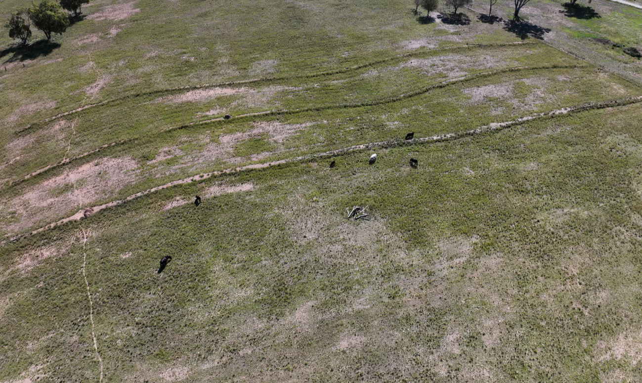
AgTech360, an Australian agricultural technology firm, implemented a comprehensive drone-based livestock monitoring system powered by FlytBase's drone autonomy software. The solution addresses critical challenges in Australia's vast farming landscapes, including labor shortages and water resource management. The autonomous drone system enables farmers to conduct remote inspections, monitor livestock movements, and enhance security across expansive properties. Early deployments show significant time savings—reducing inspection times by up to 75% while improving overall farm management efficiency and animal welfare.

Blue abstract background with speckled edges.

During one of the NestGen '25 sessions, we spoke with Coenraad Brandt, Project Manager at AgTech360, a leading Australian agricultural technology firm specializing in precision monitoring and farm management systems. With extensive experience in agricultural technology implementation across South Africa, New Zealand, and Australia, Coenraad brings a unique perspective on the challenges facing modern livestock operations.

AgTech360 has established itself as an innovative force in Australian agricultural technology, creating integrated solutions that address the unique challenges of managing livestock across the continent's vast and diverse landscapes. The company's farm management platform brings together various data sources—from live camera feeds to GIS data and animal sensor information—to provide farmers with comprehensive insights for informed decision-making. Here's what they had to say about leveraging autonomous drones for precision livestock monitoring 👇

The Challenge

"Australia is known for its variable climate, droughts, floods, extreme temperatures, and it's one of the driest habitable continents. It's also a mass of areas. I mean, just to give you a bit of background, driving from coast to coast is like driving to the moon and back twice." said Coenraad Brandt, Project Manager, AgTech360.
  • Vast Geographic Expanses: Australian farms often span thousands of hectares, making manual inspections time-consuming and inefficient. Monitoring water points, fencing, and livestock across these distances requires considerable resources.
  • Extreme Environmental Conditions: Unpredictable weather patterns, including severe droughts and floods, require constant monitoring of water resources and livestock health to prevent losses.
  • Labor Shortages: Finding skilled workers, especially in remote areas, has become increasingly difficult. This shortage limits the ability to perform regular inspections and maintenance across large properties.
  • Resource Management: Water scarcity is a critical issue, making efficient monitoring of water infrastructure essential for livestock welfare and operational sustainability.

These challenges are magnified by Australia's unique landscape, where connectivity issues and extreme distances make traditional farming approaches increasingly impractical and costly.

The Solution

AgTech360 developed an integrated precision agriculture system that combines their farm management platform with FlytBase's drone autonomy software to create a comprehensive solution for livestock monitoring and management.

The solution consists of:

  • A centralized farm management platform (AgTech360) that integrates live camera feeds, GIS data, animal sensor data, positioning information, medical records, water measurements, and weather data into a single interface
  • Autonomous drones powered by FlytBase's drone autonomy software that can be deployed on-demand or scheduled for routine inspections
  • AI-powered analysis capabilities that can detect issues, estimate water levels, and monitor animal behavior patterns
  • Integration with GPS collars and ear tags for real-time animal tracking and behavior analysis

How It Works

  • Water Monitoring: The platform displays all water infrastructure (tanks, troughs) with sensor data showing current levels and conditions. When sensors fail or readings indicate potential issues, users can deploy a drone directly from the platform interface to conduct visual inspections.
  • Livestock Monitoring: GPS collars and ear tags track animal movements across the property. When abnormal patterns are detected (unusual grouping, rapid movement, crossing boundaries), the system alerts farmers who can deploy drones to assess the situation in real-time.
  • Security Surveillance: Fixed cameras around the property provide continuous monitoring with AI-powered detection of unauthorized objects or people. Upon detection, drones can be automatically deployed to provide aerial surveillance, capturing additional evidence like vehicle license plates.
  • Scheduled Inspections: Drones can be programmed to conduct regular inspections of critical infrastructure, with images and data automatically analyzed and integrated into the management platform.

In each scenario, the drone autonomously navigates to predetermined GPS coordinates, captures visual data, and transmits this information back to the platform where it can be analyzed and acted upon.

Implementation

AgTech360 approached the implementation through a phased deployment, beginning with water infrastructure monitoring as the initial use case. This allowed the team to establish operational protocols and validate the technology's reliability before expanding to more complex livestock monitoring scenarios.

The integration process required significant collaboration between AgTech360's platform developers and FlytBase's technical team to ensure seamless communication between the farm management system and the drone autonomy software.

"It's been a super journey with FlytBase and their API enabling us to interface to their drone and drone autonomy." said Coenraad Brandt, Project Manager at AgTech360.

Technical challenges included ensuring reliable connectivity in remote farming regions—an issue addressed through satellite internet integration—and developing robust AI algorithms capable of analyzing visual data in variable lighting and weather conditions typically encountered in the Australian outback.

Impact

The implementation of the autonomous drone system has delivered substantial benefits for livestock operations:

  • Operational Efficiency
    • Reduced inspection times by up to 75% compared to traditional methods
    • Enabled regular monitoring of assets across vast properties that previously went unchecked for weeks
    • Freed up labor resources for more critical tasks, addressing workforce shortage issues
  • Enhanced Resource Management
    • Improved water management through early detection of leaks or malfunctions
    • The system detected a critical water issue that would have otherwise gone unnoticed for days, potentially saving thousands of dollars in livestock losses
    • More efficient deployment of maintenance crews, with specific issues identified before personnel are dispatched
  • Improved Livestock Management
    • Better understanding of livestock movement patterns and pasture utilization
    • Early detection of animal health issues through behavioral analysis
    • Reduced stress on animals by minimizing unnecessary human interaction
  • Security Enhancements
    • Rapid response capability for potential security breaches
    • Deterrent effect from visible drone presence
    • Improved evidence collection in case of theft or trespassing

Way Ahead

AgTech360 is actively developing enhanced AI capabilities to further automate the system. Coenraad envisions

"a scenario where a farmer within boundaries can have a number of these drones performing tasks fully autonomously, deciding when they want to go, where they want to go, and do tasks like monitoring the crops, identifying issues early, and reporting back." said Coenraad Brandt, Project Manager at AgTech360.

Future development plans include:

  • Advanced animal health monitoring through visual pattern recognition, potentially detecting stress, diseases, or calving events
  • Optimization algorithms that analyze animal movement patterns to suggest optimal placement of water points and feeding stations
  • Further integration with predictive analytics to forecast potential issues before they impact operations
"I believe safety is number one... and I believe the risk for farmers also needs to be reduced without adding any risks to the airspace users. I believe this process will be streamlined," notes Coenraad Brandt regarding the regulatory landscape.

Conclusion

The collaboration between AgTech360 and FlytBase demonstrates how autonomous drone technology can transform livestock management in challenging environments like the Australian outback. By integrating drone autonomy with comprehensive farm management systems, operations that once required significant time and human resources can now be performed more efficiently, with greater frequency, and without increasing labor requirements.

"None of these technologies mean anything if there's not an easy, insightful way for users to view this data and also to manage it," says Coenraad Brandt, highlighting the importance of creating solutions that are not only technologically advanced but also practical and accessible for everyday farm operations.

FAQ

Q1. How does AI enhance the capabilities of autonomous drones in livestock monitoring?

AI allows drones to independently identify issues such as water leaks, animal health problems, or security concerns. The system can detect unusual animal behavior patterns, analyze water levels through visual inspection, and predict potential problems before they escalate, allowing for proactive rather than reactive management.

Q2. What ROI can farmers expect when implementing autonomous drone systems for livestock monitoring?

While specific ROI figures vary by operation size, farmers typically see returns through labor savings (75% reduction in inspection time), early issue detection (preventing costly livestock losses), and improved resource allocation. Most operations report significant returns within 12-18 months of implementation.

Q3. How does the system handle the connectivity challenges common in remote Australian farming regions?

The system incorporates satellite internet connectivity to overcome traditional network limitations. Additionally, drones can operate semi-autonomously with pre-programmed missions even when live connectivity is limited, storing data onboard until reconnection for transmission.

Baisali Ghosh

As a Marcom Manager at FlytBase, Baisali oversees the content strategy, creation, and management! With over 7 years of experience in the drone industry and 3 years of it at FlytBase, she’s a self-proclaimed drone fanatic and is obsessed with all things geographical. In 2022, she has been recognized as the “Women to Watch in UAS” for AI/Autonomy category by Women and Drones.

When she’s not busy hosting FlytBase’s webinar series or organizing NestGen - a global drone autonomy focused event, you can find her exploring the Patagonian Desert, the Mid-Atlantic Ridge, or the Yellowstone Caldera on Google Earth.

Read more